
Street View for Google Map 360 Alternatives
Published by Tetiana Matsiuk on 2024-02-15Find best apps like Street View for Google Map 360, competitors and top software/SaaS apps in this
category. Welcome to Street View for Google Map 360, the ultimate app for exploring the
world with dynamic 3D views and GPS navigation maps. This app lets you explore
live locations and panoramic 360 vi...
51 Best Alternatives To Street View
What are the best software like Street View for Google Map 360 for 2024? Below are the most similar Navigation softwares we found.

GPS Tracker GPX Viewer GCS UTM
Create, import, export tracks with waypoints. Supports offline maps, no time limits, no ads, no in-app purchases...

We Camera 03 | Street View App
We Camera 03 is an app that anyone can use Street View easily.
Main Features:
• Current location navigation (Street view and map are synchronized)
• Point designation by hold
• Create route
• Street view and map on the same screen
• Multiple pins
• Four types of map
• Share
• Search
• Traffic
• Full screen
Supports:
• iPhone / iPad and Latest devices, Latest iOS
• Device Rotate (Portrait / Landscape)
...


Street Viewer plus
An app that makes Street View easier to use.
Lets you use Street View with compass and screen capture functions...

VesselView Mobile
VesselView Mobile provides Mercury Marine SmartCraft® engine owners with the ability to view live engine data, monitor fuel usage, obtain detailed descriptions when a fault occurs and receive maintenance alerts when due. The full functionality of the app is available when used in conjunction with the Bluetooth Low Energy VesselView Mobile module...

Drive Street Viewer
This app Is the Street View application, which can move in a simple operation.
Automatically camera will rotate in the direction of movement...

GPX viewer
Import your routes in GPX format (tracks) into the application.
Display them on different preset maps (plan, satellite, OpenStreetMap, OpenTopoMap, Swisstopo) or on your own custom maps...

GNSS View
This application enables you to see where the Quasi-Zenith Satellite System in the sky!
●What is QZSS?
Quasi-Zenith Satellite System (QZSS) is a Japanese satellite positioning system composed mainly of satellites in quasi-zenith orbits (QZO).
Satellite positioning systems use satellite signals to calculate position information...

Skyview
En SkyView GPS ofrecemos un sistema de rastreo satelital que permite la localización de cualquier vehículo terrestre en tiempo real.
La plataforma utiliza una constante transmisión de datos vía GPRS que da a conocer el lugar donde se encuentra el vehículo, historial de recorridos otros brindando a los clientes diferentes beneficios y servicios que darán seguridad y facilidad en el uso de sus vehículos, todo esto podrás...

ShoreView
Immerse yourself in the world of the coast and sail without limits with ShoreView.
ShoreView is the first coastal guide with a tool for sailors and real-time information, born to change the rules of the game in recreational sailing and coastal leisure and democratise access to nautical tools using your mobile phone...

iStreets - Google Street View™
iStreets provides simple and easy access to Google's Street View imagery on your iOS device.
With search powered by Google Places, simply enter a query such as "Restaurants in London" and a list of relevant locations will appear on screen...

Street Viewer Pro - 360°
Get Street View back in iOS! All new version 6!
Street Viewer Pro allows you to tap into the power of Maps and Street View to help you discover places as if you were there.
Street Viewer Pro in this app will reflect the movements you make with your iPhone or iPad (by using the built-in compass)...

GPX viewer 2
GPX viewer 2 is the brand new version of my first GPX viewer app! With new features, a new modern user interface and new interactions. I've listened to your needs and built a new app just for you!
Import your tracks from GPX files (tracks or routes) into the app...

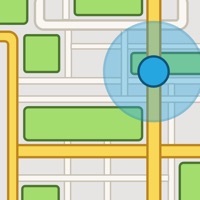
Street View Map 360
Street View is a useful application that will help you better navigate unfamiliar areas! By downloading it to your device, you get an excellent opportunity to view a panoramic view of any street. Here you can not only view every building in your city, but even take a virtual tour around the world!
Easily find any places, sights and just enjoy panoramic street images! Make your movement around the city more comfortable...

TrackView - Find My Phone
***OVER 12 MILLION DOWNLOADS! ***
TrackView is the world’s leading Find My iPhone, iPhone Tracker, Find My Friends, Home Security and Video Surveillance app for FREE!
TrackView is Find My iPhone + Life 360 + Ring Video Doorbell + Nest + ADT Pulse for FREE!
TrackView turns your iPhone and other devices into
Family Locator (like Life 360, Zenly, Life360, FamilyBase),
Find My Phone (like Find My iPhone, Find My Fr...

PDX Bus, MAX, Streetcar & WES
PDX Bus is an award winning application that displays arrival times for public transport in Portland, Oregon.
** PDX Bus won Best in Show at the CivicApps...

Live Street Route Map
Get directions to the place instantly where you want to go with the Live Street Route Map application. You are on the move and want to explore something new and interesting around you, Live Street Route Map is the right map world for you to navigate yourself...

Street Art Cities
With the Street Art Cities app, it is easy to explore street art all through the world. Simply use the map to see what's around you, or look at our routes to get your bicycling or walking on and discover the beautiful artworks in your city...


Street-go
Streetco is the first collaborative pedestrian GPS adapted to reduced mobility people’s movements. Discover accessible locations around you and go there easily no matter your mobility...

Street Alert
The Street Alert app aims to reduce street assault and harassment.
It allows you to send alerts in one click to nearby users so that they can come to you to fix your situation of danger in the street (aggression or harassment for example )...

StreetCrowd
StreetCrowd is a technology platform that connects people to share mobility and micro-mobility companies. The goal is to help more people in cities get access to safe, clean, and reliable shared mobility options...

Lyft
Count on Lyft to take you where you need to go with safety first. Got an appointment? Need to pick up some groceries? We’ll match you with a driver, help you find the quickest bus route, or show you the nearest scooter — you’ll be on your way in minutes...

Google Maps
Navigate your world faster and easier with Google Maps. Over 220 countries and territories mapped and hundreds of millions of businesses and places on the map...


Wanderlog - Travel Planner
Wanderlog is a free travel app for planning every kind of trip, including road trips and group travel: create a trip itinerary, budget costs, organize flight and hotel reservations, view places to visit on a map, and collaborate with friends. After your trip, share a travel guide to inspire other travelers...

Fake GPS Location -for iPhone
My Family Locator:
My Family Locator is the location tracker app which allow you to take care of your family and friends. Keep them safe with our app which includes the GPS tracker and locator with phone status information...

SmartHalo - Bike smarter.
Bike smarter with SmartHalo, a minimalist, award-winning, circular interface that pairs with your iPhone to elevate your cycling experience. This is the smart biking device you’ve been waiting for...

KeyDrive - Digital Car Connect
Introducing KeyDrive, the ultimate mobile app that empowers you to take full command of your vehicle no matter where you are. With support for over 40 makes DriveKey ensures you stay connected and in control at all times...

iMaps+ for Google Maps
iMaps+ brings Google maps, directions and street view to your iOS device.
Features:
- Search by address or textual query (eg 'London, UK' or 'Restaurants in New York')...

Google Earth
Explore the whole world from above with satellite imagery, 3D terrain of the entire globe, and 3D buildings in hundreds of cities around the world.
Zoom to your house or anywhere else then dive in for a 360° perspective with Street View...
GSVExplorer for Google Maps™
Search, view, bookmark and share Google street view
Features
- Tap on map view to search a nearby street view
- Optionally show Google street view coverage layer
- Sophisticated full screen Google street viewer with a bottom map view to help you navigate
- Load Wikipedia articles (if available) near a street view location
- Share & bookmark panoramas
- Sync bookmarks between devices
- View bookmarks as list or on map view
- ...

Cool Locations on Google Maps Lite
Since Google has released Google Earth and Google Maps, a lot of fans search the most interesting and curious details that can be seen via satellite. With "Cool Locations on Google Maps Lite" app you will see different google map crash locations with airplanes, wrecks, the Costa Concordia accident and more...

Tokyo Metro Subway Map
Tokyo Metro Subway is the navigation app that makes travelling by Tokyo Metro public transport in Tokyo simple
From the Tokyo Tower to the Sensō-ji Temple, cheering on the Yomiuri Giants or rooting for FC Tokyo, whether you’re a Tokyo native on your commute to work or sightseeing fresh from Narita International Airport we’ll show you the best way to get where you’re going in Tokyo. We make riding the metro easy...

EVDC Charging Map
EVDC (Electric Vehicle Charging) is a user-friendly application developed to address the growing needs of the EV community. With the rapid rise in electric vehicles' popularity, we recognized the need for a comprehensive tool that empowers EV owners and simplifies the charging process...

Kamo - کامۆ (Speed Camera)
This App gives the drivers a full control over their speed limit on the road to help them avoid over-speed fines and keep driving safely.
ئەم ئەپە یارمەتی شۆفێران دەدات بۆ کۆنترۆڵ کردنی خێرایی ئۆتۆمبێلەکانیان لەسەر شەقامەکان وە پابەند بوونیان بە خێرای دیاریکراوی سەر شەقامەکان بە مەبەستی لێخوڕین...

TWISTYroute
You’re familiar with GPS/Navigation apps, but none of them work like TWISTYroute. No matter the reason why you ride or drive, TWISTYroute is your perfect companion, through every twist and turn...
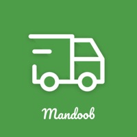
Mandoobku
مندوب كويت - تم تصميم هذا البرنامج لتوفير وسيلة فعالة ومباشرة لتلبية الاحتياجات الشخصية للأفراد...

Parkaroo
Quickly find on-street parking with the Parkaroo iPhone app. If you are frustrated weaving through city streets looking for parking or paying for an expensive garage, Parkaroo is the app for you...

Waze Navigation & Live Traffic
Always know what’s happening on the road with Waze. Even if you know the way, Waze tells you instantly about traffic, construction, police, crashes, & more...

ParkMobile: Park. Pay. Go.
With over 20 million users, ParkMobile is a smarter way to park. Easily pay for street, lot, or garage parking right from your mobile device...

Transit • Subway & Bus Times
"Gives you the best route to where you want to go" - New York Times
“You won't realize how much time you can save planning until you use this app” - LA Times
“Killer app” - WSJ
"MBTA has a favorite transit app — and it's called Transit" - Boston Globe
Transit is your real-time urban travel companion. Navigate your city’s public transit system with accurate real-time predictions, simple trip planning, step-by-step...

SpotHero: #1 Rated Parking App
Park smarter with the SpotHero iPhone app. SpotHero helps you get everywhere, easier by making it fast and convenient to find and reserve parking in major cities...

onX Hunt: GPS Hunting Maps
onX Hunt has been featured in Field and Stream, Outdoor Life and American Hunter as the best hunting app, hiking app, and GPS app for any outdoorsman or hunter. Used by millions of US hunters...

ParkWhiz - #1 Parking App
Take the hassle out of parking with the ParkWhiz app. Find parking in any major city, compare prices, plus save up to 50% when you book in advance...

Exxon Mobil Rewards+
The most secure and easy way to pay for fuel and earn rewards.
Exxon Mobil Rewards+ app allows you to stay in the comfort of your vehicle while you pay for Synergy™ fuel with your phone...


Avenza Maps: Offline Mapping
Avenza Maps, #1 app for hiking, biking and all trails. Featuring maps from National Geographic, national parks and more!
On your next adventure, stay on track with GPS using offline mobile maps...


