GPX viewer 2 Reviews
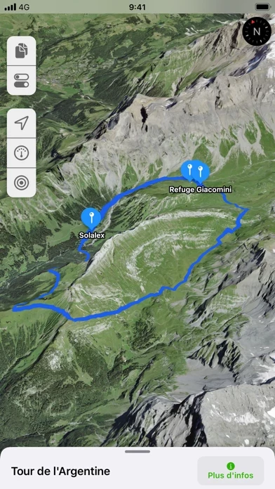
Published by Jonathan Gander on 2026-06-03🏷️ About: GPX viewer 2 is the brand new version of my first GPX viewer app! With new features, a new modern user interface and new interactions. I've listened to your needs and built a new app just for you! Import your tracks from GPX files (tracks or routes) into the app.