Avenza Maps: Offline Mapping Reviews

Avenza Maps: Offline Mapping Reviews

Published by on 2024-06-26

🏷️ About: Avenza Maps is a free app for hiking, biking, and all trails that features maps from National Geographic, national parks, and more. The app allows users to stay on track with GPS using offline mobile maps and import custom maps. It also offers the largest mobile Map Store of hiking, topographic, cycling, city, nautical, travel, and trail maps. Avenza Maps is available for free, with maps available for free or purchase from the in-app Map Store. Plus and Pro subscriptions are available for unlimited custom map imports and professional users with full access to all features and mapping tools.



Overall Customer Experience 😎


👿🤬😠 Negative experience
49.6%

😎👌🔥 Positive experience
34.8%

🙄💅🫥 Neutral
15.6%

~ from Justuseapp.com NLP analysis of 115,153 combined software reviews.


Summary of Customer Reviews (Takeaways): 💎

- Doesn't drain phone battery quickly

- Has all the trails/paths/roads mapped

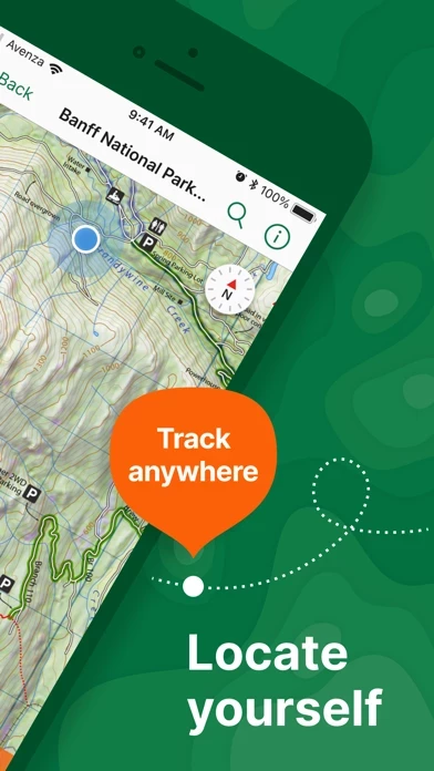
- Accurately shows current location

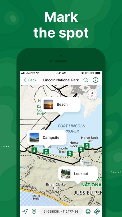
- Ability to plot photos and mark trails

- Utilizes GPS in phone


Read 29 Customer Service Reviews 👿🤬😡😠💢😤

4.8 out of 5

Unusable topographic maps

2022-05-22

I bought AvenzaMaps for topographical maps. I downloaded a set of maps around Placerville, CA. At least one failed to download due to errors. I tried multiple times without success. My query for assistance, which included all the info they requested went unanswered.

The maps I downloaded were all the smallest scale, a few miles on a side. There were no large scale maps as a reference, nor any way to link them to any other map to know the area any of these maps referenced. Just a big empty grid like a piece of graph paper. They were almost totally useless. The only good feature was I could hit a link that popped up the map of the immediate area I was in. Very nice feature but not of any real value in how I wanted to use them.

I would take my money back in a heartbeat!

hardly worth it

2022-06-23

I got AvenzaMaps for the free VA State Park maps. I guess you get what you pay for- the information on hiking trails is incomplete and rudimentary and the maps are low information content. However AvenzaMaps itself gets downgraded for the braindead download interface. If anything happens during a download ( which can take a while especially when you are away from fast wifi) the download simply stops and/or starts all over again. Even if the iPhone screen turns off! I spent the better part of an hour with repeated attempts and finally succeeded by keeping the iphone screen on without doing anything else that would have immediately cancelled the download again

Nice features, but horrible search engine

2022-07-24

Don’t bother with AvenzaMaps unless you plan to upload your own maps. If you do, the PDF tracking features are great, and transferring a GeoPDF from e-mail just works — no trouble, no fuss.

Unfortunately, the built-in map store is all but unusable. I’m not exaggerating when I say that it has *the* worst search engine I’ve ever seen. It’s extremely inaccurate. It has no apparent way to refine search terms (except a few built-in options, which aren’t much use given the rest). It doesn’t recognize quotation marks. There’s no way to exclude terms. I literally cannot find specific US national forest maps by searching the name of the forest — most of the time, they simply aren’t in the results.

It’s incredibly frustrating to have such a potentially awesome app made unusable by search alone. Please, devs, *fix* it!

Decent

2022-08-25

When I am able to get the maps they work well but that is a BIG if. The button to “download” a map have writing that is illegible so you can’t read the price. There are two buttons below that, which I have no idea what they say because again the words are shown illegibly. It doesn’t tell you when a map is downloaded when click the box that I think says download. When I search for a specific free map it won’t show up unless I specifically use the link from another site. And at least half the time the maps don’t download. So many bugs make this an app o would not recommend but it is the only app where I Can get NYS park maps for free so I am stuck with it

Frustrating App

2022-09-26

I’ve been using AvenzaMaps for approximately six months during a handful of off-road trips.

It’s adequate when you acquire a map which is originally done in PDF (such as from Tom Harrison, National Geographic, and some others). Many of the maps, however, are in fact sourced from compressed scans of printed maps (or low quality renderings) that are virtually unusable when zoomed in to ascertain area details. The store does not indicate which are native PDF and which are scans.

Many of the better available maps are available in hard copy for essentially the same price, though missing only the nice ability to use your device’s GPS to indicate and track your location. An issue of all mapping apps is that it’s sometimes nice to spread out a paper map to get the big picture as something is lost when you use an app such as this to zoom out making features so small that they’re unrecognizable and text unreadable.

Overall, if you needs maps, you’re much better off getting the much more capable Gaia app and suffering the subscription fee which you’ll quickly rack up in a handful of maps with AvenzaMaps versus unlimited maps in Gaia.

I think there’s a place for AvenzaMaps if you restrict yourself to Tom Harrison maps or are able to get lucky and find native PDF maps which are not available on Gaia, but all of the Nat Geo Trails illustrated and topographic maps are in Gaia ... and much easier to find and download.

Smart tracking, clunky interface

2022-10-27

Often overlooked are AvenzaMaps ’s intelligent tracking capabilities that are very customizable and can yield more accurate tracks with less noise than many leading GPS apps. However, you will be hard pressed to reliably export features like tracks to other apps because Avenza’s approach to layers is just all wrong. So bad. Record a track and you should be able to name it right away and have it be findable at top level directory rather than buried in a sea of Avenza’s generic, self-named Layers. Tracks and waypoints should simply transfer to other apps via iPhone’s Open In sharing option, but because your actual track is a so-called Feature within a Layer and never expressly named, you can’t reliably locate it during export. It’s a shame because Avenza isn’t realizing the full potential of what is good about it, and I feel it’s due to misunderstanding its user base and believing all they want are digitized PDFs they can draw on. This is the niche around which the whole ecosystem revolves.

What happened to searching for maps?

2022-11-28

I used to love Avenza. I still use it with the maps i have in my collection, but to search for a new map, forget about it. I liked that you can put searching maps for recreation but now that option is gone so you get ALL the types of maps they have on file. I need hiking trails not topographical maps or other kinds of maps. Don’t even bother searching a specific area because it will send you somewhere else not even in your own State. The buttons cut off so you just see the top of the word (Download, next, previous...) so I have to guess what it says without pressing the buy button. So frustrating. I want to love AvenzaMaps again since I’m always out on the trails. Fix the problem please so I can get new maps without going to a different app.

Solid App Support

2022-12-29

Latest update has performance problems on my iPad. Not sure why, but the latest update has “broken” the map view. By “broken” I mean that when I select a map, the map displays quickly, but you cannot interact (pan/zoom) with the map for 20+ or more seconds. I submitted a support ticket with Avenza. —————- Older: I may have some issues with how Avenza handled the custom maps transition with limiting how many you could have without a pricy subscription. That is a marketing decision, and there are other factors that can be important to consider. Based on my experiences in interacting with their support team, I have found that Avenza has a solid support team and development team behind them. Case in point, iOS 11.3 came out and I discovered shortly after updating, that I could not create placemarks on a map. AvenzaMaps crashed when creating a placemark. This was a real issue for me, as I do this often when planning hikes for parking and such. I reached out to Avenza via their support site and was quickly informed that the the company was aware of the issue and working on a fix. And, they were. Within a day the update was available and the issue that I experienced has been corrected. To me this speaks a lot for a company in how they interact with their customers.

My go-to hiking navigation app

2023-01-30

Hands down, this is my favorite app to use while hiking. I am in New York City, USA and I do most of my hiking in the highlands north of the city. Avenza has really high quality maps showing all the local trails. It tracks my location on those maps and doesn’t use too much battery. I also like the ability to record GPS tracks. I would give it a 5 except for a few clunky features that are a bit hard to use. It is hard to get the tracks to disappear off a map without deleting them altogether. They obscure the view of that map for subsequent hikes. I would also like the ability to draw paths freehand to measure trail distances. As it is now, you have to create a series of straight line segments that don’t mimic actual trail geometry. Overall, though, I haven’t found a better app for the price. And, you can buy and download the maps. I used this for a trip to Athens!

Overall a good product, but...

2023-03-03

I recently set up a new iPad from the backup of my old one. The first time I opened Avenza maps, a message told me that I needed to re-download my maps. Started doing that. An error message told me that the maps were no longer available in the Map Store. Great. Hundreds of dollars worth of maps are not available? Eventually I found that I just needed to log back into my Map Store account. Should have realized that, but anyway, in this situation the error message should remind the user to log in—NOT that the maps are not available.

Feature request: when scrolling near the edge of the map, it would be nice to have a pop up of some sort advise the user of adjoining maps (if any).

Perfect for public lands

2023-04-01

Ability to locate public land boundaries I have been unable to find anywhere else. Make sure you have the maps before you go. Should not have to tell anyone that but, it is a strange planet. Not very intuitive when it comes to searching maps in the map store. Takes some figuring out but worth the little time it will take to get your sea legs. Maps with specialty info such as land plats are available. Which is Awesme! Some maps are a bit spendy. Would have been five stars if not for the prices of certain maps. GPS is spot on and battery usage makes it usable all day.

Good app, comes in handy

2023-05-03

We’ve used AvenzaMaps many times to find maps of areas we are traveling to for camping and hiking. Several times we ended up with no reception and these maps helped us get back easily, even will show your location on the map if there is a brief signal. Only two wishes for improvements: when a map expires, have a link or suggestion for a replacement map. And better descriptions for why one map may be better than another-Yellowstone for example has so many available maps for free or to buy-but which is the location, level of detail, etc that you want?-can’t always tell by the descriptions.

Official Maps on your devices

2023-06-03

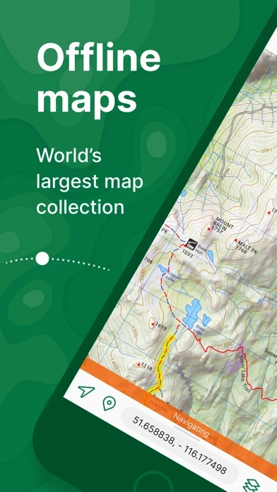
Avenza offers a wide variety of maps from National Geographic and other sources that can be downloaded to your device and used to track your hikes on the various trails. Because the map is on your device and not online you don’t need an internet connection while in the field.
On the other hand it would be nice to be able to share maps with tracks between devices by being able to store maps with tracks on line in your Avenza account while connected to the internet.

Great map tool.

2023-07-05

I have been using for a few years I like how reliable it is and you never have wonder if your map will work offline. I purchase a lot of forest service maps which can get expensive but I like knowing I am using an official map.
The black and white motor vehicle use maps are all free and work ok but I like to see topography so I choose to pay for the better maps. Keep up the good work. I’d wish it could be made easier to search for maps I want. Usually is search then click through the results trying to find right map.

The only map app I use for work.

2023-08-05

Avenza maps application is very detailed and depending on the map your using can help you with backpacking, work, traveling and recreating. I personally use it most for work because I am a wildland firefighter. It helps immensely with navigating through areas I am unfamiliar with, minimizing the hazard of becoming lost in potentially high stress situations. I would recommend this application for anyone who works outside or plays outside.
Also I don’t know if I mentioned this but it works offline and will show your approximate location even without service. Applause to avenza!

Great app

2023-09-06

I’ve used AvenzaMaps for years and I am finally getting around to writing a review. I recently had to access customer support and they were immediately responsive and helped me with my problem. A+ service. I live that once you purchase a map, you own it and don’t have to pay a subscription. Finally, as a mushroom hunter, I often go off-trail and I love that I can download the appropriate map on my phone, turn the phone to airplane mode ( to conserve the battery) and use AvenzaMaps to satellite track my location on the map not only to mark a mushroom spot but also to help guide me back to a road or trail if I’m in need of that!

My time with Avenza

2023-10-08

I was up on top of a mountain top hunting driving life four-wheel-drive of theSome steep hills and I saw a lady sitting on the road and her bicycle laying on side and I thought she may have crashed I pulled up and asked her if she was OK and she said she was fine she was just riding over the mountain. She saw me looking at some paper maps for the roads and she told me about a Venza and that’s where my experience with the van to begin I am so impressed with this program as with on X without satellite feed you can’t use the map but with Avenza you can use the map and it tells you where you’re at every place you are magnificent program thank you very much strange lady on the mountain and thank you Avenza Randy Watson hunting near Garibaldi.

A Must Have

2023-11-08

I absolutely love AvenzaMaps. My family enjoys hiking, biking, and off highway motorcycle riding which is where AvenzaMaps excels. For all you single track and trail riding motorcycle enthusiasts find your map by searching for either “MVUM” (multi vehicle use map) and/or “OHV” (off highway vehicle). No worries about cell service as AvenzaMaps utilized the GPS in your phone.
I also love the ability to plot photos and mark my trails which makes it a joy to share later with friends.

A feature I would like to see added would be the ability to share my recorded “track” via a simple text. The track would then be imported into other applicable maps and more importantly with friends who also have AvenzaMaps and corresponding map(s) so that they could follow the same track at a later date.

The best for hiking/biking. Doesn't drain the phone battery!

2023-12-10

I've tried several other apps for hiking/biking in (un)known areas and there was always some issue with them: or they would drain my phone battery in an hour (not good when you are far in the wild), or they wouldn't have all the trails/paths/roads mapped or they wouldn't show accurately my location at the moment (crucial on a new trail). AvenzaMaps has it all! Really have been a saviour when I would get lost in the woods and it also makes exploring new routes adventures, enjoyable and interesting! The phone doesn't seem to lose power faster then in normal circumstances. And your current location is shown even if you have zero bars of connectivity and google maps fail. Highly recommendable and big thanks, developers!:)

Recent update no longer accurately mapped

2024-01-10

After this most recent update, all of my pins as well as my location are now on the very small reference map at the bottom and not on the main one. Is there a way to revert back to a previous version?

Update 11/5: after a couple of version updates, my issue was finally fixed. Thanks to the developer for their efforts in resolving the problem. It would be easy for a company to forget about small concerns like mine but to their credit, they did not and got things working like new again. Thanks for all the help!

Fees to add your own maps!

2024-11-17

Why make someone pay to add something that they already paid for? This is ridiculous that you have moved to making people pay for imports. I'm a firefighter and our agency previously used AvenzaMaps till they started charging fees to import your own maps. We are on the move all the time switching from fire to fire, we need to give other people the maps when necessary but can't because they have to pay now. It's a bad business call if you're trying to make more money or have a following that use your app. Because from what I see all you're doing is making more people mad and losing more customers. You lost a whole firefighting community where I live that used to use AvenzaMaps. Google maps is what we use now if anyone cares to know.

Very poor quality topo maps

2024-11-17

Unlike many negative reviews mine has nothing to do with being upset about Avenza moving to a pay per map model. That's fine to me. I'm happy to pay a few dollars for a useful tool. What upsets me is that I have paid money for a worthless map. What is described as "the finest available" map is actually a low resolution image that is quite useless. Zooming into the map reveals the low quality image. The topo elevations are 100% illegible, as are most road names. Google maps provides more detail and features than this map did, and that's a free. And since google has added a feature to download portions of a map for offline use, I used G maps more than the Avenza maps. Again, happy to pay money when it is worth it. This was not worth it.

Forest Service MVUM maps

2024-11-17

A little hard to find the specific USFS MVUM your looking for because government bureaucracies have zero creativity when it comes to map titles,but if your accustomed to using MVUM’s - then Avenza is the source for these free maps.

I used them for the first time last summer on a dirt bike trip to Idaho. The GPS tool worked on my IPhone 6 just fine and it was very accurate. I carry a GPS and Spot, as well. But, I always went to Avenza on my phone first.
1’ve only scratched the surface of available features, but I have a friend who laid out the Black Hills KTM rally using it and it was a great tool.

Hunting with Avenza

2024-11-17

Have used your app to hunt in Montana, Colorado, Idaho and South Dakota. Love to see where I am and all the detail available. Will use this fall on another site in Montana to hunt birds and deer. Hunt with 2/3 other guys and we all use them. Wish you had system to follow them too as we hunt in a loose group and want to keep track of each other.
Some difficulty with finding the maps. Need more practice but some times confusing if don,’t know exact name of area or there are numerous pins in same proximity.
All that said, we are glad we found Avenza maps. Keep up the good work.

You own the maps

2024-11-17

A great app for hikers in which you permanently own the maps once you buy them but do not buy them through the apple store. Instead Buy them on the Avenza website just in case you do not find they were not what you expected or hoped for. The Apple Store will not refund your purchase but Avenza will.

The only drawback to the Avenza app is that it does not automatically save your routes or waypoints. You must save/ export them as layers to your files then import them.

Hopefully they will streamline that process in the future

Pretty good app

2024-11-17

I use AvenzaMaps while flying. And it works great. I think it’s performance really depends on the quality of the map you add. My only real complaint and it is really not a complaint only a suggestion is that I cannot zoom in or out while wearing my flight gloves, like any other app I use while flying. Most other apps have added a plus or minus button that you can zoom in or out with using a stylus which is what I have to do when I fly. I would like to see a zoom plus or minus button add it to the map page

Great Map!

2024-11-17

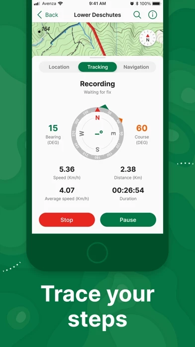
AvenzaMaps has many cool features. I love the “pin” feature. When we park our car at a trail I insert a pin exactly where the car is. If you turn on the “recording” feature you can track the route you have taken as well as how far you have gone and the speed you are hiking. To me, the main comfort is that you can never get lost with AvenzaMaps. However, my strong recommendation is that you bring an external battery and have it connected to your phone so you don’t run out of juice.

Russ
2020-12-23

Exporting or sharing map data not working hours and fricken hours no progress It garbage

John
2020-12-14

Stay away! They charge small amounts and their programs are difficult and poorly designed so you just abandon the small amount paid. Trust me, for a few dollars you are getting a world of headaches. Support responds but the programs are so bad they can do little to help you. They cannot even send you a link to download a map!!!! Ripoff.


Is Avenza Maps Safe? 🤗🙏


Yes. Avenza Maps: Offline Mapping is very safe to use. This is based on our NLP (Natural language processing) analysis of over 115,153 User Reviews sourced from the Appstore and the appstore cumulative rating of 4.8/5 . Justuseapp Safety Score for Avenza Maps Is 41.2/100.


Is Avenza Maps Legit? 💯


Yes. Avenza Maps: Offline Mapping is a totally legit app. This conclusion was arrived at by running over 115,153 Avenza Maps: Offline Mapping User Reviews through our NLP machine learning process to determine if users believe the app is legitimate or not. Based on this, Justuseapp Legitimacy Score for Avenza Maps Is 59.7/100..


Is Avenza Maps: Offline Mapping not working? 🚨


Avenza Maps: Offline Mapping works most of the time. If it is not working for you, we recommend you excersise some patience and retry later or Contact Support.


Payments 💸🤑💰

**Pricing data is based on average subscription prices reported by Justuseapp.com users..

Pricing Plans Amount (USD)
BaseImage, LLC Map Product $0.99
Avenza Maps Plus $32.99
National Geographic Map Product $11.99
US Forest Service R5 Map Product $4.99
US Forest Service R6 Product $4.99
Avenza Maps Pro $159.99
Forest Service Topo Product $0.99
Map the Xperience Map Product $4.99
Garmin Tier 1 $0.99
Western Michigan University Map Product $2.99


How was your experience with Avenza Maps: Offline Mapping? Post a Review


Features

- Realtime GPS position and direction finding, even when offline

- GPS track recording during activities

- Compass tools for navigating to features

- Adding photos and notes to any location

- Placemarks with recreational symbols

- Distance measurement and time estimation

- Supports KML, GPX, and CSV Formats

- Map Store with premium maps from various publishers

- Avenza Maps Plus subscription for unlimited import of custom maps and geofencing

- Avenza Maps Pro subscription for high-accuracy GPS devices, unlimited geofences, Esri Shapefile import, and more

- Annual subscriptions available through Apple ID with auto-renewal options

- Support available through support.avenzamaps.com

- Privacy Policy and Terms of Use available on avenzamaps.com

- Social media connections with Avenza Maps on Facebook, Twitter, and Instagram.

  Customer Service/Support
Developer:
Avenza Systems Inc.

Contact e-Mail:

Website: