Topo Maps US Software
Company Name: David Crawshay
About: Topos creates location intelligence products that provide new social, cultural, and business
insights about neighborhoods and cities.
Headquarters: New York, New York, United States.
Topo Maps US Overview
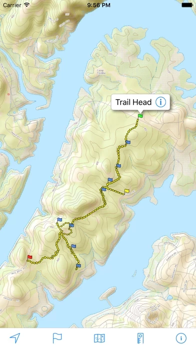
Import trails (tracks) using GPX files you find on the Internet or from your personal GPS track collection.
Organize your trail types by color, for example, mountain bike trails, hiking trails, and OHV trails.
Share trails with others using email or AirDrop.
Topographic maps are useful for recreational activities such as hiking, canoeing, camping, fishing, mountain biking, geocaching, and exploring.
Record your own trails to show where you've been on the map, follow them later, and share with others.
Share flags with others using email or AirDrop.
Import flags from other sources using GPX files and geocache LOC files.
Official Screenshots


Product Details and Description of
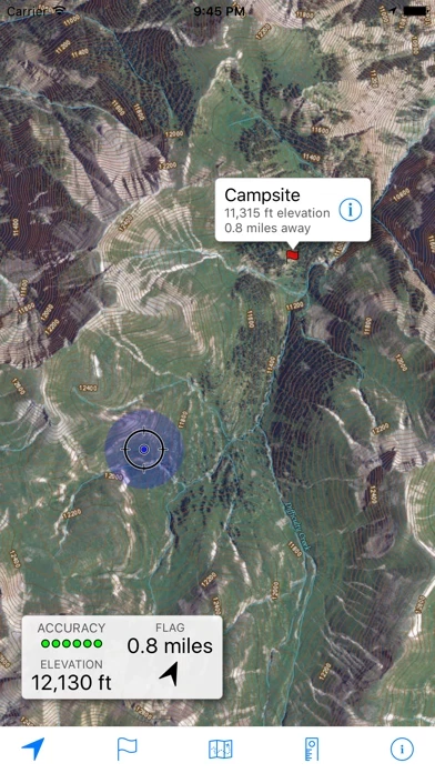
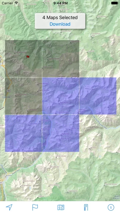
Download and view topographic maps covering the United States. Topographic maps are useful for recreational activities such as hiking, canoeing, camping, fishing, mountain biking, geocaching, and exploring. MAPS Choose from 2 map sources: USGS standard topographic or USGS hybrid topographic. OFFLINE Download maps for areas of interest to view them later when you don't have Internet access or you don't want to use cell data. TRACKING Use location tracking to show where you are on the map, your elevation, and the accuracy of the GPS signal. FLAGS Flags are included with map downloads. Add flags (waypoints) to the map to mark your current location or other locations. Import flags from other sources using GPX files and geocache LOC files. Share flags with others using email or AirDrop. Organize your flag types by color, for example, geocaches, trailheads, and summits. TRAILS Trails are included with map downloads. Import trails (tracks) using GPX files you find on the Internet or from your personal GPS track collection. Share trails with others using email or AirDrop. Organize your trail types by color, for example, mountain bike trails, hiking trails, and OHV trails. TRAIL RECORDING Record your own trails to show where you've been on the map, follow them later, and share with others. ELEVATION PROFILE Recorded trails include an elevation profile (distance/elevation chart). NAVIGATION Navigate to a flag by following the direction arrow that uses your compass heading. Useful for geocaching. MEASURE Measure the distance between points on the map. Note: Continued use of GPS running in the background can dramatically decrease battery life.
Top Reviews
By dartex
USGS and University Approved!!
As a team of geologists from the USGS and a State University who have used this app extensively for field work, this app is officially amazing! Doing field work in the back roads near Yellowstone, this app was invaluable. We used it for navigation, correlation to geologic maps, and even to mark the location of our vehicle before long hikes into the back country. Thoroughly impressed, 5/5. The only thing that would be handy is a data sync option in which you can actively sync waypoints between devices so everyone is on the same page.
By andrewking-me
Request Addition of Time Stamps in GPX Export
This is an incredible app for hiking! However, it’s missing one key ingredient- time stamps in the GPX export. I would like to use your app during hikes and then upload GPX with time information to fitness tracking sites like Strava. At the moment the lack of time information in the GPX export is preventing this workflow. Any chance you would consider adding time information?
By Colin Jensen
Works and Free
Does what it promises — lets you easily download Topo maps onto your phone. No frills but it gets the job done. Our family wanted a map for a hike in an area where cell service is spotty. This app let us easily see where we were at all times