Topo Maps+ Software
Company Name: Glacier Peak Studios LLC
About: Topos creates location intelligence products that provide new social, cultural, and business
insights about neighborhoods and cities.
Headquarters: New York, New York, United States.
Topo Maps Overview
What is Topo Maps? Topo Maps+ is an app designed for backcountry adventurers, providing maps and tools for planning and executing outdoor activities. The app offers maps for every activity, planning tools, on-trail tools, and navigational mindset tips. It also has subscription levels, including a free level, Topo Maps+ Pro, and Topo Maps+ Hunt, and can be synced across all iOS and Mac devices.
Features
- Maps for every activity, with the ability to set up maps based on planned activity
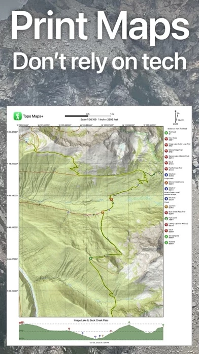
- Planning tools, including the ability to compare and download maps for offline use, combine overlays, use smart route-building tools, add waypoints, and print, email, or share custom maps and routes
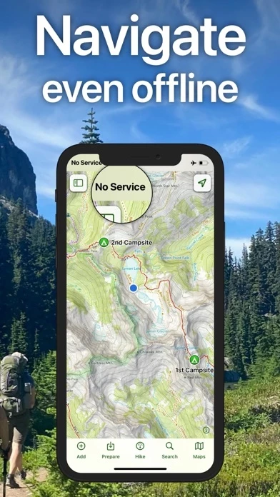
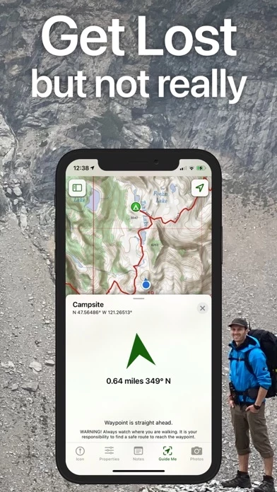
- On-trail tools for offline use, such as viewing current location, recording tracks, receiving proximity alerts, using line of sight, tracking progress on the trail, and downloading elevation data for route-creation
- Navigational mindset tips for staying safe in the backcountry
- Subscription levels, including a free level, Topo Maps+ Pro, and Topo Maps+ Hunt, with varying features such as high resolution maps, MapBox Satellite map, US public and private land overlays, parcel and ownership contact info, and game management units
- Apple Watch compatibility for viewing offline maps and current location
- Cloud syncing for routes, trips, subscriptions, and waypoints across all iOS and Mac devices
- Subscription payment information, with automatic renewal unless canceled at least 24 hours before the end of the free trial or current period
- Privacy Policy and Terms of Service links provided
- Note that continued use of GPS running in the background can decrease battery life.
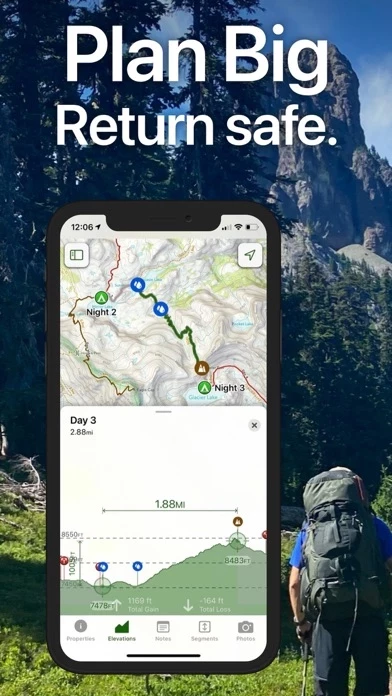
Official Screenshots

Topo Maps Pricing Plans
| Duration | Amount (USD) |
|---|---|
| Billed Once | $75.03 |
**Pricing data is based on average subscription prices reported by Justuseapp.com users..
Product Details and Description of
Designed and tested on real dirt, Topo Maps+ is packed with the maps & tools to plan and execute your backcountry adventure. ‣‣ MAPS FOR EVERY ACTIVITY ‣Setup your map based on your planned activity ‣‣ PLANNING TOOLS ‣ Compare and Download maps for use offline. ‣ Combine overlays to customize your map view ‣ Smart route-building tools ‣ Waypoints ‣ Print, email or share custom maps and routes ‣ Public, Private, and Hunting land boundaries ‣ Parcel Information ‣‣ ON-TRAIL TOOLS (Offline) ‣ View your current location ‣ Record your tracks ‣ Proximity Alerts - notify me when I’m close to a waypoint, trail, or region ‣ Line of Sight - what am I looking at? ‣ Progress on Trail - how much further on the trail ‣ Guide Me to a waypoint ‣ Downloaded elevation data for route-creation on the trail ‣ Photo Waypoints - snap a pic and instantly shows on the map ‣‣ NAVIGATIONAL MINDSET - helpful tips and tricks for keeping you safe in the backcountry! SUBSCRIPTION LEVELS: FREE level: view low resolution maps, record your tracks, and limited features Topo Maps+ Pro: high resolution maps, download maps, planning & on-trail tools, driving mode, import geospatial PDFs and TIFFS Topo Maps+ Hunt: includes Pro plus MapBox Satellite map, US public and private land overlays, parcel and ownership contact info, game management units APPLE WATCH View your offline maps and current location just by glancing down at your wrist. CLOUD Sync your routes, trips, subscriptions, and waypoints between all of your iOS and Mac devices. SUBSCRIPTION PAYMENT INFORMATION Topo Maps+ subscriptions will be charged to your Apple ID account at the confirmation of purchase. Subscription automatically renews unless it is canceled at least 24 hours before the end of the free trial or current period. Your account will be charged for renewal within 24 hours prior to the end of the current period. You can manage and cancel your subscriptions by going to your account settings on the App Store after purchase. Privacy Policy: https://glacierpeak.app/privacy.html Terms of Service: https://glacierpeak.app/tos.html Continued use of GPS running in the background can dramatically decrease battery life.
Top Reviews
By Rather be on Trails
Topo Maps is great
I used another apps for hiking trails prior using Topo Maps. Topo Maps has been great a mobile phone GPS apps. The maps are great. Logging trails and marking waypoints are easy to do. The stats on distance, elevation, hiking duration, etc, are great features and are pretty accurate. Maps download is simple to do. This apps has all the features that I need to track and record my trails. Although I have a GPS, I have been using this apps instead of my GPS. Once I downloaded the maps I need, I can use them offline which is an important feature to me. When I need to reinstall the apps due to phone issue, I don’t lose my recorded tracks which is a big plus. The apps is dependable and has all the features I like to have for my needs. When you have questions regarding the apps, you get response back promptly which I really appreciate. Great apps to use for trails for my needs. Thanks for developed a great GPS apps for mobile phone.
By M1tchka
Great!
Free version has Offline Downloadable map chunks, decent resolution, and RELIABLE. GPS location compatible. I download the map chunks and use them with google earth when planning my 3-7 day hikes in "real" wilderness with only animal trails and forest service roads. I can use it for alternative routes (paths of least resistance) and emergency locations for rescue and water refill. ALWAYS share your path, and points of interest throughly with someone else, and be realistic. I can hike 4 MPH on clear roads and trails for 12 hours a day... But in the wild your paths are not straight, and the going is not that easy. For safety, I plan for 2 miles a day, and use the rest of the time for food, camp, and water. I don't want anyone fired from their job, hurt, lost, or freaking out wondering about the unknown if something were to happen to me. I'm a professional, and this a a simplified review. If you are confident, you are going to fail. Plan better. This tool helps.
By Caleb-G
The Best Out There, So You Can Get Out There
I’ve tried all the other backcountry mapping apps, and I always come back to this app+. The interface is easy to use, looks (and behaves) native, the free version is very usable, and my goodness, the number of power-user features is amazing. I’ve been intensely mapping trails and points of interest for the last several years in a mountain range, and I’m able to keep my hundreds of waypoints and trails organized and at-hand because of the clever tagging system. There are a lot of good maps, even without the pro subscription or map pass. And the other hiking oriented features work great too (I love “Progress on Trail”). It’s saved my bacon several times when navigating off-trail in deep woods in the dark, so, thank you developers!