Ohio Trails - DETOUR Software
Company Name: Ohio Department of Natural Resources
Ohio Trails Overview
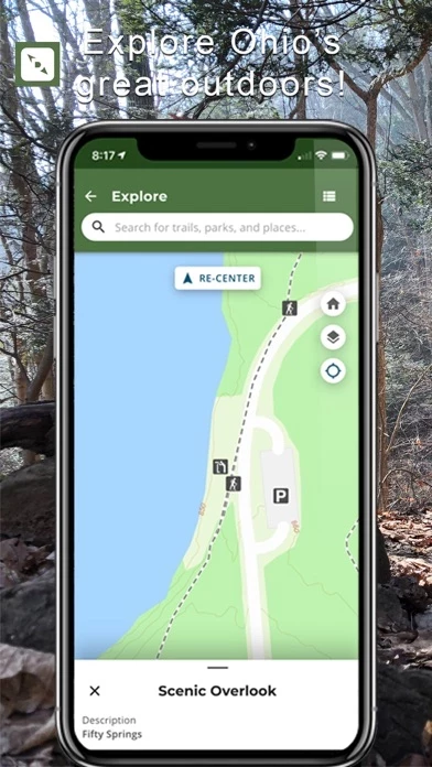
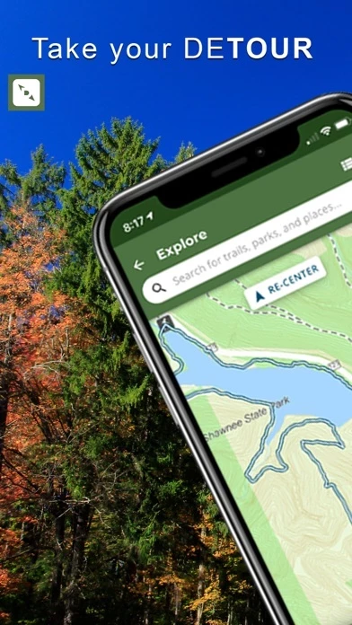
Whether at home planning your trip or on the road looking for spontaneous adventure, the new DETOUR trails app will make it easy to find what you are looking for.
Official Screenshots


Product Details and Description of
Explore and provide feedback on this release of the new DETOUR mobile trails app. Get off the beaten path. Find your DETOUR. This new app will help you discover Ohio's recreational trails in new ways. With over 6,000 trails to explore, DETOUR will prepare you for every twist and turn of your adventure. The DETOUR Ohio trails app offers the most comprehensive inventory and detailed information for all that each of Ohio’s unique trails has to offer. FEATURES • Basemap selections • Search (By trail name, location) • Filter (By Primary Trail Type, Activity Type, Difficulty, Trail Length, and Suitability) • Trail Attributes • Elevation Information • Featured Routes • Driving Directions to a Trailhead • User Profiles • Record Your Trip • Track your progress along the trail • Trip History • Favorite Trails • Upload Photos • Trip Reports • Submit Feedback • Report a Trail Problem • Offline Use FEATURES COMING SOON • Social Media Integration • Geotagged Photos • Interactive Elevation Profile • Weather Icon & 7-Day Forecast • View Preferred Direction of Trails FIND YOUR NEW FAVORITE TRAIL Whether at home planning your trip or on the road looking for spontaneous adventure, the new DETOUR trails app will make it easy to find what you are looking for. What are You Waiting for? Find your DETOUR!
Top Reviews
By Toxic Sadness
Needs work, but optimistic
Tried to favorite a trail for Mohican and it wouldn’t work. I am a hiker and nature photographer. I have been using a combination of All Trails and The OH division of wildlife Hunt Fish OH apps to search and plan my nature adventures around NE Ohio. It would be nice to have all this info in one place. A map that highlights public lands, an overall location/park map, and the detailed trail maps. For instance, if I search Mohican State Park, it would bring up a map of that location showing public lands and all trails. It would list the trails below, where you could tap on each one to get further info on that trail and a detailed map of said trail. I look forward to your future updates and the ability to use offline....as some locations are no service areas and I have to fill my phone full of screenshots of maps. I do like all the details and descriptions given of the trails. You’re on the right track. 😊
By Srlynch1
I Want to Use It...
I love the idea of this app! Not user friendly for searching for hikes if you don’t already know the name of the trail. You also can’t search near locations, only a radius from a current location. Great idea, needs work