Mapillary Software
Company Name: Mapillary AB
About: Mapillary has built a street-level imagery platform that uses photos which have been uploaded by
members of the public.
Headquarters: Malmö, Skane Lan, Sweden.
Mapillary Overview
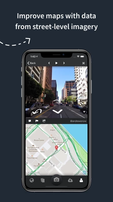
Mapillary combines all images into a collaborative street-level view of the world that’s available for anyone to explore and use for improving maps, cities, and mobility.
Mapillary is the street-level imagery platform that scales and automates mapping using collaboration, cameras, and computer vision.
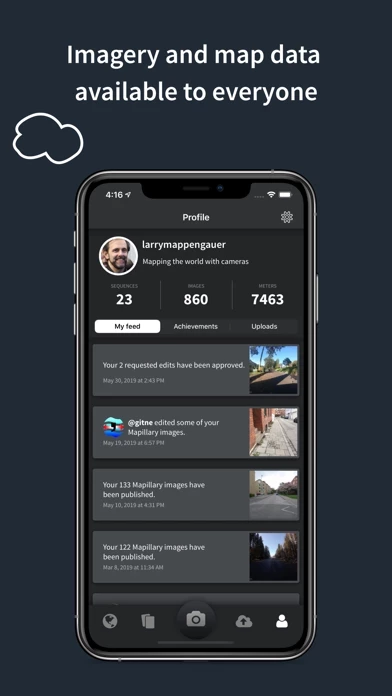
Official Screenshots
Product Details and Description of
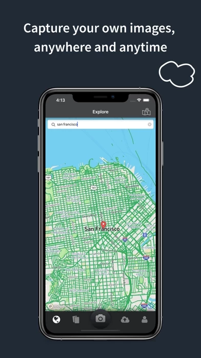
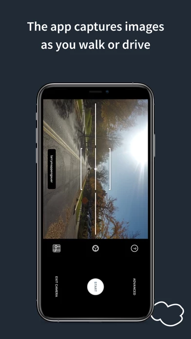
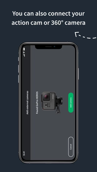
this app is the street-level imagery platform that scales and automates mapping using collaboration, cameras, and computer vision. Anyone can capture images of any place, as often as needed, with any camera—including smartphones. this app combines all images into a collaborative street-level view of the world that’s available for anyone to explore and use for improving maps, cities, and mobility. Computer vision technology provides a smooth viewing experience and speeds up mapping through machine-extracted map data. Capturing with the this app mobile app is the easiest way to join our contributor network. Let’s get started! CREATE YOUR OWN STREET-LEVEL VIEWS You control when and where to capture to create the freshest street-level imagery. this app’s technology combines all images into a navigable view and blurs faces and license plates for privacy. ACCESS AND OPEN UP DATA this app contributors are people, organizations, companies, and governments in 190 countries. Millions of images are added to the dataset every week, which you can explore right here in the mobile app. MAKE BETTER MAPS Use imagery and machine-extracted data to add details to maps and geospatial datasets. this app integrates with tools like OpenStreetMap iD editor and JOSM, HERE Map Creator, and ArcGIS. To access the available map data, go to this app.com/app.
Top Reviews
By Frode07
Instagram for maps!
Love this app! Mapped my home town on a bike over two weekends and now anyone can see what it looks like. Tried sending links to photos when I'm traveling and works great as a way for my friends to follow my adventures.
By rupo
Creating your own Google Street View, but better
Great geomapping crowdfunding app. So much fun, so useful to have access to all the images feo your trips in the past and so important to not depend from the commercial mapping monopoly of Google.
By JTs2Kool4Skool
This app is genius...!
I've seen other apps trying to share photos specific to places, but no one had thought as far ahead as these guys -- mapping the world in all views via social connections.