
Summit, Hiking Log Peakhunter Alternatives
Last Updated on 2022-10-19 by Peakhunter AG
Find best apps like Summit, Hiking Log Peakhunter, competitors and top software/SaaS apps in this
category. Features
- Bag peaks with GPS verification.
- Map: with peak location, compass
and distance grid
- Fit for the outdoors! No network needed. Works offline.
-
Download peak data (for offline use...
38 Best Alternatives To Summit Hiking Log Peakhunter
What are the best software like Summit, Hiking Log Peakhunter for 2025? Below are the most similar Navigation softwares we found.

GolfLogix Golf GPS App + Watch
GolfLogix is the pioneer of Golf GPS and for the past 22 years over 5 million golfers all around the world continually trust our groundbreaking technology to guide them on the course.
3D Flyovers of every hole using your personalized club distances
Precise GPS distances with slope adjustments
Full-color 3D course maps showing the contours of the fairway
Color heat maps of the green slopes so you know where to land your ap...

Waze Navigation & Live Traffic
Always know what’s happening on the road with Waze. Even if you know the way, Waze tells you instantly about traffic, construction, police, crashes, & more...
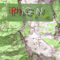
Iphigénie | The Hiking Map App
Everyone understands the need for a map; to prepare for an outing, a walk, a hike, a trip or simply to know where you are and about the environment that surrounds you. Iphigénie is a complete mapping app which - thanks to more than 40 maps - will allow you to find your way anywhere in the world...

Fietsknoop bike and hiking app
Use the bike and hike nodes system in The Netherlands, Belgium and the borders of Germany to plan your own bike routes. After you make your route you can save, mail and share it...

myTracks - The GPS-Logger
myTracks turns your iPhone or Apple Watch into a fully functional GPS logger. During recording, you can add waypoints to highlight important locations...

ParkMobile: Park. Pay. Go.
With over 20 million users, ParkMobile is a smarter way to park. Easily pay for street, lot, or garage parking right from your mobile device...

Avenza Maps: Offline Mapping
Avenza Maps, #1 app for hiking, biking and all trails. Featuring maps from National Geographic, national parks and more!
On your next adventure, stay on track with GPS using offline mobile maps...

Hiking & biking in SW Germany
Baden-Württemberg – The sunny side of Germany
Welcome to sunny SouthWest Germany, a very special vacation destination. Start with historic cities...

KOMPASS Outdoor & Hiking Maps
Wo der Asphalt endet, beginnt die Welt von KOMPASS. Die ganze Welt von KOMPASS gibt es in unserer KOMPASS-Wanderkarten-APP...

iLogger GPS
Easy and simple way get your GPS coordinates as well as their accuracy. You can log the readings as well as add notes and email the logs...

Transit • Subway & Bus Times
"Gives you the best route to where you want to go" - New York Times
“You won't realize how much time you can save planning until you use this app” - LA Times
“Killer app” - WSJ
"MBTA has a favorite transit app — and it's called Transit" - Boston Globe
Transit is your real-time urban travel companion. Navigate your city’s public transit system with accurate real-time predictions, simple trip planning, step-by-step...

SpotHero: #1 Rated Parking App
Park smarter with the SpotHero iPhone app. SpotHero helps you get everywhere, easier by making it fast and convenient to find and reserve parking in major cities...

Rother: Hiking & Maps
Wandern mit GPS-Navigation, Karte und Wegbeschreibung – Hol Dir die beliebten Rother Wanderführer als interaktive, offline nutzbare Guides.
Jeder Guide enthält rund 50 geprüfte Touren von ausgewiesenen Gebietskennern...

Google Maps
Navigate your world faster and easier with Google Maps. Over 220 countries and territories mapped and hundreds of millions of businesses and places on the map...

ParkWhiz - #1 Parking App
Take the hassle out of parking with the ParkWhiz app. Find parking in any major city, compare prices, plus save up to 50% when you book in advance...

Exxon Mobil Rewards+
The most secure and easy way to pay for fuel and earn rewards.
Exxon Mobil Rewards+ app allows you to stay in the comfort of your vehicle while you pay for Synergy™ fuel with your phone...

onX Hunt: GPS Hunting Maps
onX Hunt has been featured in Field and Stream, Outdoor Life and American Hunter as the best hunting app, hiking app, and GPS app for any outdoorsman or hunter. Used by millions of US hunters...

neanderland STEIG Hiking App
This app is the perfect companion and tour planner for your hike on the neanderland STEIG. It contains all the important information about the route, restaurants and sights...

bergfex: hiking & tracking
◄ bergfex Outdoor Tracking & Tours App ►
The perfect ALL-IN-ONE tool for all your outdoor activities. Use it for Hiking, Mountain Biking, Running, Cycling, Climbing, Nordic walking, Ski Tours, Fitness and much more...
Trails · Outdoor GPS Logbook
Record all your outdoor activities be it hiking, jogging, cycling, or canoeing, and observe real-time statistics on your Apple Watch.
Trails records and displays your geo coordinates along with comprehensive statistics including duration, distance, altitude, ascent/descent, speed, pace, step count (iPhone 5S and newer), and many more...

Paddle Logger: SUP & Kayaking
Record your epic sessions on the water for free!
For paddlers by paddlers. With carefully thought out, accessible design, Paddle Logger provides powerful functions to record your journeys, track your goals and be safer on the water...


SmartHalo - Bike smarter.
Bike smarter with SmartHalo, a minimalist, award-winning, circular interface that pairs with your iPhone to elevate your cycling experience. This is the smart biking device you’ve been waiting for...

FLYLOG.io - For Pilots
PILOT LOGBOOK • VFR NAVIGATION • GENERAL AVIATION
- Professional pilot logbook for all pilots with PPL, CPL, ATPL, LAPL
- EASA, FAA, CASA, TCA compliant exports in PDF
- Digital signatures
- Night-time calculation
- Connect with friends and colleagues
VFR NAVIGATION
- Worldwide maps, airspaces, airports, runways, frequencies
- Interactive NOTAM's
- AUP (Airspace Use Plans)
- Route planning
GENERAL AVIATION
- from reserv...

Archäologischer Park Xanten
Wie lebten die Römer am Rhein? Wie sah eine römische Stadt vor 2000 Jahren aus? Welche Berufe und Freizeitmöglichkeiten hatte man damals? Die Tour durch den APX beantwortet diese Fragen und mehr.
Die Tour führt Sie zu den sehenswerten Punkten im LVR-Archäologischen Park Xanten und bietet jede Menge Hintergrundinformationen zum RömerMuseum und den Rekonstruktionen wie Amphitheater, Hafentempel, Herberge, Handwerkerhäus...

Hiking Maps - PeakVisor
PeakVisor will make you a superhero of outdoor navigation by putting state-of-the-art 3D maps and mountain identification magic wand in your hand.
"PeakVisor uses your iPhone's camera and augmented reality (AR) technology to display names and elevation of nearby peaks...
Track My Journey - Travel Log
Top Ranking App in Navigation 2022
# Australia
# United States
# United Kingdom
# Ireland
# New Zealand
"Track My Journey" is an amazing app that helps you to save your important journeys with lots of features.
Click on the start button before every trip and end your trip by clicking the Stop button...

Topo Map & Hiking Tracker
** The #1 Hiking Tracker App for iOS **
TRACK YOUR STATS!
+ Total distance
+ Total vertical
+ Total time
+ Calories burned
* Optimized to save battery life
VIEW YOUR TRACKS!
+ Recap your hike on the map
+ Color coded tracks based on relative elevation
+ Quickly view stats on Apple Watch display
+ iOS 14 home screen widget
BACKUP TO iCLOUD
+ Automatically backup data to iCloud
+ Share data between devices
THE BES...

IGNrando' – France hiking maps
IGNrando’ is a French collaborative platform offering curated data and services related to outdoor activities.
RICH DATA OFFER
• Tens of thousands of available routes accross Metropolitan and Overseas France
• Choose the activity, difficulty and length to find routes around you or near any other place
• Download routes or mark them as favorites
MAPS IN FREE ACCESS (with internet connection)
• Plan IGN: most updated...

Wanderlog - Travel Planner
Wanderlog is a free travel app for planning every kind of trip, including road trips and group travel: create a trip itinerary, budget costs, organize flight and hotel reservations, view places to visit on a map, and collaborate with friends. After your trip, share a travel guide to inspire other travelers...

Orca: Boat GPS, Charts, Routes
Better boating with Orca.
Find your destination with accurate marine charts...

onX Backcountry Hiking Trails
Summer is here, and the onX Backcountry App is your ultimate guide to discovering new adventures, knowing exactly where you are in the backcountry (even without cell service), and getting home safely after a day -- or a week! -- in the mountains. Brought to you by onX, the leader in outdoor-recreation mapping apps loved by millions of users, onX Backcountry provides the unique combination of guidebook-quality trail content and...

Houston ConnectSmart Traffic
Avoid traffic and save time and money with ConnectSmart, Houston’s first all-in-one, customized commuting and transportation app that improves your daily commute and travel within the greater Houston region.
Customized Travel Options Tailored To Fit Your Needs
Whether you’re a Houston driver looking to avoid traffic with real-time GPS navigation and road conditions, a METRO rider looking to improve your trip, or a carpoo...

GPS Tracker: Offline Maps, GPX
Create, import, export tracks with waypoints. Supports offline maps, no time limits, no ads, no in-app purchases...

Parkaroo
Quickly find on-street parking with the Parkaroo iPhone app. If you are frustrated weaving through city streets looking for parking or paying for an expensive garage, Parkaroo is the app for you...
Nevada 511 Road Conditions
The best way to view 511 Nevada CCTV traffic cameras.
MAIN FEATURES INCLUDE:
- Create custom camera groups
- Quickly view all cameras on your route
- Add camera widgets to your home screen
- Live stream applicable cameras
- View NDOT & Vegas cameras
CREATE CUSTOM CCTV CAMERA GROUPS
Create custom groups of cameras based on your frequented routes and then simply scroll through the list of images...


