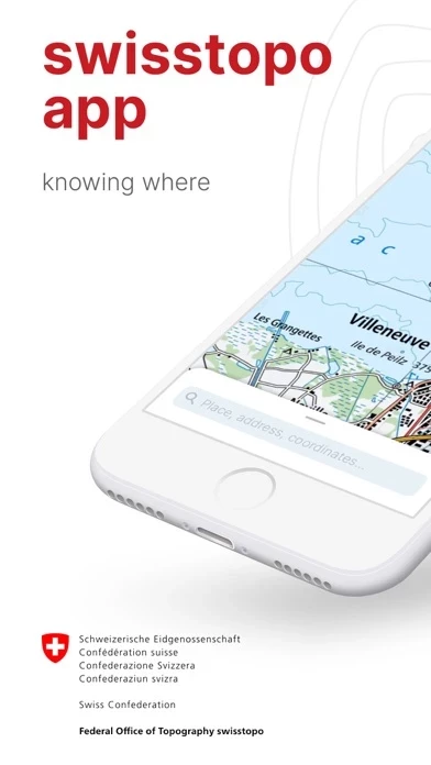
swisstopo Overview
What is swisstopo? The swisstopo app is a free app that won the "Master of Swiss Apps 2021" award. It provides access to national maps of Switzerland and offers features related to hiking, cycling, snow sports, and aviation. The app is free of advertising and does not require a login. It also offers offline use of all functions and data.
Features
- Access to all scales of national maps from 1:10,000 to 1:1 million
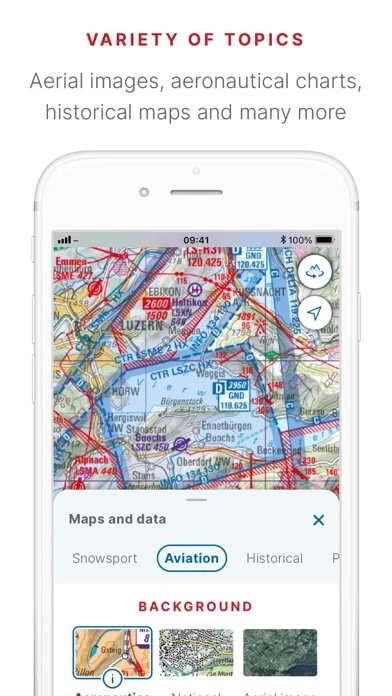
- Current aerial images and historical maps
- Official hiking, mountain hiking, and alpine hiking trails
- Closures of hiking trails
- Snowshoe and ski routes
- SwitzerlandMobility routes
- Public transport stops
- Free offline maps from 1:25,000 to 1:1 million
- Ability to draw, record, import, and share your own tours
- Set tour type (hiking, cycling, mountain biking) and personal pace
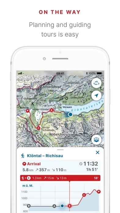
- Tour guide with arrival time and remaining distance
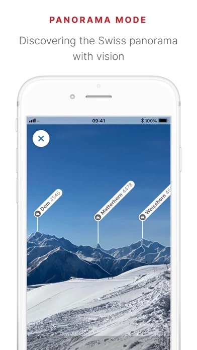
- Panorama mode with labelled panorama and view tour in "3D"
- Ability to save markers, add notes, and share
- Tools such as measure, compare, and search for geographical names, addresses, or coordinates
- Ability to report changes to maps and geodata
- Aeronautical charts, obstacles, and airspaces for aviation enthusiasts
- Landing sites and restrictions for drones and model aircrafts.
Official Screenshots

Product Details and Description of
On the road with the best app of the year: the this app app won the "Master of Swiss Apps 2021" award. Use the famous national maps to discover even the most remote places in Switzerland and topics such as hiking, cycling, snow sports and aviation. All functions and data of the app as well as offline use are free of charge. The app is free of advertising and does not require a login. - all scales from 1:10 000 to 1:1 million - current aerial image and historical maps - official hiking, mountain hiking and alpine hiking trails - closures of hiking trails - snowshoe and ski routes - SwitzerlandMobility routes - public transport stops ON THE ROAD - free offline maps (1:25 000 to 1:1 million) - draw, record, import and share your own tours - set tour type (hiking, cycling, mountain biking) and personal pace - tour guide (arrival time, remaining distance) - panorama mode (labelled panorama, view tour in "3D") - save markers, add notes, share TOOLS such as measure, compare and search (for geographical names, addresses or coordinates) Report changes to maps and geodata AVIATION - aeronautical charts, obstacles, airspaces - landing sites - restrictions for drones and model aircrafts Do you have a question? Then write to us: support-cd@this app.ch
Top Reviews
By tduehrko
Ganz tolle App
Funktioniert wirklich super gut! Schön, dass ihr den Massstab aufgenommen habt, der im Juli noch auf der Wunschliste war! Noch eine Idee, ich weiss nicht wie realistisch: Schummerung ist ja ein wesentliches Element, das die Landeskarte einzigartig macht. Jetzt wo die Karten digital generiert werden, könnte man da nicht die Sonnenrichtung und den Sonnenstand der Schummerung anpassbar machen? Ist vielleicht zu schwierig aber cool wäre es! Lg Tim
By C2C Rider
A really poor replacement
Swiss topi is an incredible disappointment compared to Swiss Map Mobile. The missing features are too numerous to mention. Please bring back Swiss Map Mobile.