FishTrack - Charts & Forecasts Software
Company Name: Surfline/Wavetrak
FishTrack Overview
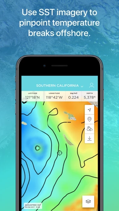
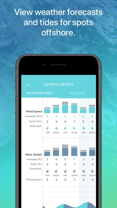
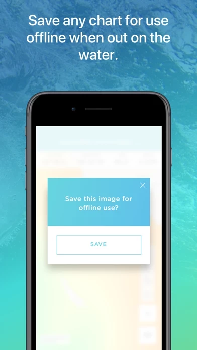
What is FishTrack? FishTrack is an app designed for saltwater anglers to help them find fish. It provides users with a range of features including Cloud-free Sea Surface Temperature (SST) charts, high-definition global satellite imagery, water temperature charts, water color, currents, tides, moon phase, and marine weather forecasts. Users can mark hot spots and record GPS locations of temperature breaks and color barriers. The app also allows users to save imagery and overlay data for offline use to identify bite zones while navigating offshore.
Features
- Cloud-free Sea Surface Temperature (SST) charts
- High-definition global satellite imagery
- Water temperature charts
- Water color, currents, tides, moon phase, and marine weather forecasts
- Mark, name and save data of potential hot spots
- Save fishing chart imagery for offline use
- Plot waypoints and calculate distances
- Overlay bathymetry, ocean currents and sea surface height
- View marine weather forecasts
- View your current location while offline
- Submit questions or comments through the app
- FishTrack Premium purchase option with subscription services/benefits for 1 month or 1 year period depending on product selection.
Official Screenshots


Product Details and Description of
this app provides saltwater anglers with everything they need to find fish. The this app app offers Cloud-free Sea Surface Temperature (SST) charts, high-definition global satellite imagery, including water temperature charts, water color, currents, tides, moon phase and marine weather forecasts – all in one layered tool. Users can mark ‘hot spots’ and record GPS locations of temperature breaks and color barriers. Save imagery and overlay data for offline use to identify bite zones while navigating offshore. With this app you can: -View the Latest SST and Chlorophyll imagery -Mark, name and save data of potential hot spots -Save fishing chart imagery for offline use -Plot waypoints and calculate distances -Overlay bathymetry, ocean currents and sea surface height -View marine weather forecasts -View your current location while offline Don't fish blind. Save time and fuel with the this app app. Download now to get started! We want to hear from you! Submit your questions or comments through our app to let us know what you think. If you'd like to speak directly with our customer service team, please e-mail us at: support@this app.com. — this app Premium purchase small print — • Subscription services/benefits (described above) are rendered for 1 month or 1 year period depending on product selection • Payment will be charged to iTunes Account at confirmation of purchase • Subscription automatically renews unless auto-renew is turned off at least 24-hours before the end of the current period • Account will be charged for renewal within 24-hours prior to the end of the current period, and identify the cost of the renewal • Subscriptions may be managed by the user and auto-renewal may be turned off by going to the user's Account Settings after purchase • Any unused portion of a free trial period, if offered, will be forfeited when the user purchases a subscription to that publication, where applicable • Full terms and conditions can be found here https://www.this app.com/terms-of-use http://www.this app.com/privacy-policy/
Top Reviews
By sellersname
Pick your days
Pick your days with this app and enjoy the sport!!
By 1cabo
This is the best app I’ve seen period
Awesome app five stars
By Capt Mike D
Excellent forecast
Great app for fishermen