TrackaShip Universal Overview
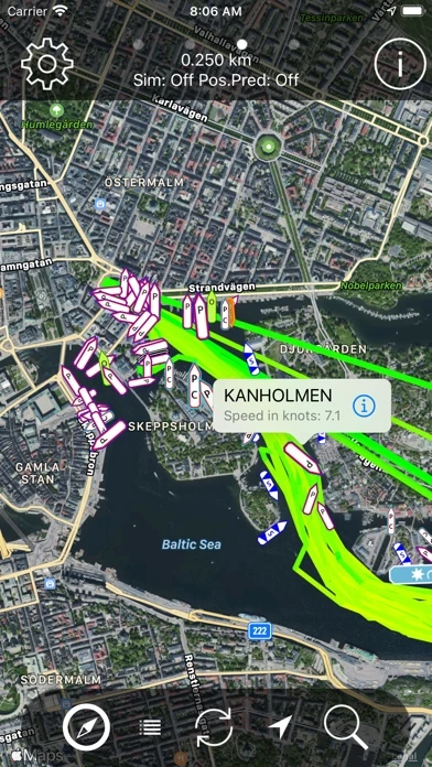
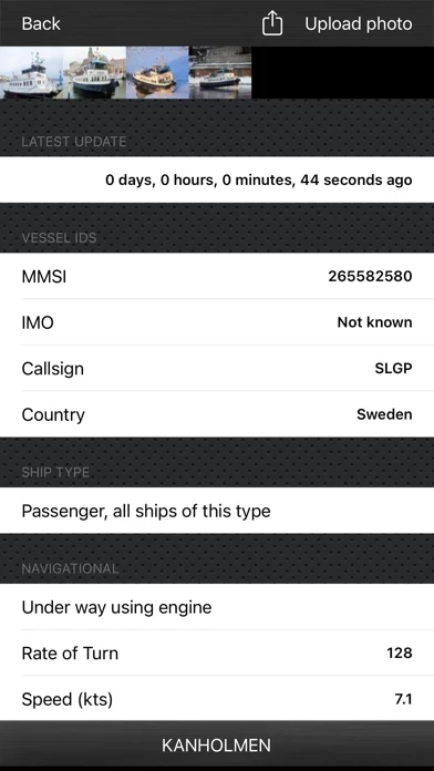
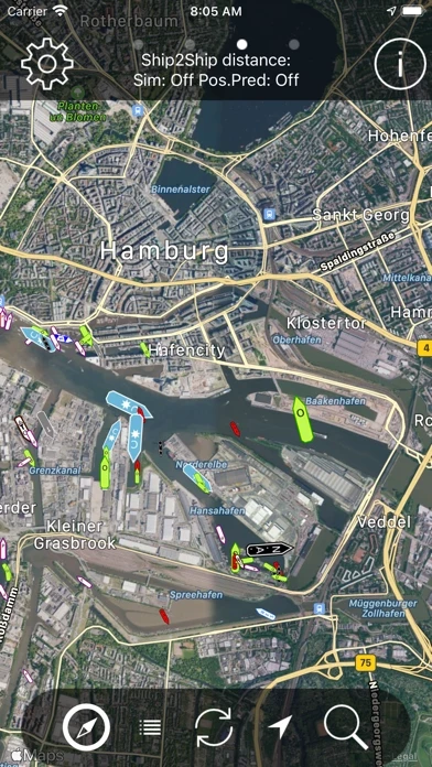
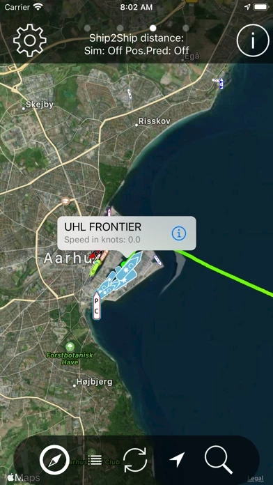
What is TrackaShip Universal? The app allows users to identify ships passing by the beach by providing details such as size, speed, course, destination, estimated time of arrival, and more. It has an easy-to-use interface and supports both iPhone and iPad. Users can access OpenSeaMap data within the app, measure the distance between ships, view ships on the map with large icons, and use the built-in compass and "direction" vector to find the direction of the ships. The app also allows users to upload and view images of the ships and place user-defined waypoints on the map.
Features
- Identify ships passing by the beach
- View details such as size, speed, course, destination, estimated time of arrival, and more
- Easy-to-use interface
- Supports both iPhone and iPad
- Access OpenSeaMap data within the app
- Measure the distance between ships
- View ships on the map with large icons
- Use the built-in compass and "direction" vector to find the direction of the ships
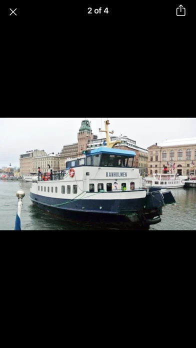
- Upload and view images of the ships
- Place user-defined waypoints on the map
- Copy waypoint positions to the clipboard
- Prepare a text message with the position of the waypoint
- Check out the free version of the app before buying
- Data is collected on a voluntary basis and may change without notice
- Accuracy and reliability of data are not covered by any guarantee and should not be used for navigation
Official Screenshots
Product Details and Description of
Ever wondered what ship it is you see passing a few miles off the beach?? This App gives you the ability to find out all the details of the ship, including size, speed, course, destination, estimated time of arrival and much more. All done with an easy to use and great looking App, which supports both iPhone and iPad. What people are saying about our App: "Best user interface of any ship app I have tried" B. Colson, Maine. "Love the graphical design and the large icons that makes it easy to determine the ship type" R. Clark, London. OpenSeaMap data is now accessible from within the app giving the possibility of showing the map data delivered by OpenSeaMap which includes seamarks, navigational rules and buoys in many areas of the world. Furthermore, you may measure the distance to the ships from your position, as you may measure distance between any two ships. This will show you if they are really on collision course or if it's just an illusion. See the ships displayed on the map with large and crystal clear icons. Built-in compass and "direction" vector which helps find the direction of the ships and vessels. Furthermore, images of the ships may be watched or uploaded directly from the app. This version supports iOS split screen multitasking found on selected device. Also we added the possibility to place user defined waypoints on the map (press and hold your finger on map). The waypoints can be used as measurement points from the user or between ships. Furthermore, by pressing the waypoint the position is copied to the clipboard, making it easy to paste positions into other applications. Pressing the callout of the waypoint will prepare a text message with the position ready to send to other users.Once the text message is received the user can press it and get the position up in various map apps. This functionality has been requested by search and rescue workers who would like a tool to help pin point positions to colleagues out at sea. Make sure to check out our FREE version of the app (Trackaship Superlite) before buying if in doubt about the coverage of you local area. The free version will show the same ships, but not any details. This app depends on the data received via the Internet and is dependent on the Internet for displaying data. Data is collected on a voluntary basis and may change without notice. If you live in an area with poor or no coverage, you have possibility to improve the situation. Send an email to [email protected] and we will contact you. Please note that the accuracy and reliability of data in this app are not covered by any guarantee and that, under no circumstances should be used for navigation. This app is no substitute for proper maritime instruments.
Top Reviews
By BravoEcho36
A Truly Fantastic App
This App is exquisitely crafted, and does everything it says it will do and everything you would want from a App like this. If you have any questions about any feature of the App, just write to the developer and he will be back to you very quickly, and precisely. I would highly recommend this App to anyone who has any interest in the movement of vessels on the oceans and ports of call around the globe.
By carisonlyheal
Excellent app
This is an amazing tool to locate a ship in a coverage zone of ocean/ sea by the identities we know about the ship. The app has nice design and works smooth, accurate information, easy to track ships. I'm not in the industry any more but find it great to keep an eye on "my ship""
By Marsbucks
Useful
This application is so useful.With it I can locate the direction and measure the speed of the ship.Really a practical tool!