
Atlas Nautical Charts Alternatives
Last Updated on 2023-02-24 by MapITech
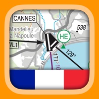
Find best apps like Atlas Nautical Charts, competitors and top software/SaaS apps in this
category. Mapitech launches Atlas, a worldwide digital cartography that combines vector
data with the best official up-to-date paper charts ie marinas, depth contours,
wrecks, fishing spots, boat ramps,...
31 Best Alternatives To Atlas Nautical Charts
What are the best software like Atlas Nautical Charts for 2025? Below are the most similar Navigation softwares we found.

Waze Navigation & Live Traffic
Always know what’s happening on the road with Waze. Even if you know the way, Waze tells you instantly about traffic, construction, police, crashes, & more...

ParkMobile: Park. Pay. Go.
With over 20 million users, ParkMobile is a smarter way to park. Easily pay for street, lot, or garage parking right from your mobile device...

Avenza Maps: Offline Mapping
Avenza Maps, #1 app for hiking, biking and all trails. Featuring maps from National Geographic, national parks and more!
On your next adventure, stay on track with GPS using offline mobile maps...

PRO CHARTS - Marine Navigation
MiraTrex PRO CHARTS™ is a powerful, yet easy-to-use marine navigation system. Whether you’re a fisherman, weekend cruiser, sailor, diver, jet-skier, or an offshore captain needing to find an exact location hundreds of miles offshore, PRO CHARTS™ will get you there and back home safely – with nothing more than your iPhone or iPad...

Transit • Subway & Bus Times
"Gives you the best route to where you want to go" - New York Times
“You won't realize how much time you can save planning until you use this app” - LA Times
“Killer app” - WSJ
"MBTA has a favorite transit app — and it's called Transit" - Boston Globe
Transit is your real-time urban travel companion. Navigate your city’s public transit system with accurate real-time predictions, simple trip planning, step-by-step...

SpotHero: #1 Rated Parking App
Park smarter with the SpotHero iPhone app. SpotHero helps you get everywhere, easier by making it fast and convenient to find and reserve parking in major cities...

Google Maps
Navigate your world faster and easier with Google Maps. Over 220 countries and territories mapped and hundreds of millions of businesses and places on the map...

ParkWhiz - #1 Parking App
Take the hassle out of parking with the ParkWhiz app. Find parking in any major city, compare prices, plus save up to 50% when you book in advance...

NV Charts GPS Navigation AIS
A clearly structured navigation app with intuitive and comprehensive tools for navigation on board. All current editions of the boating charts or maps from NV Verlag / NV Charts can be easily downloaded and used for offline navigation with the NV Charts App...

Exxon Mobil Rewards+
The most secure and easy way to pay for fuel and earn rewards.
Exxon Mobil Rewards+ app allows you to stay in the comfort of your vehicle while you pay for Synergy™ fuel with your phone...

onX Hunt: GPS Hunting Maps
onX Hunt has been featured in Field and Stream, Outdoor Life and American Hunter as the best hunting app, hiking app, and GPS app for any outdoorsman or hunter. Used by millions of US hunters...

BayernAtlas-App
Liebe Nutzerinnen und Nutzer der BayernAtlas-App!
Die Bayerische Vermessungsverwaltung hat sich dazu entschlossen, die BayernAtlas-App zum Jahresende 2020 einzustellen.
Die App wird ab diesem Zeitpunkt nicht mehr im App-Store verfügbar sein...

FishTrack - Charts & Forecasts
FishTrack provides saltwater anglers with everything they need to find fish. The FishTrack app offers Cloud-free Sea Surface Temperature (SST) charts, high-definition global satellite imagery, including water temperature charts, water color, currents, tides, moon phase and marine weather forecasts – all in one layered tool...

Camio (HD Dashcam)
Record your driving/cycling trips on HD video with crucial data overlays such as speed, time and geographical location and map. Get accurate speed reading on gauges from GPS with adjustable update frequency...

Tide Charts
Finally a beautiful and simple way to view tides on your mobile device! In addition to worldwide tidal estimates, you can see the lunar data, weather forecast, and current radar making your next outdoor adventure as easy to plan as possible.
By default, the application will pick the closest station to you, but picking a different station is as easy as viewing a map of your current location...


SmartHalo - Bike smarter.
Bike smarter with SmartHalo, a minimalist, award-winning, circular interface that pairs with your iPhone to elevate your cycling experience. This is the smart biking device you’ve been waiting for...

RipCharts
Welcome to RipCharts, an industry leader in satellite fishing maps. This app is free to download for existing RipCharts Premium subscribers...
i-Boating: Marine Charts & Gps
This App offers access to Marine Charts for USA,Canada,UK/Ireland,Germany,Netherlands/Holland &
Europe Rivers (Danube,Drava,Rhein etc). Coverage includes NOAA marine vector
charts,freshwater lake maps,USACE inland river maps (HD/1ft/3ft bathymetry
included where available),charts derived from UKHO & CHS data...

Fires - WILDFIRE INFO & ATLAS
Fires is a comprehensive wildfire information resource and navigation app.
▶▶ WILDFIRE INFORMATION RESOURCE
▶ Incident Details
Fires provides maps, photos, and information about wildfires from several sources for the United States...

Angelatlas
Der Angelatlas Sachsen ist ein mobiles und interaktives Verzeichnis aller sächsischen Angelgewässer. Er zeigt Dir die Flüsse und Seen, für die die drei Regionalverbände Dresden Elbflorenz, Südsachsen Mulde / Elster e...


HiiKER: The Hiking Maps App
HiiKER is the hiking app that is dedicated to building tools specifically for the hiking community. More than just a map and a compass, the app enables you to hike in the great outdoors with confidence, now with free offline maps...

Orca: Boat GPS, Charts, Routes
Better boating with Orca.
Find your destination with accurate marine charts...


GPS Tracker: Offline Maps, GPX
Create, import, export tracks with waypoints. Supports offline maps, no time limits, no ads, no in-app purchases...

Parkaroo
Quickly find on-street parking with the Parkaroo iPhone app. If you are frustrated weaving through city streets looking for parking or paying for an expensive garage, Parkaroo is the app for you...

Atlas Obscura Travel Guide
Find your adventurous spirit, get off the beaten path and discover unique places to experience near and far, all contributed by Atlas Obscura’s global community of explorers.
---
EXPLORE THE MAP
We’ve plotted the entire Atlas Obscura database in a single map, allowing you to easily find unique places nearby or to help plan your next trip...
Nevada 511 Road Conditions
The best way to view 511 Nevada CCTV traffic cameras.
MAIN FEATURES INCLUDE:
- Create custom camera groups
- Quickly view all cameras on your route
- Add camera widgets to your home screen
- Live stream applicable cameras
- View NDOT & Vegas cameras
CREATE CUSTOM CCTV CAMERA GROUPS
Create custom groups of cameras based on your frequented routes and then simply scroll through the list of images...


