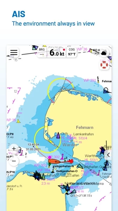
You can connect a Wlan AIS receiver to the NV Charts and the app display AIS Class A and B signals and navigation aids (ATON), as well as MOB AIS SART transponder distress transmitters, directly in the digital chart in real-time and the traffic situation can be assessed better.
One way to have great nautical charts both on paper and on our phone or tablet is to use our popular combination pack of paper and digital nautical charts, which includes both charts in clever atlas format and a license for digital nautical marine boating charts/maps for use in the NV Charts App, including an update service.
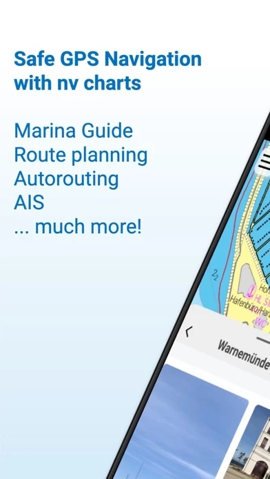
All current editions of the boating charts or maps from NV Verlag / NV Charts can be easily downloaded and used for offline navigation with the NV Charts App.
In addition you can also purchase digital boating charts as a subscription directly in the NV Charts App.
You can now add marinas, anchorages and navigation warnings to the digital chart and also add and share interesting places beyond navigation, such as restaurants or points of interest with pictures.