Hurricane Track Outlook Overview
gives you the most up to the minute and reliable hurricane & Typhoon path,Tracking Map,coordinates data,Satellite Images, Computer Models,Warning Information and high resolution Satelite maps... with data provided by 22,000+ trusted or official weather stations all over the world.
* Optional Forecast Model Viewer Add-On: View forecast models (also known as spag models) for active systems on an interactive map complete with panning, zooming, and individual model point information when tapped.
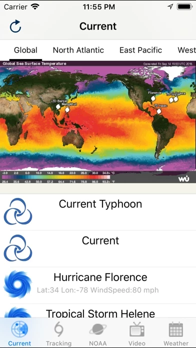
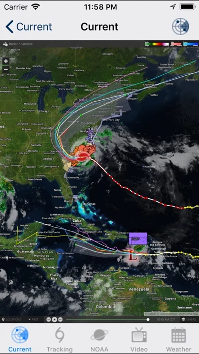
Official Screenshots

Product Details and Description of
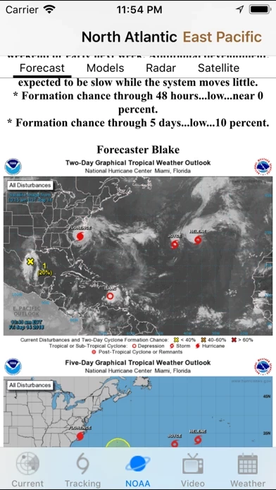
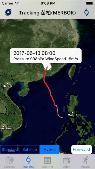
Hurricane & Typhoon Track allows you to keep track of tropical storm ,Typhoon,and hurricane activity in the Global Ocean basins. gives you the most up to the minute and reliable hurricane & Typhoon path,Tracking Map,coordinates data,Satellite Images, Computer Models,Warning Information and high resolution Satelite maps... with data provided by 22,000+ trusted or official weather stations all over the world. Also, you will be able to stay informed on the status of the local and national power grid and surge probability. Here are the key highlights of this application... * Quick overview of active hurricanes, tropical storms, depressions, and other cyclones * Get real-time Hurricane & Typhoon Tracking * Emergency Shelters * Tap on any map to view full screen, with pinch-to-zoom, drag, and scroll support, even during loop playback * Current Storm Location * Computer Models * Forecast cones (5-day uncertainty track), wind speed probability, storm surge maps (when available), and GOES Floater satellite imagery * Storm Surge Probability * Optional Forecast Model Viewer Add-On: View forecast models (also known as spag models) for active systems on an interactive map complete with panning, zooming, and individual model point information when tapped. Features selectable models, start time, and run length * Sharing of screenshots with any app that supports it (Facebook, Twitter, etc.) * Multiple types of regional summary maps and satellite loops to choose from (full list below) * Road Maps * Historical Map * Per-storm advisory & discussion text from the experts at the National Hurricane Center, Public & Marin Advisory ************************************** all the data is just from National Oceanic and Atmospheric Administration, (NOAA) Stay informed about the latest tropical systems in the Atlantic,Pacific,Indian Ocean and Caribbean . Get the most recent maps and forecast details about active storms.
Top Reviews
By Carlos2291pr
Ads!
Please!!! Removed Ads options!!!
By Sas707
Crashing!
Love the app, lots of great info but it's constantly crashing.
By MrLimoAK
2 stars could be more if ad's were substantially reduced.
Well the app is nice. But you have to constantly close ad's. Should be marked as Ad with hurricane background. Greedy developer I would pass on this app!