Earthquake Lite - Realtime Tracking App Software
Company Name: Mobeezio, Inc.
About: Mobeezo is a mobile software developer for androi
Headquarters: San Diego, California, United States.
Earthquake Lite Overview
What is Earthquake Lite?
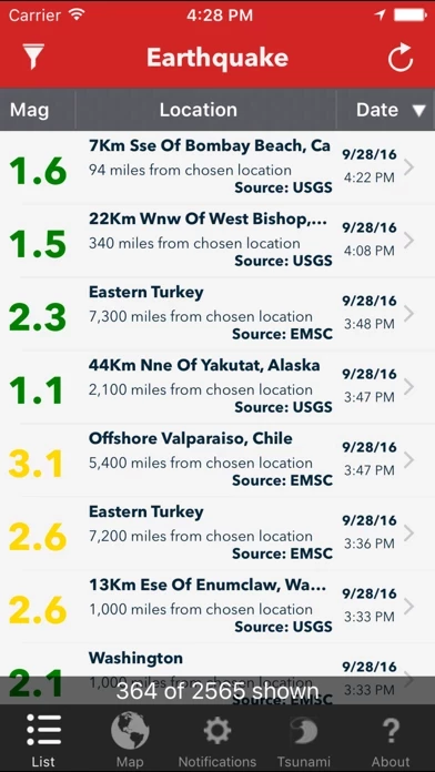
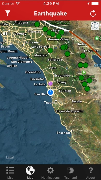
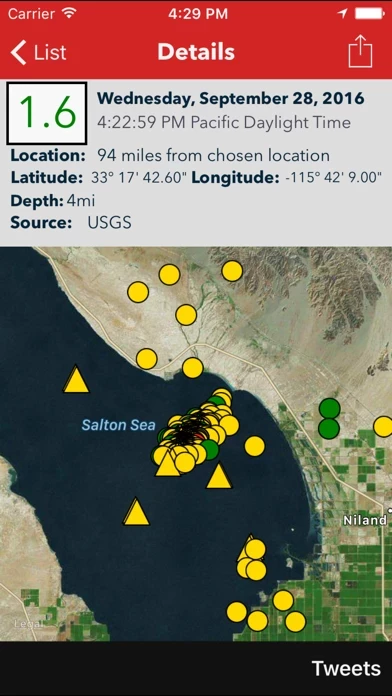
The Earthquake app is a free smartphone application that allows users to track and follow earthquakes in real-time from around the world. The app provides live earthquake data, international data, tsunami information, and full Google Map integration with detailed map view. It also offers color and size-coded pins to see relevant earthquakes at a glance, integration within the map to the reporting agencies' website, and real-time Twitter and Facebook integration.
Features
- Live earthquake data delivered quickly to your phone
- International data from various reporting agencies
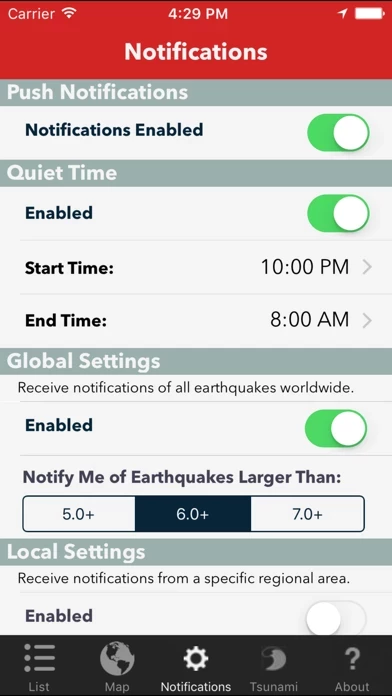
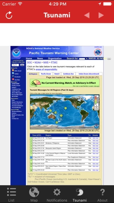
- Tsunami information
- Sort list by Magnitude, Location, or Time
- Full Google Map integration with detailed map view
- Color and size-coded pins to see relevant earthquakes at a glance
- Integration within the map to the reporting agencies' website
- Report if you felt an earthquake directly on the USGS website
- Email detailed screenshots of maps and vital details anytime to anyone
- Real-time Twitter and Facebook integration
- Optimized for the iPhone, iPod Touch, and iPad
- Free lifetime updates
- Other apps by the same developer include Dog Whistler, Mobile Caddy, Hurricane Monitor, Air Quality, Thumper, Date Util, Polar Opposite, Earthquake (full version), and Free Metal Detector.
Official Screenshots
Product Details and Description of
***** As written in the NY Times. The free version of Computerworld's "Favorite smartphone apps" ***** Track and follow earthquakes now around the world in real time! * Live earthquake data delivered quickly to your phone * International data (USGS, EMSC, GeoNet, Natural Resources Canada, British Geological Survey, GFZ, INGV, KNMI, MNSS, OVSICORI, and GeoScience Australia) * Tsunami information * Sort list by Magnitude, Location, or Time * Full Google Map integration with detailed map view * Color & size coded pins to see at a glance relevant earthquakes * Integration within the map to the reporting agencies' website * Report if you felt an earthquake directly on the USGS website * Email detailed screenshots of maps and vital details anytime to anyone * Real time Twitter and Facebook integration! See Tweets related to the earthquake plus Tweet out your own news. Post to Facebook a detailed map & information plus your own comments. * Optimized for the iPhone, iPod Touch and iPad * Free lifetime updates (Please let us know your suggestions. We love to hear from you and implement most ideas. [email protected]) ** Please check out our other apps, Dog Whistler & Dog Whistler Pro (consistently ranked in top 10), Mobile Caddy (previously chosen as a Staff Favorite), Hurricane Monitor, Air Quality, Thumper, Date Util, Polar Opposite, Earthquake (full version), and Free Metal Detector.
Top Reviews
By Arizona Willy
Great app
I look at this app daily since 2012. I wish you could color each seismic number with a different color? 2.1-2.9 green e.g., 3.0-3.9 yellow e.g., 4.0-4.9 orange, 5.0-5.9 e.g., red, And so on. It would be very helpful. I use this app for my geography lesson. Thanks. AZ Bill.
By Old learner
Great
I’ve been interested in earthquakes for decades. For maybe 15 years I’ve been receiving notifications from USGS ENS about worldwide earthquakes at levels I want. It’s FREE. Half an hour I upgraded this QuakeFeed app for $2. Well worth it.
By Ken6220
Thanks
I wish I could afford to upgrade this. It’s sure showing me where all the earthquakes are and how close they are.