Iphigénie The Hiking Map App Overview
What is Iphigénie The Hiking Map App?
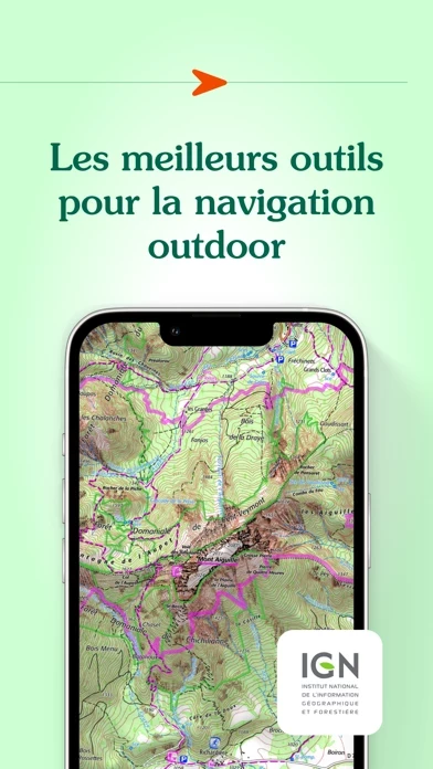
Iphigénie is a mapping app that provides access to more than 40 maps worldwide. It offers a variety of tools to prepare, follow, record, archive, and share your outings. The app allows you to download maps for offline access, create, edit, and import GPS tracks, position and import useful markers, follow a GPS track with optional guidance sounds, record your track and position, and export your tracks and markers in GPX format.
Features
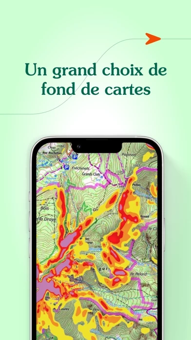
- Access to more than 40 maps worldwide, including OpenTopoMap, OpenSnowMap, French IGN topographic national maps, SwissTopo maps, Spanish topographic maps, Norwegian topographic maps, and many others.
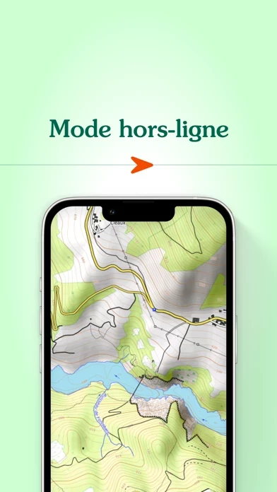
- Download maps for offline access.
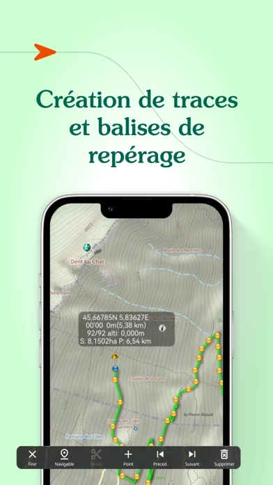
- Create, edit, and import GPS tracks.
- Position and import useful markers (e.g. avalanche path, mushroom spots…).
- Follow a GPS track with optional guidance sounds to keep you on-track.
- Customized vocal alerts.
- Information like distance covered, distance remaining, estimated arrival time.
- Beacon, to allow chosen contacts to follow your outing progress in real-time.
- Record your track, your position.
- Information like distance covered, elevation gain and loss, average and current speed.
- Tracks and markers saved in a folder.
- Cloud access.
- Export your tracks and markers in GPX format.
- Customer-focused team available to answer all your questions and assist you as you progress.
Official Screenshots
Product Details and Description of
Everyone understands the need for a map; to prepare for an outing, a walk, a hike, a trip or simply to know where you are and about the environment that surrounds you. Iphigénie is a complete mapping app which - thanks to more than 40 maps - will allow you to find your way anywhere in the world. We include some of the most popular maps in the world: - OpenTopoMap (worldwide topography) - OpenSnowMap (worldwide ski slopes) - French IGN topographic national maps - SwissTopo maps - Spanish topographic maps - Norwegian topographic maps and many others*… But much more than just your location on a map, iPhigénie offers you a variety of tools that will allow you to prepare, follow, record, archive and share your outings. PREPARE - download maps for offline access - create, edit, import GPS tracks - position, import useful markers (e.g. avalanche path, mushroom spots….) - 3D view FOLLOW - follow a GPS track (with optional guidance sounds to keep you on-track) - customised vocal alerts - information like distance covered, distance remaining, estimated arrival time - beacon, to allow chosen contacts to follow your outing progress in real time. RECORD - record your track, your position - information like distance covered, elevation gain and loss, average and current speed ARCHIVE - Tracks and markers saved in a folder - Cloud access SHARE - export your tracks and markers in GPX format By selecting iPhiGéNie, you enjoy not only a complete and stable application, but also a customer-focused team available to answer all your questions and assist you as you progress. So, if you encounter any difficulty with the app, do not hesitate to contact us: support(at)xn--iphignie-f1a.com *AVAILABLE MAPS : Note : editor subscription needed for marked “**” maps - IGN France : Topographic and road maps (current, 1950)**, Scan 1/25k all scales**, OACI (aviation)**, ESRI** (worldwide), French satellite view (current, 1950-1965, 2000-2005, 2006-2010), cadastre**, French administrative limits, Plan IGN V2, slopes 30° 35° 40° 45°, restricted drone areas, 19th century maps, Paris satellite view (1818-1824, 1906, 1965-1980). - SwissTopo : Topographic and road maps, satellite view, hiking trails, gliding maps, OACI (aviation), geological maps, slopes >30°. - IGN Belgium : Topographic and road maps (Cartoweb)**. Institut Cartogràfic de Catalunya Topographic maps. - Instituto Geografico Nacional (Spain) : Basic maps, topographic and road maps. - Bundesamt für Kartographie und Geodäsie (Germany) : Topographic and road digital maps - Kartverket (Norway) : Topographic and road maps - OpenTopoMap.org (worldwide) : OpenTopoMap. - OpenCycleMap (worldwide) : OpenCycleMap, landscape, transport, outdoor. OpenSnowMap (worldwide) Ski areas, pistes and trails. - Geological and Mineral Research Bureau (France) : Geological maps. - Forests National Office (France) : Public forest delimits, public forest plots. NOTES: Beacon : WARNING, do not rely solely on this feature for safety. Planning, communication and knowledge are the ultimate tools for safety in the mountains. Apple Store subscriptions are recurrent, their renewal is automatic. ** Editor subscription required *** Vmax module purchase is required to access iPhiGéNie’s tools (this is not a subscription) – without Vmax module you only get access to your location on the map.
Top Reviews
By Bonrandonnee
Absolutely indispensable!
Ok, so obviously several reviews are in English and the lack of English documentation is an issue they should address eventually. But as it is--for me at least--things speak for themselves! It's maps, people: you zoom in and out and back and forth and voila, all of France is on your device. I'm currently one month into a year-long hiking journey in France and the $16 price has paid for itself dozens of times over (each IGN map, printed, is not only cumbersome and heavy, but quite expensive) already. The GR trails are extensively mapped and nearly *every* feature is named and displayed, from the Louvre to ramshackle outhouses in Provence. The trail blazes themselves are sometimes sparse and less than perfect; it is then that this app is worth its electronic weight in gold. DO YOUR RESEARCH to determine if it's the right app for you, and take advantage of the English section on their website's forum BEFORE you buy. Do that, and I promise you'll thank your lucky etoiles for this app every day.
By short tack
Decent for trip tracking in France
After MotionX Drive failed to load local maps in France due to a (permanent) network error, I switched to this app as a navigation aid. Pleased with the ability to see where we were and where we were going, especially on country roads in the middle of Normandy. We even got (briefly) on a farm track that was mapped as a country road. (It was), but we knew how to route around. For most travelers, the ability to pre-load any level of map detail via WiFi will keep your France data downloads to a minimum, and save huge amounts of money on a one or two week trip. The iPad ability to zoom out and then zoom in to the 200 meter level is great and much appreciated. My wife the Navigator liked this app so much she wants an iPad. Note: the tracking and planning features are rudimentary. And you'll have to pay for a map update subscription after a few months, so one strategy would be to buy/install the month of your trip. Overall, I would use MotionX Drive if it worked in France as it has turn-by-turn voice instructions. Bon voyage!
By longshadows
Beautiful, but...
The price is extremely good value and the maps supported are excellent and up to date, but the interface is cryptic. The support documentation is all in French. So, unless you have a pretty good grasp of French, be warned. I downloaded a section of maps for the Dordogne region, for off-line use to avoid data rates, taking up a lot of space on my iPad, but I have no idea how to delete them, after I return from holiday and no longer need them. Okay, this is French mapping program, but get real, many English-only speaking people travel to la belle France and would enjoy this app. I'd give it five stars, if it had English documentation.