Topo Map & Hiking Tracker Reviews

Topo Map & Hiking Tracker Reviews

Published by on 2024-06-12

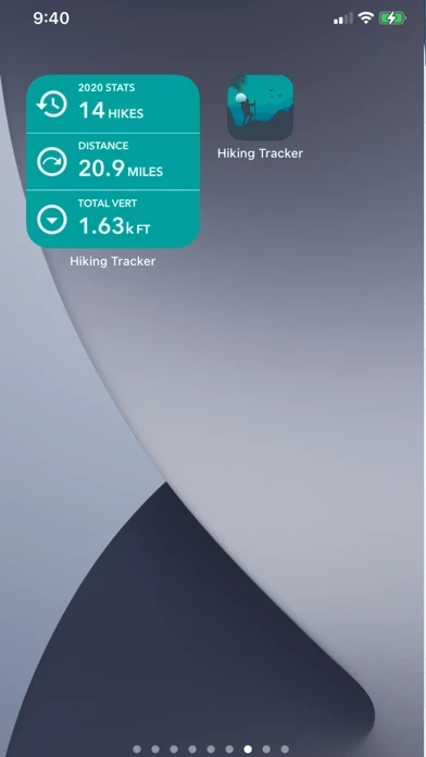
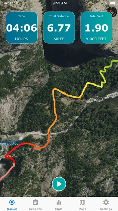
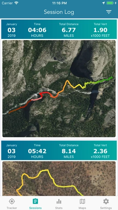
🏷️ About: ** The #1 Hiking Tracker App for iOS ** TRACK YOUR STATS! + Total distance + Total vertical + Total time + Calories burned * Optimized to save battery life VIEW YOUR TRACKS! + Recap your hike on the map + Color coded tracks based on relative elevation + Quickly view stats on Apple Watch display + iOS 14 home screen widget BACKUP TO iCLOUD + Automatically backup data to iCloud + Share data between devices THE BES.



Overall Customer Experience 😎


😎👌🔥 Positive experience
50.2%

👿🤬😠 Negative experience
25.6%

🙄💅🫥 Neutral
24.2%

~ from Justuseapp.com NLP analysis of 1,315 combined software reviews.


Read 30 Customer Service Reviews 👿🤬😡😠💢😤

4.7 out of 5

Doesn’t work

2022-10-28

Took TopoMapHikingTracker for a try on my 30 mile hike just outside a Major city in Silicon Valley. The map feature worked for about 10 minutes before it went black. There isn’t an ability to zoom out from your route to see how far you’ve been. The whole screen just starts to flash if you do that. To put a cherry on top TopoMapHikingTracker “encountered an error” and erased the entire 30 miles of data from the last 8.5 hours.

No apps were running in the background. Nothing else was open.

All TopoMapHikingTracker did was drain my battery life

It doesn’t track your total Vert

2022-11-29

Everything is great about TopoMapHikingTracker except that it doesn’t track your total amount of vertical gain. So if you walk up a mountain and down a valley and then back up a mountain again TopoMapHikingTracker doesn’t count the second hill. It’s soul crushing that TopoMapHikingTracker fails to track all your hard work. All the rest doesn’t matter.

Distance is way off

2022-12-30

I recently started hiking again after 13 years of being on a cane/walker and have been really excited to track my progress as I go. I have loved being able to show my doctors/surgeon all the progress I have made. However, it appears none of my hikes have been accurately tracked. This morning I stopped to sit for a few minutes and while I was checking my route on TopoMapHikingTracker , my distance kept increasing. When I sat down I was at exactly a mile but when I got up I was at 1.05 miles. The last update notes for TopoMapHikingTracker state that the distance problem was fixed but clearly it’s not and now I feel terrible about excitedly showing everyone my progress. I know it may seem trivial but for someone who was essentially bedridden for my entire adult life, this is devastating. So, thanks for “fixing” this issue.

Only the timer works right.

2023-01-31

Tested TopoMapHikingTracker out on a local trail. The timer worked well and was pretty much the only good thing about TopoMapHikingTracker.

Local signs stated the trail was 7.1 miles and google stated it was 7 miles even. After completing the trail, TopoMapHikingTracker said it was 8.12 miles. The description says they fixed this distance accuracy, but that’s false.

The trail was pretty much flat, I personally didn’t notice any elevation gain, but TopoMapHikingTracker stated there was an increase of 45 over the 7 mile stretch. What confuses me is that there’s a lot of yellow, orang or red coloring for such a minor elevation gain. This needs to be fixed.

TopoMapHikingTracker has a lot of promising features, but non of them work.

Two important missing features

2023-03-04

This is a pretty good app but it has two features that I think ought to be included: 1) I cannot force TopoMapHikingTracker to save maps when I am home or in a lodge using Wi-Fi. It only appears to save the maps as the developer intended when I am somewhere using cell phone data service, which is not only more expensive but problematic if I’m in a place where there isn’t any cell service. It’s also very unclear how long maps are stored when I do successfully save them. This makes it impossible and potentially dangerous to rely on TopoMapHikingTracker in many situations. 2) I can’t find any way to export the sessions into a .KML or .GPX format so that I can pull it into another mapping program where I plan my routes and save records of old trips. I understand that TopoMapHikingTracker is really intended as an exercise tool, but I have used it in remote situations to ensure that when I am off trail I am actually where I think I’m supposed to be in wilderness exploring using a paper topo map. It’s great to be able to use just my cell phone and not carry another heavy electronic device and batteries on a backpack to validate my map reading skills!

Missing data as on saved data

2023-04-02

Excellent app. Doesn't, however, save calories or elevation data on saved hike map. Data is there on bottom of map when u finish a hike, but when u save, data not on saved map.

Calories

2023-05-04

I love everything about TopoMapHikingTracker , except it doesn’t save the calorie burn information for each logged hike. It does this for distance, elevation, and time but not calories and I wish it would. Besides that I think it’s perfect!

Distance issues, otherwise love

2023-06-04

I did the same hike a week apart, and it said there was a mile more the second time (this is a hike I’ve done dozens of times, so no chance I took a different route). The gain however was almost identical each time. So mileage tracking is a bit off. However I do overall love this. I love being able to visualize my progress! I love getting my own map of the trail, and even if mileage is off it still gives me a ballpark idea.

Horseback riding

2023-07-06

Great app!
I use TopoMapHikingTracker while horseback riding and hiking. It is easy to figure out, has accurate maps and with the continuous tracking lines it is easy to get back to the trailhead. Also, unlike other apps, I can use my camera, check my messages while TopoMapHikingTracker continues to run.

Excellent; Lite and simple.

2023-08-06

This is a very nice, lite, clean app. No ads, just a few basic options and no clutter. User interface is simple and intuitive.
Only used it a handful of times so far but really like it. I will use it daily for my woods walks with the dogs.
I wish all apps were this lite and simple.

Don’t leave home with out it.

2023-09-07

The simplest tracking app and most accurate with lots of features that I’ve ever come across. Not cumbersome not complicated even a monkey could do it.

Lots of data

2023-10-09

Great app for walking-hiking. Provides a lot of useful data and allows use of phone and other apps while tracking. Worked smoothly. Add Health app connection and its tops.

Simple, useful, and actually free

2023-11-09

I wanted to track my hike on Peaks Island on vacation - I found TopoMapHikingTracker and it did not disappoint. Easy to use, informative interface, everything an app like this should be.

Does the job

2023-12-11

So many gps aps add all sorts of unnecessary stuff. I don’t want anything more than a trail of breadcrumbs I can use to figure out where I started, where I am, and help me get a good guess about the way home.

All those extra features/layers/buttons most GPS aps add are just an annoyance. This, while not at all bare bones, does everything I need but keeps it simple.

Hiking Tracker App

2024-01-11

Love being able to use TopoMapHikingTracker in the background. Tracking is decently accurate, but probably my phones natural locating is the problem rather than the apps.

Also love the utilization of multiple topographical maps because different topo maps have different features -some are better showing roads and trails while others are better with natural geographical features.

Oh and let’s not forget... no advertisements to be bothered with!!!

Great app so far

2024-02-12

Very simple and easy to navigate. I’ll be hiking with it this week and will update my review when I’ve seen it in action.

THANK YOU!! Best Value for My Needs

2024-03-15

Ah the good old times of NO SUBSCRIPTIONS & NO ADS. Very clever design features: battery charge preservation during the trip by using phone’s Airplane mode and preloaded local map. Thank you for the user friendly phone-sized controls. TopoMapHikingTracker does everything I wanted for casual hiking and biking, for a BUCK, without a 50-page PDF tutorial. I hope the developer sells hundreds of millions; it will be a well deserved fortune, and a positive step in the right direction away from ripoff auto-renew subscription apps.

Hiking

2024-04-14

This is a great app. Would only change one thing - to add the ability to name the trails. I don’t think you have it on there as I can’t find it if you do. Thank you.

We use this all the time for hiking!

2024-05-16

Best app ever! Thank you for making it so affordable. We use it to hike all over Upstate NY. Very user friendly!

Great app

2024-06-16

Finally, with the help of TopoMapHikingTracker I was apply to find my way through the woods to a known road I wanted to get to instead of going the traditional route. With my map and compass accompanied by TopoMapHikingTracker I succeeded. I do think the mileage is way off though. And I wish it calculated vertical gain and loss. Maybe it does and I just haven't figured out all the features yet.

Distance very inaccurate

2025-01-15

Could be a very good hiking app. I Like most of the features of TopoMapHikingTracker , but one major issue. The distance mileage recording is way off. Not even close to accurate. What’s the point is it’s not even close to accurate. Fix that and its easily a 4-5 star app.

Poor accuracy

2025-01-15

I did a 2 mile hike yet TopoMapHikingTracker recorded it as close to 5 miles. Not satisfied with the accuracy of TopoMapHikingTracker, I was using a newer iPhone XS Max in cell service with location services on and allowed to run in the background.

Not accurate

2025-01-15

App recorded 18.2 miles, but hike was only 14.7 miles (confirmed with garmin gps. App also only records difference between lowest elevation and highest elevation.

Seemless and smooth connection to the US topo maps and your device

2025-01-15

I’m loving TopoMapHikingTracker. Quick, easy, no headaches, no BS. It just works the way I want it to.

I love this app!

2025-01-15

It is so easy to use. It gives me all the information I want and more than I expected. I’m really enjoying it.

Exactly what I wanted!

2025-01-15

Tracks distance and elevation while providing topo maps. No annoying ads or extra crap!

So much fun

2025-01-15

I love checking out the nearby bodies of water and the hiking to go along with it. The accuracy of its coordinates are awesome to see with the seriously funny road names!!

Super app for hiking fanatics

2025-01-15

So glad I found this! I love TopoMapHikingTracker! Tracks my hike without draining my phone battery. Easy to pause & restart & save my hikes.

Easy to use

2025-01-15

Very easy app & accurate. Just press start & go hiking.

Hiking tracker

2025-01-15

This is a great app for new or experienced hikers. We use it and absolutely love it!


Is Topo Map Hiking Tracker Safe? 🤗🙏


Yes. Topo Map & Hiking Tracker is very safe to use. This is based on our NLP (Natural language processing) analysis of over 1,315 User Reviews sourced from the Appstore and the appstore cumulative rating of 4.7/5 . Justuseapp Safety Score for Topo Map Hiking Tracker Is 66.3/100.


Is Topo Map Hiking Tracker Legit? 💯


Yes. Topo Map & Hiking Tracker is a totally legit app. This conclusion was arrived at by running over 1,315 Topo Map & Hiking Tracker User Reviews through our NLP machine learning process to determine if users believe the app is legitimate or not. Based on this, Justuseapp Legitimacy Score for Topo Map Hiking Tracker Is 98.2/100..


Is Topo Map & Hiking Tracker not working? 🚨


Topo Map & Hiking Tracker works most of the time. If it is not working for you, we recommend you excersise some patience and retry later or Contact Support.


How was your experience with Topo Map & Hiking Tracker? Post a Review


Features

USGS Topo project is a tile cache base map service that combines the most current data in The National Map (TNM), and other public-domain data, into a multi-scale topographic reference map.

USGS Imagery Topo is a tile cache base map of orthoimagery in The National Map and US Topo vector data.

Orthoimagery data are typically high resolution images that combine the visual attributes of an aerial photograph with the spatial accuracy and reliability of a planimetric map.

Data themes included are Boundaries, Geographic Names, Transportation, Contours, Hydrography, Land Cover, Shaded Relief, Trails, etc.

The USFS Topo Map Area of Interest covers the USFS National Forests and Grasslands.