Terra Map Overview
What is Terra Map?
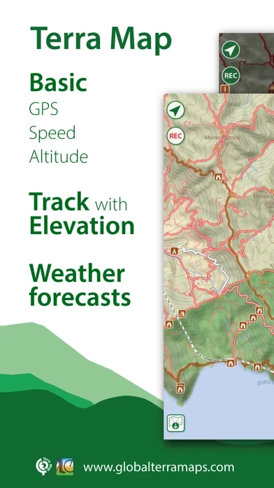
The app is designed for hikers and bikers to fulfill their outdoor needs. It offers clear maps with elevation contours, trails, huts, parks, etc. that can be downloaded for free and used without an internet connection. The app also provides weather forecasts, live sharing, elevation and speed graphs, and the ability to share tracks, tours, markers, and photos in various formats. The app is optimized for both iPhone and iPad use and has an easy-to-use interface.
Features
- Optimized for both iPhone and iPad use
- Clear maps with elevation contours, trails, huts, parks, etc.
- Easy-to-use user interface
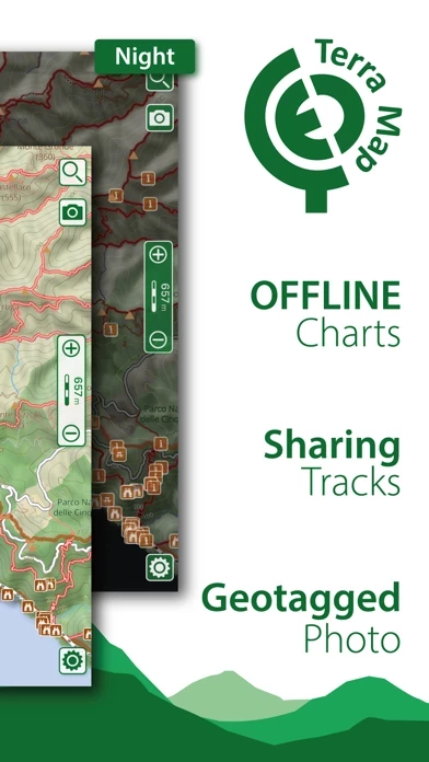
- Maps can be downloaded for free and used without an internet connection
- Topo Maps for US, Canada, Europe, South America, Asia, Africa, Oceania
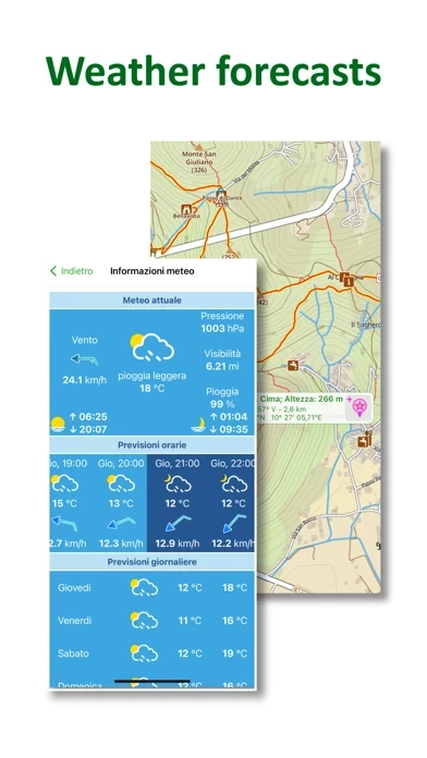
- Access to the latest weather forecasts for all points on the map
- Live sharing function to connect with friends
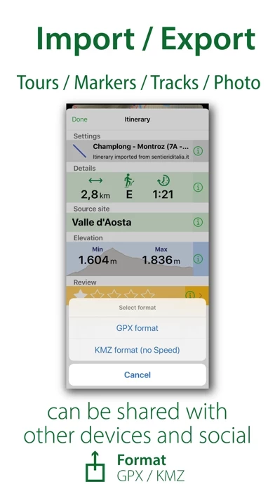
- Ability to share tracks, tours, markers, and photos in various formats
- Satellite images can be added as an overlay of the map
- Optimized battery usage with battery monitoring
- Tracks can be stored without the need for cellular data or phone signal
- Different map colorings can be switched between
- Marker's icon and Track's color can be customized
- Distances can be measured on the map
- Any track, tour, and marker can be loaded from internet communities
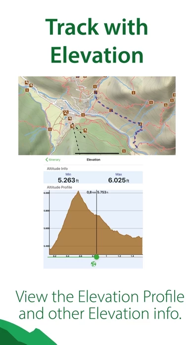
- Graph of the elevation profile and speed for each track
- World places can be searched by name
- Weather forecast for the next 7 days can be obtained for any point on the map (PRO mode must be activated)
- Exchange of data with the Aqua Map community and following favorite users on the screen
- GPS track can be recorded while the app is in the background and while the device is locked
- Unlimited and subscription type of purchases available.
Official Screenshots
Product Details and Description of
An app to satisfy all your Hiking and Biking’s needs, developed with the help of professional hikers and bikers. You will be able to download the best topo maps and enjoy your new outdoor season. Press the RECORD button, put the phone in your pocket and record your day. ►► Features: • Optimised for both iPhone and iPad use. • Amazingly clear maps, thanks to the Retina technology usage. • Easy to use user interface. • You can download maps (for FREE) on the device, to be used later without any internet connection. • Topo Maps for US, Canada, Europe, South America, Asia, Africa, Oceania (the whole world !!!). • Access the latest weather forecasts for all points on the map • Connect to your friends using the Live Sharing function • Share tracks, tours, markers and photos in various formats (KMZ, KML, GPX). • Share your track together with all the photo taken along in one single file. • Add the Satellite images as overlay of your map. • Optimized battery usage with battery monitoring. • Store your track without the need of cellular data or phone signal. • Switch between different map colouring. • Customize your Marker's icon and Track's color. • Measure distances on the map. • Load any track, tour and marker from internet communities (KMZ, KML, GPX even if zipped) • Graph of the elevation profile and speed for each track. • Search world places by name ► MAPS Terra Map lets you download — for FREE !!! — the best topo maps with elevation contours, trails, huts, parks, etc. and no additional purchase is required. You can download the maps at home within your device and then use them without any Internet connection need. Check our maps at: www.globalterramaps.com/terraviewer.html ► SHARING Why not sharing your favorite markers on Facebook or sending an email with your last daily track, with all the pictures you captured (Note 1) to show them on Google Earth™ or Maps ? With Terra Map it is just a click. ► WEATHER FORECAST Select any point in the world on the map and get the weather forecast for the next 7 days (PRO mode must be activated). ► LIVE SHARING Enable the exchange of your data with the Aqua Map community and follow your favorite users on the screen. See all active users around you. ► ELEVATION ANS SPEED GRAPHS Record all important info of your track and plot the graph of elevation and the graph of the speed. ► iOS BACKGROUND MODE You can record GPS track while Terra Map is in background and while the device is locked. ► TYPE OF PURCHASES - Unlimited: you can download and update your charts forever. - Subscription: it is an year auto-renewable subscription, it will automatically renews unless auto-renew is turned off at least 24-hours before the end of the current period. Account will be charged for renewal within 24-hours prior to the end of the current period. Subscriptions may be managed by the user and auto-renewal may be turned off by going to the user's Account Settings after purchase. Payment will be charged to iTunes Account at confirmation of purchase Terms of Service: http://www.globalaquamaps.com/Acknowledge.html Privacy Policy: http://www.gec-it.com/GEC-privacy.pdf ———— Note 1. Pictures captured by Terra Map while recording the track are automatically linked to the track itself, and sent with the track when you share it. Note 2. The effective battery duration depends by the battery condition, by the temperature and the device usage.
Top Reviews
By lostnavigator100
Good app with great support
Love this app for being easy to understand and easy to use, plus the maps are very good. I had a problem with OS13 update and the app. Emailed support, and had an answer and fix quickly.
By Travis10537
Excellent program
Very readable maps and works well offline when there isn’t reception
By radio9phs
Great
Great maps and user interface. What more do you need?