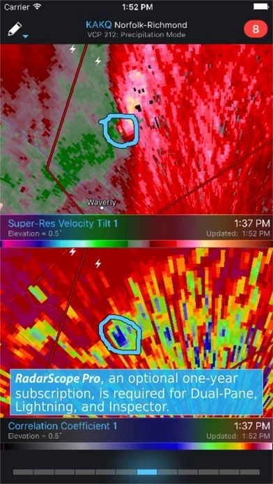
- View NEXRAD Level 3 and super-resolution radar data
- Display tornado, severe thunderstorm, flash flood, special marine, and snow squall warnings issued by the U.S. National Weather Service
- Pinch or stretch to zoom in and out
- Drag your finger around the map to scroll
- Select one of the 289 different radars in the United States, Canada, Australia, Germany, Korea, Puerto Rico, Guam, or Okinawa
- Plot your current location by tapping the location button and optionally report it to the Spotter Network
- Tap the play button to download and animate over recent images
- Display the names of over 25,000 cities and towns on the map as you zoom and scroll
- Tap and hold the color legend to see the data values
- Retrieve and display updated data automatically and intelligently
- Display radar data from our servers, NOAA's public access web site, or your Allison House subscriber account
- RadarScope Pro subscription with two different tiers to choose from
- Real-time lightning data in the U.S. and Canada that animates along with the radar loop
- Up to 30 frames of radar data, including extended loops of super-resolution data
- Data interrogation tool to quickly determine data values for specific radar pixels
- Optional dual-pane mode for viewing two radar products side-by-side
- SPC outlooks, mesoscale discussions, local storm reports, hail size and probability contours, and azimuthal shear contours in the U.S.
- 30-day archive of all radar products
- Ability to use subscription features across multiple platforms
- Privacy policy available for review at: https://www.dtn.com/privacy-policy/


