As I’m standing at the stop, waiting for the bus, clueless as to whether or not Im wasting my time:
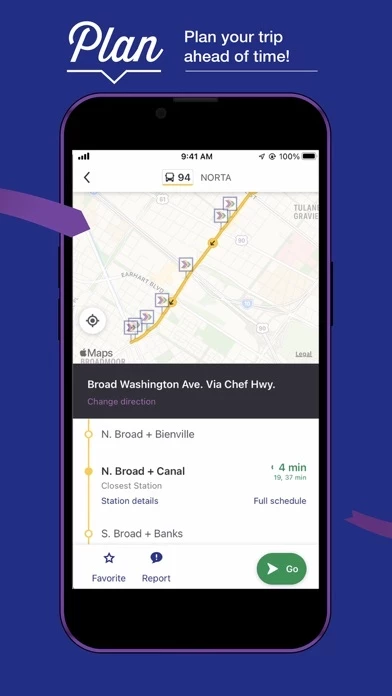
Sure. RTALePass offers GPS based arrival times. But you have to go to the routes, select the route, then the direction you’re going, and you only see the bus or streetcar on the route IF it’s approaching your stop. What about checking the route to see if I just missed my ride?
For instance, I got to the stop 5 minutes before the posted pickup time, and have been standing here for 20 minutes, and I have absolutely no idea if the bus is even coming, or if it already left. I just am relegated to stand on this street corner, looking down the street to see if I see it approaching. The only way I can surmise that a bus is on its way is because one on the opposite direction just passed.
After a few months of using RTALePass to commute, all I can say about it is that it offers little to no useable information unless the route is running smoothly, and let’s be honest, they seldomly are.
I beg of the dev to put tools in place to allow riders to have just a tiny bit more information on what’s going on with their route. Just show the buses and streetcars and their direction on the whole route, this piecemeal stuff is incredibly frustrating, and makes an already somewhat frustrating commute even more so l.