SailFreeGPS Overview
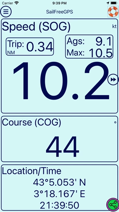
-SailFreeGPS displays current location, course (COG), speed (SOG), max speed, Trip distance, speed average and magnetic compas.
Official Screenshots

Product Details and Description of
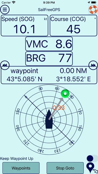
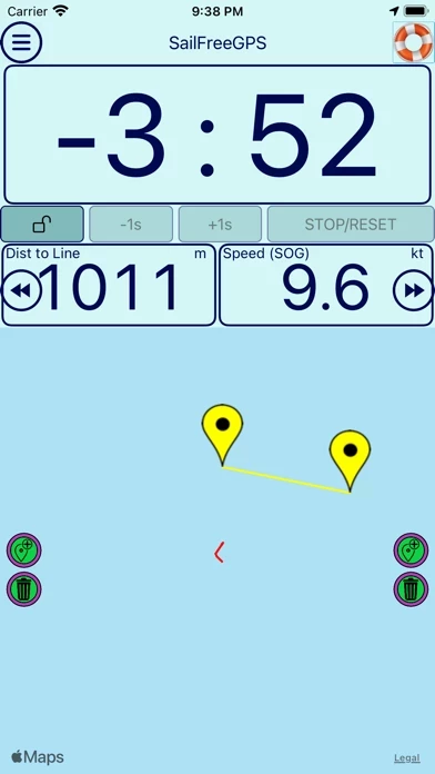
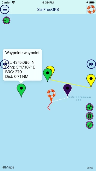
Hello, * this app displays current location, course (COG), speed (SOG), max speed, Trip distance, speed average and magnetic compass. * this app displays COG and SOG history (6h) to help you to see trim effect on your sails. * this app filters GPS information for more accuracy (average of an amount of last measures you can set). * this app can share your position, COG, SOG to your friends. * this app helps you during Man OverBoard maneuver (MOB). It stores the location and lead you to it. * this app displays your track on google map (24h). * this app helps you during Regatta with its countdown timer and its departure line * You can store up to 8 waypoints and activate a GOTO function with ETA (Estimated Time to Arrival computation) * You can save/load track to/from GPX/KML file * You can calculate distance and heading * You can use it on every boat, motor or sail boat. * You can now activate an anchor alarm or a course alarm. I am an amateur sailor who has decided to create this app after a Transatlantic cruise. I add periodically functionalities to this app when I have some spare time. Please send me an email for any question or problem : this [email protected] Encourage me to continue by subscribing to premium version. List of features of Premium Version Premium version DOES NOT CONTAIN ADS. GPS INFO Tab: * Doucle click on SPEED will reset trip, max and ags speed * Long click on COURSE to display compass * Double click on coordinates to display/hide position Graph Tab: * Double click COG graph to switch to full screen mode MOB Tab: * Displays of relative bearing of the MOB * Displays of tack angles * Double click graph to switch to full screen mode Waypoint Tab: * Up to 200 Waypoints * Displays of relative bearing of Waypoint * Displays of tack angles * Double click graph to switch to full screen mode Map Tab: * Displays of SOG and COG (speed & course) * Your track segments are displayed according to your speed Anchor alarm: * Anchor area can be a polygon and you can adjust its shape Regatta Tab: * "Gun Button" allows to round seconds to nearest minute Ex: 4:03 => 4:00 or 3:58 => 4:00 * Enter exact départure time up to the second * Displays of time to kill/save continuing the same way (speed and course) * Displays of ideal speed to cross the line at 0:00 on the same course!!! Settings Tab: * Displays reverse color (white on black back) * You can select Hybrid map * Select on which duration is calculated the speed scale of your track: last 5min, 15 min or all the track * Select your tack angle value. It will be displayed on MOB and WAYPOINT tabs Exit: * Ask to save the track before Exit