Atlantic Hurricane Tracker Overview
Atlantic Hurricane Tracker is am interactive mapping application for tracking hurricanes, tropical storms and tropical depressions in the Atlantic ocean.
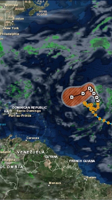
Official Screenshots
Product Details and Description of
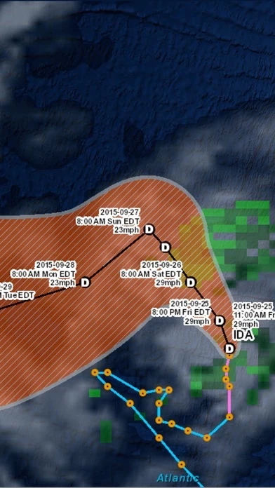
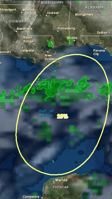
Atlantic Hurricane Tracker is am interactive mapping application for tracking hurricanes, tropical storms and tropical depressions in the Atlantic ocean. All data comes from the NHC, NOAA and NWS. Listed below are the featured layers of this application. -Global Cloud Cover -Hurricane Tracks -NHC Chance of Development -Tropical Storm Tracks -Tropical Depression Tracks -Wave Height Data -3 Hour Precipitation Data -NOAA Buoy and Ship Observation Data -GPS Location -Wave Direction -Global Surface Winds
Top Reviews
By Ksatreya
Nice App
The app provides plenty of real time radar and several neat features for interacting with the maps.
By Mrs Ohh
Not user friendly
Shows the storms just fine but you have to close out the app to exit some of the screens and options.
By PJYOUNG18311
Tracker
Very difficult to get the info I need and more info than I care about! Maybe good for someone writing a detailed report.