MyRadar Weather Radar Software
Company Name: Aviation Data Systems, Inc
About: https://github.com/generalized-intelligence/GAAS
Headquarters: , , .
MyRadar Weather Radar Overview
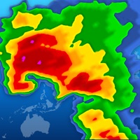
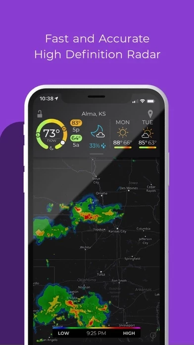
What is MyRadar Weather Radar? MyRadar is a weather app that displays animated weather radar around your current location and provides advanced rain alerts. It has an ever-increasing list of weather and environmentally-related data layers that you can overlay on top of the map. The app also has the ability to send weather and environmental alerts, including alerts from the National Weather Service, such as Tornado and Severe Weather alerts. Additional upgrades are available, including real-time hurricane tracking and the professional radar pack.
Features
- Animated live radar with radar loop lengths of up to two hours
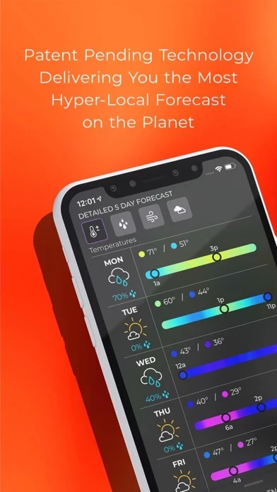
- Advanced rain alerts with patent-pending process for predicting hyper-local rainfall
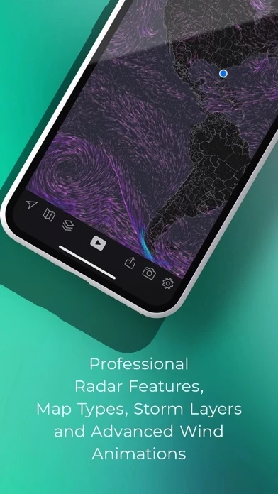
- Weather and environmentally-related data layers that you can overlay on top of the map, including animated winds, frontal boundaries, earthquakes, hurricane, and wildfires layers
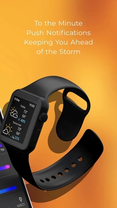
- Ability to send weather and environmental alerts, including alerts from the National Weather Service, such as Tornado and Severe Weather alerts
- Real-time hurricane tracking with additional data above and beyond the free version, including the cone of probability for tropical storm/hurricane forecast tracks, and a detailed synopsis from the National Hurricane Center
- Professional radar pack, which allows greater detail of radar from individual stations, including the ability to select individual radar stations around the US, select the radar tilt angle, and change the radar product being displayed, including base reflectivity and wind velocity
- Aviation Charts subscription (not required in order to use MyRadar) for tracking flights and displaying their IFR flight plans and paths
- Privacy Policy and full terms of service available on the MyRadar website.
Official Screenshots
MyRadar Weather Radar Pricing Plans
| Duration | Amount (USD) |
|---|---|
| Billed Once | $7.40 |
| Monthly Subscription | $9.99 |
| Yearly Subscription | $10.29 |
**Pricing data is based on average subscription prices reported by Justuseapp.com users..
Product Details and Description of
Thanks to everyone for making MyRadar so successful, with over 50 million downloads! MyRadar is a fast, powerful, easy-to-use weather app that displays animated weather radar around your current location and to quickly show what weather is coming your way. Just start the app; your location pops up with animated live radar, with radar loop lengths of up to two hours. This basic functionality provides the quickest way to get a snapshot of the weather on-the-go, and it's what has made MyRadar so successful over the years. Check your phone and get an instant assessment of the weather that will impact your day. One of the most useful features in MyRadar is the ability to provide advanced rain alerts; our patent-pending process for predicting hyper-local rainfall is the most accurate in the industry. Instead of having to check the app all the time, MyRadar will send you an alert up to an hour in advance as to when the rain will arrive at your current location, down to the minute, including details on intensity and duration. These alerts can be a life saver when you're on-the-go and don't always have time to check the weather - our systems will proactively do the work for you and let you know in advance before the rain hits. In addition to the live radar, MyRadar has an ever-increasing list of weather and environmentally-related data layers that you can overlay on top of the map; our animated winds layer shows a breathtaking visual representation of both surface winds and winds at the jetstream level; the frontal boundaries layer shows high and low pressure systems as well as frontal boundaries themselves; the earthquakes layer is a great way to stay on top of the latest reports on seismic activity, completely customizable as to severity and time; our hurricane layer allows users to stay on top of the latest tropical storm and hurricane activity throughout the world; the aviation layer overlays AIRMETs, SIGMETs and other aviation-related data, including the ability to track flights and display their IFR flight plans and paths, and the "wildfires" layer allows users to stay abreast of the latest fire activity around the United States. MyRadar also has the ability to send weather and environmental alerts, including alerts from the National Weather Service, such as Tornado and Severe Weather alerts. A new feature introduced in this version of MyRadar includes the ability to receive alerts based off of Tropical Storm and Hurricane activity; you can configure the app to send you an alert any time a tropical storm or hurricane forms, or is upgraded or downgraded. In addition to the free features of the app, additional upgrades are available, including real-time hurricane tracking - great for the start of hurricane season. The hurricane tracker provides additional data above and beyond the free version, including the cone of probability for tropical storm/hurricane forecast tracks, and it also includes a detailed synopsis from the National Hurricane Center. The premium upgrades also include the professional radar pack, which allows greater detail of radar from individual stations. Users can select individual radar stations around the US, select the radar tilt angle, and also change the radar product being displayed, including base reflectivity and wind velocity - great for experienced weather buffs looks to stay on top of possible tornado formation. Download MyRadar today and try it out! * Aviation Charts subscription (not required in order to use MyRadar) ($24.99 USD per YEAR) * Payments will be charged to your iTunes account * Account will be charged for renewal within 24-hours prior to the end of the current period * Auto-renewal may be turned off at any time by going to your settings in the iTunes Store after purchase. MyRadar's Privacy Policy, visit: https://myradar.com/privacy Full terms of service: https://myradar.com/terms
Top Reviews
By red pills rule
Great App!
Very Accurate, but I have suggestions. It's supposed to provide useful info for pilots. I really appreciate the inclusion of the fire locator function so I can tell smoke clouds by wind direction. However, VOG and Saharan Desert Dust also would be pertinent info. I'm not a pilot, but as a person who doesn't have breathing problems unless exposed to a trigger, I'd be willing to pay extra to get fire smoke clouds, VOG, and Saharan Dust mappers so I know when the clouds reach my area and when to wear a mask or stay indoors and change my air filter after the condition passes. It would probably be best to toggle this info so as not to overcrowd the map. Also nice would be a show of the jet-streams, fronts, high pressure systems like the Bermuda High that are pertinent to hurricane tracks, and dry air and moist air indicators to see whether fronts are coming in wet or dry. The dumbed down weather nowadays rarely shows these indicators that people used to rely on to predict the weather themselves (often better than the meteorologists). If you already have this for purchase, please let me know, or consider adding.
By CarterInTheBar
Great fee app, great paid app
I switched over to this app after Weather Underground’s “Storm” radar app was obsoleted and replaced by the terrible sequel by The Weather Channel. Immediately, I appreciated all the layers that this app has, and the customization that it’s capable of. I also like that while you can get a “basic” paid functionality (do it! Even if you don’t mind the ads, support people who make quality apps!), you can upgrade different bits of functionality a la carte, as you need them. For example, while I’m a private pilot, I’m not actively flying currently. But if I DO get back into it, the aviation charts functionality is built into the app, for an annual subscription (which makes sense, since av charts update and need to be kept current). Excellent, excellent app. The only suggestion that comes to mind is to enhance the functionality of the “storm center” feature so that the center moves with the time-lapse. Currently, it is stationary, and stays in the position it is in the latest radar frame, as the radar time lapse “catches up” to it.
By Dr.Cruise
When beauty enhances accuracy
There’s lots to be said for simplicity. This app delivers clear, dynamic, and beautiful radar images quickly. Moreover, the images provided appear to provide (in my opinion) a better indication as to how a storm is developing and moving. I’m able to look out from 7600ft to the south and west from the southern Sangre de Christos, taking in a thousand square miles of view shed and storms up to 100 miles away. I can watch individual storm cells developing and compare them to what I see on my screens. I’ve tried dozens of other apps and when it really matters I’ll always revert to the raw NEXRAD feed, toggling between clutter on & off when making important go/no go decisions for travel in remote areas. But this is the radar app I keep coming back to. I wish I understood why it’s better. It may be due to the fact it includes some of the info in a “clutter included” nexrad image without including too much of the noise. It also smooths out gaps in the radar image caused by inversions, dust, etc. Nice work, MyRadar developers!