MyRadar Weather Radar Pro Software
Company Name: Aviation Data Systems, Inc
About: https://github.com/generalized-intelligence/GAAS
Headquarters: , , .
MyRadar Weather Radar Pro Overview
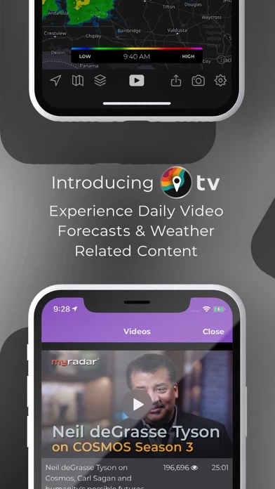
What is MyRadar Weather Radar Pro? MyRadar is a weather app that displays animated weather radar around your current location and quickly shows what weather is coming your way. It has an ever-increasing list of weather and environmentally-related data layers that you can overlay on top of the map. MyRadar also has the ability to send weather and environmental alerts, including alerts from the National Weather Service, such as Tornado and Severe Weather alerts. One of the most useful features in MyRadar is the ability to provide advanced rain alerts. In addition to the free features of the app, additional upgrades are available, including real-time hurricane tracking.
Features
- Animated weather radar around your current location
- Radar loop lengths of up to two hours
- Weather and environmentally-related data layers that you can overlay on top of the map
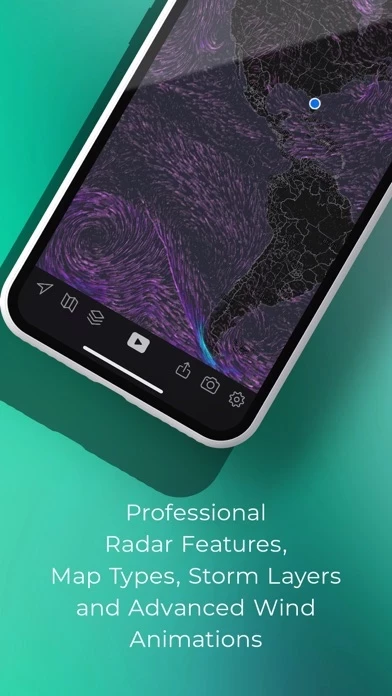
- Animated winds layer that shows a visual representation of both surface winds and winds at the jetstream level
- Frontal boundaries layer that shows high and low pressure systems as well as frontal boundaries themselves
- Earthquakes layer that allows you to stay on top of the latest reports on seismic activity
- Hurricane layer that allows users to stay on top of the latest tropical storm and hurricane activity throughout the world
- Aviation layer that overlays AIRMETs, SIGMETs and other aviation-related data, including the ability to track flights and display their IFR flight plans and paths
- Wildfires layer that allows users to stay abreast of the latest fire activity around the United States
- Ability to send weather and environmental alerts, including alerts from the National Weather Service, such as Tornado and Severe Weather alerts
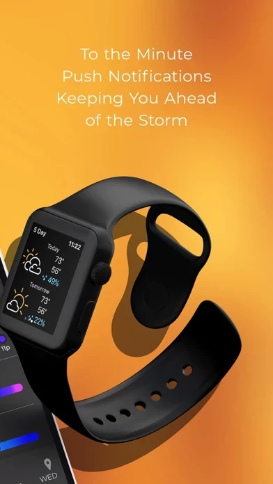
- Advanced rain alerts that send you an alert up to an hour in advance as to when the rain will arrive at your current location, down to the minute, including details on intensity and duration
- Real-time hurricane tracking with additional data above and beyond the free version, including the cone of probability for tropical storm/hurricane forecast tracks, and a detailed synopsis from the National Hurricane Center
- Professional radar pack that allows greater detail of radar from individual stations, including the ability to select individual radar stations around the US, select the radar tilt angle, and change the radar product being displayed, including base reflectivity and wind velocity.
Official Screenshots

MyRadar Weather Radar Pro Pricing Plans
| Duration | Amount (USD) |
|---|---|
| Weekly Subscription | $9.99 |
| Monthly Subscription | $4.27 |
**Pricing data is based on average subscription prices reported by Justuseapp.com users..
Product Details and Description of
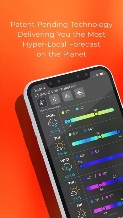
Thanks to everyone for making MyRadar so successful, with over 50 million downloads! MyRadar Pro is IDENTICAL to the free version of MyRadar; it comes without the ads by default. MyRadar is a fast, powerful, easy-to-use weather app that displays animated weather radar around your current location and to quickly show what weather is coming your way. Just start the app; your location pops up with animated live radar, with radar loop lengths of up to two hours. This basic functionality provides the quickest way to get a snapshot of the weather on-the-go, and it's what has made MyRadar so successful over the years. Check your phone and get an instant assessment of the weather that will impact your day. In addition to the live radar, MyRadar has an ever-increasing list of weather and environmentally-related data layers that you can overlay on top of the map; our animated winds layer shows a breathtaking visual representation of both surface winds and winds at the jetstream level; the frontal boundaries layer shows high and low pressure systems as well as frontal boundaries themselves; the earthquakes layer is a great way to stay on top of the latest reports on seismic activity, completely customizable as to severity and time; our hurricane layer allows users to stay on top of the latest tropical storm and hurricane activity throughout the world; the aviation layer overlays AIRMETs, SIGMETs and other aviation-related data, including the ability to track flights and display their IFR flight plans and paths, and the "wildfires" layer allows users to stay abreast of the latest fire activity around the United States. MyRadar also has the ability to send weather and environmental alerts, including alerts from the National Weather Service, such as Tornado and Severe Weather alerts. A new feature introduced in this version of MyRadar includes the ability to receive alerts based off of Tropical Storm and Hurricane activity; you can configure the app to send you an alert any time a tropical storm or hurricane forms, or is upgraded or downgraded. One of the most useful features in MyRadar is the ability to provide advanced rain alerts; our patent-pending process for predicting hyper-local rainfall is the most accurate in the industry. Instead of having to check the app all the time, MyRadar will send you an alert up to an hour in advance as to when the rain will arrive at your current location, down to the minute, including details on intensity and duration. These alerts can be a life saver when you're on-the-go and don't always have time to check the weather - our systems will proactively do the work for you and let you know in advance before the rain hits. In addition to the free features of the app, additional upgrades are available, including real-time hurricane tracking - great for the start of hurricane season. The hurricane tracker provides additional data above and beyond the free version, including the cone of probability for tropical storm/hurricane forecast tracks, and it also includes a detailed synopsis from the National Hurricane Center. The premium upgrades also include the professional radar pack, which allows greater detail of radar from individual stations. Users can select individual radar stations around the US, select the radar tilt angle, and also change the radar product being displayed, including base reflectivity and wind velocity - great for experienced weather buffs looks to stay on top of possible tornado formation. Download MyRadar today and try it out! * Aviation Charts subscription (not required in order to use MyRadar) ($24.99 USD per YEAR) * Payments will be charged to your iTunes account * Account will be charged for renewal within 24-hours prior to the end of the current period * Auto-renewal may be turned off at any time by going to your settings in the iTunes Store after purchase. MyRadar’s Privacy Policy, visit: https://myradar.com/privacy Full terms of service: https://myradar.com/terms
Top Reviews
By Three60guy
Forecasts cut off
I believe forecasts in weather apps should have the highest priority whether they have radar or not. This developer doesn’t agree. At least their actions do not agree with their written statements after telling them the forecasts get cut off before the completion of the forecast on both the iPhone and iPad Pro. They said they will eventually fix the problem but they have other priorities right now. I would imagine you can guess what I said to them after that one. In all other areas it’s a pretty good app. But because I believe the forecast being cut off was not addressed on purpose I gave the app 3 stars. Once they fix that issue I would give it 5 stars. It’s funny that the forecast appears in full on their Apple Watch version of this app. Edit: The forecast problem was fixed. So as stated above I have changed the number of stars to 5. This is now my go to weather app. Edit 2: I also would love it if it supported Personal Weather Stations (PWS).
By Coastaldog
Great for travel and home use
Use it all the time to check for rain along travel route. App supplements what I get on local TV. I can zero in on specific locations with it to check rainy or flooding conditions. I highly recommend it. For a time - earlier in 2016 - the location dot did not work right. I could travel from home to Mobile, AL and the locator dot would track me. However, lots of times when I got home the locator dot still showed me to be in Mobile. Hasn't done it in about two months. Maybe it was a bug the developers fixed - I hope so anyway. Update Sep 2018 - Hey developers! Some of us wear trifocals. Your zoom in feature on locale temps works in reverse! When one zooms in on Billings, MT, for example, the numerical values of temp get smaller. You too will someday wear bifocals or tri-focals. Give us a break and let the numbers stay BIG when we zoom into a location.
By MikeyGinTX
Excellent Depiction Weather App
As an instructional aviator, I use a variety of government and non-government weather sources to get my short and longer term weather picture. My Radar is one of my “go to” favorites. With the aviation layers turned on, I can get a great color enhanced current weather depiction that allows me control of the layers I need to see to build a weather picture. With the wind flow depiction, I frequently use this app to train my students in understanding cyclonic and anticyclonic wind flows and their relations to cloud formation, rainfall patterns, and frontal activity. If I could add one feature to this app, it would be an optional overlay of pressure system centers and related frontal boundaries. These can easily be seen using other apps and website weather, but adding it here would really enhance the utility of this otherwise perfect app. I highly recommend this app and it’s add ins!!