onX Hunt: GPS Hunting Maps

onX Hunt: GPS Hunting Maps Software


Company Name:

About: onxMaps is a Montana-based mobile apps company which provide maps for hunters and other outdoor
recreation.
Headquarters: Missoula, Montana, United States.

 
  2023-12-11

onX Hunt Overview


What is onX Hunt?

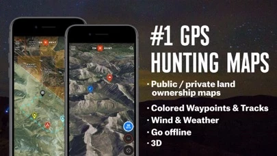
onX Hunt is a hunting and outdoor GPS app that provides accurate map data for private and public land ownership, hunting units, roads, trails, and topographic maps. The app is used by millions of US hunters and has been featured in popular outdoor magazines.


Features


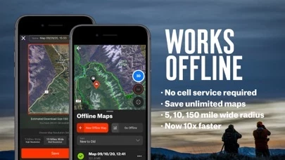
- Free GPS functionality with offline maps and location tracking

- Aerial view maps and 24K Topographical Maps with GPS Navigation

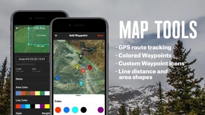
- Custom waypoints and tracks for navigation

- Distance measurement tool for treestands, hunt stands, and blinds

- Shape tool for measuring acreage of food plots

- GPS hunting tracker for tracking distance, duration, and speed of hunts

- Points of interest and geographic features

- DNR maps

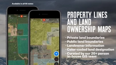
- Premium State Membership for access to proprietary hunting GPS maps, public land maps, landowner names and boundaries, hunting units for multiple species, and more

- Elite Membership for access to proprietary maps for all 50 states and exclusive tools and services

- Subscription management and auto-renewal options

- Customer support for feedback and feature requests.


Official Screenshots


onX Hunt Pricing Plans

Duration Amount (USD)
Billed Once $47.49

**Pricing data is based on average subscription prices reported by Justuseapp.com users..


Product Details and Description of


onX Hunt has been featured in Field and Stream, Outdoor Life and American Hunter as the best hunting app, hiking app, and GPS app for any outdoorsman or hunter. Used by millions of US hunters. Know where you stand with the most trusted and accurate map data. Use onX Hunt as a fully functioning free GPS on your phone. View private and public land ownership maps, Hunting Units, roads and all trails, US topographic maps and more! Turn your phone into the best free hunting app with offline maps, location tracking GPS for hunting, and more! ▶ FREE TRIAL While onX Hunt & many of its features are free, you will also start a free Premium State Membership trial when you install the App. This allows you to try a full-featured Premium State Membership for 7 days. ▶ FREE HUNTING APP FEATURES • NO ADS • Web Map for scouting at home and syncing data to your mobile • Aerial view maps and 24K Topographical Maps with GPS Navigation •The onX Hunt App is a hunting GPS with tracks & custom waypoints: mark waypoints with icons to navigate back to your vehicle, camp, or hunt stand • Easily measure distances between treestands hunt stands and blinds • Mark Custom Waypoints: Camp, Truck, Trail Cam, Deer, Elk, etc. • Measure acreage with the Shape Tool to easily measure food plots • Track the distance, duration, and speed of your hunt with our GPS Hunting Tracker • Topographical quad maps • Points of Interest & Geographic Feature • DNR maps ▶ OFFLINE GPS Turns your phone into the best GPS for outdoor GPS functionality by using the GPS tracker built into your phone, or tablet, to display your location on the map. Cellular network coverage is NOT needed, as our technology allows you to save basemaps and layers for offline maps. ▶ PREMIUM: With a Premium State Membership, you gain access to our proprietary hunting GPS maps developed by our GIS team. A Premium State Membership costs $29.99/year. Get the same great features of onX Hunt but with the additional benefits of: • Public land like Forest Service, Bureau of Land Management (BLM maps), Wildlife Management Areas, County and State land hunting maps, Timber Lands, and more! • Landowner names with property line maps and boundaries • Search by landowner name or hunting property landowner boundaries to scout and look for new areas to hunt • Save private, or public hunting land maps for use when you are out of cell phone coverage. • GMUs or Hunting Units for multiple species (such as Antelope, Bighorn Sheep, Bison, Black Bear, Elk, Moose, Mountain Lion, Mule Deer, Mountain Goat, Wolf, White Tailed Deer, and Turkey Hunting) • Possible Access Lands, Walk-In areas, Block Management Areas and private lands open to the public for hunting and recreation • The largest database of nationwide Roads and Trails ever built • 3D Maps * Private landownership maps may not be available for all counties ▶ ELITE NATIONWIDE: With an Elite Membership, you gain access to our proprietary maps for all 50 states. You also get access to exclusive tools and services that maximize your hunting experience. Easily scout and plan hunts in any state now for one membership price. Available for $99.99/year or $14.99/month. ▶ MANAGE SUBSCRIPTION •Subscription automatically renews unless auto-renew is turned off at least 24-hours before the end of the current period. Your iTunes account will be charged for renewal within 24-hours prior to the end of the current period, & identify the cost of the renewal. •Payment will be charged to iTunes Account at confirmation of Purchase. •Visit the following URL for full terms of use: http://www.onxmaps.com/tou ▶ FEEDBACK: Having a problem, or want to request new features please contact us at [email protected]


Top Reviews

By Hunt&FishVA

Best hunt map app! Easy to use!

I’ve used a couple other apps in the recent past that were recommended by friends, but none of them were really user friendly or had all of the options that I was looking for. Then I found OnX. SO much easier to use than the other apps. It’s now my go-to-app when I’m at home looking at my maps or in the field marking game sign and scouting new areas for stands or blinds. I’m sold for life; OnX is perfect for my hunting map needs. Highly recommended! **Update after 4 months of use** The onX app continues to be one of the most useful hunting tools in my arsenal! I have completed mapping our 1200 acres of private hunting land using onX, including mapping all of the trails and marking locations of more than 110 tree stands. Throughout the process, I have learned more about the land that we hunt than I ever could’ve imagined. Thanks to onX, learning the (complete) lay of the land was so much easier than I thought it would be. I’ll definitely have the app open every time I go in the woods! Being able to share way points with friends has been super helpful. If you’re considering trying out onX, do it with confidence! The app is great!!

By dccycleworks

Most useful app I have

I was hesitant to try this app after some other ones came up very short, but after a few friends recommended it I tried the free trial. I was hooked the first time I used it! For once there is an app that actually does what it advertises. Just today it was well worth the yearly subscription, I had hiked about 7 miles into the woods along a game trail and it was getting very hot and I was very tired, I decided to open OnX to see how much further I had to go if I stayed on the trail to intersect the road, when I opened the app I saw that I had just started paralleling the road but the intersection was another two miles away, but as the crow flies I was only a half mile from the road, so I just hiked the half mile and was back on the road I had parked on saving me probably a couple hours. Also customer support is great! I was having an issue with the app when off grid sometimes, I emailed them about it and they responded quickly stating they were aware of the issue and it had already been fixed in the update that got released that same day, I updated the app and it has been flawless ever since! Best app ever

By Mr. Frantz

Solid Conservationist App

The versatility of this App is second to none in regards to the realm of conservationists. Being able to see all public, private, leases, wilderness areas, weather reports, etc. all from one app AND being able to ping places you’ve hunted so you can remember them for the next time is just too handy. That paired with the unbelievably reasonable subscriptions there truly isn’t anything to complain about, a service like this I was expecting to pay $$$/ month. The customer service is beyond exceptional. I originally got signed up in Texas and use only the Texas OnX maps, I am now moving to Wyoming and when reaching out to support to see if I could get my states changed over there was no hassle. No, “well we can’t really do that” no, “well you have to pay a fee” no nonsense. I asked if that was something they could do and within 5 minutes they emailed me back politely letting me know that my request had been completed. Every conservationist in my family uses this, I would and do recommend this app to every conservationist I come across. Thanks for the awesome service OnX!


Most Popular Apps in Navigation