Active Wildfire Tracker Map Reviews
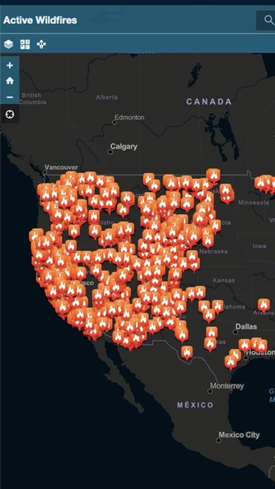
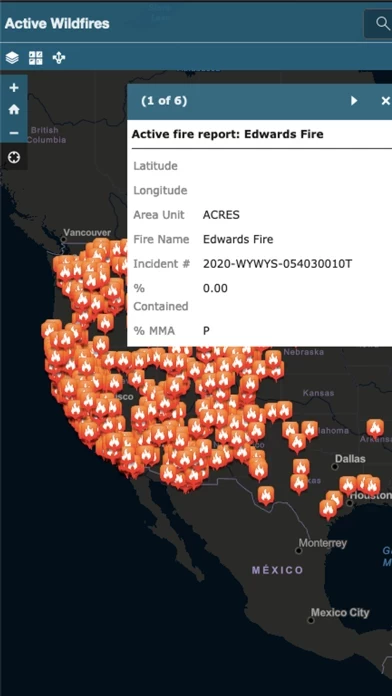
Published by corey hoggard on 2025-01-29🏷️ About: Active Wildfire Tracker Map is an interactive mapping application that tracks the current active wildfires in the US. The data is updated hourly and offer GPS capabilities.