AirScope Overview
With the ADS-B Interface users can connect AirScope to their local receiver and display traffic data as it's being broadcast.
On top of that, with the built-in complimentary cloud based ADS-B, users can see real traffic from various places in the world (anywhere where there's voluntary coverage) even without being there or having a receiver themselves.
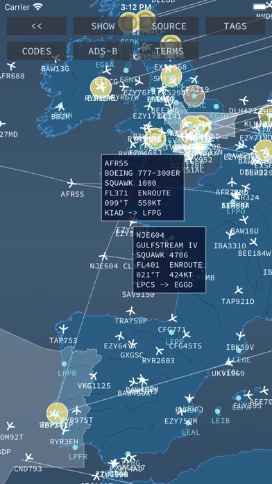
AirScope is a plane plotter that retrieves aircraft positions and measurements from online sources and displays them on top of a world map in radar / ATC style.
The data is retrieved from the online and public info servers of the respective networks (for which an Internet connection is required) at periodic intervals and traffic is plotted accordingly.
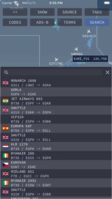
When flying online with VATSIM or IVAO (or even as preparation for a flight in one of these networks) it's often useful to have an overview of who's in the air at any given moment or which ATC positions are currently filled and online.
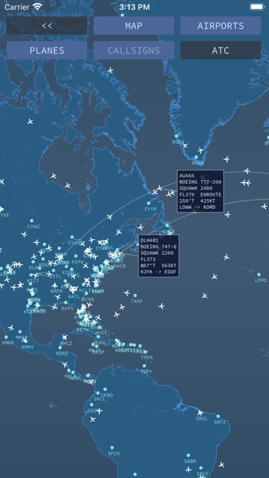
Tapping on a plane (target) further discloses a tag with additional information about the flight such as its callsign, aircraft type, squawk, flight level, vertical speed, flight stage, course, speed, departure and arrival.
AirScope can connect to a computer with one of these receivers and an instance of dump1090 to recognise messages in SBS (BaseStation) format on a TCP port (default 30003) and plot air traffic on its map.
VATSIM and IVAO positions currently online are also plotted / shaped and shown on the map together with their frequencies so that virtual pilots can contact them should they enter their airspace.
Official Screenshots


Product Details and Description of
this app is a plane plotter that retrieves aircraft positions and measurements from online sources and displays them on top of a world map in radar / ATC style. When flying online with VATSIM or IVAO (or even as preparation for a flight in one of these networks) it's often useful to have an overview of who's in the air at any given moment or which ATC positions are currently filled and online. this app shows just that in a stylish universal interface for iOS and macOS devices. With the ADS-B Interface users can connect this app to their local receiver and display traffic data as it's being broadcast. this app can connect to a computer with one of these receivers and an instance of dump1090 to recognise messages in SBS (BaseStation) format on a TCP port (default 30003) and plot air traffic on its map. On top of that, with the built-in complimentary cloud based ADS-B, users can see real traffic from various places in the world (anywhere where there's voluntary coverage) even without being there or having a receiver themselves. The ADS-B Interface functionality is enabled and available through an in-app purchase. The data is retrieved from the online and public info servers of the respective networks (for which an Internet connection is required) at periodic intervals and traffic is plotted accordingly. Tapping on a plane (target) further discloses a tag with additional information about the flight such as its callsign, aircraft type, squawk, flight level, vertical speed, flight stage, course, speed, departure and arrival. VATSIM and IVAO positions currently online are also plotted / shaped and shown on the map together with their frequencies so that virtual pilots can contact them should they enter their airspace.