Free Map Tools Overview
What is Free Map Tools?
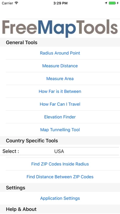
Free Map Tools is a collection of map-based tools that allow users to perform various functions for a wide range of applications. These tools include measuring distances and areas, plotting radius around a point, finding out how far one can travel within a set time, and more. The app also offers country-specific tools for the USA and UK.
Features
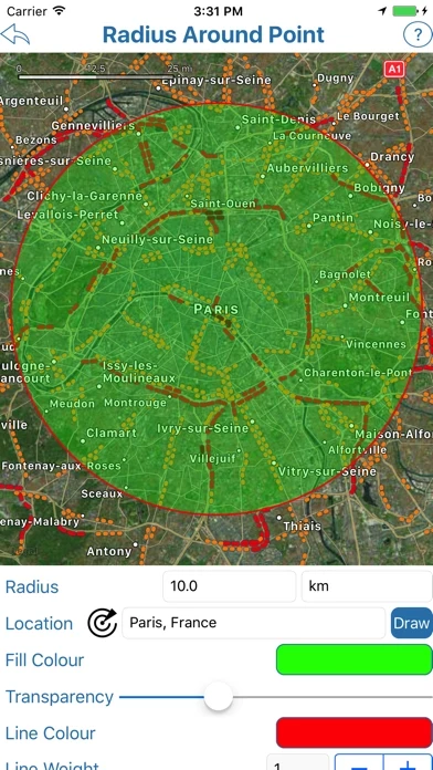
- Radius Around Point tool: plot a distance radius on a map, specify the center point, radius, and other features such as color, and visualize the radius to see the area covered.
- Measure Distance tool: plot a route on a map, find out the distance covered in various units, and use GPS sensor to plot the route automatically.
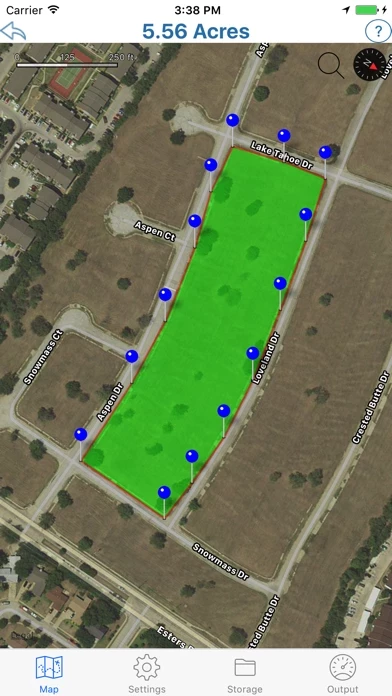
- Area Calculator Tool: draw an area on the map and find the measurement of the area enclosed.
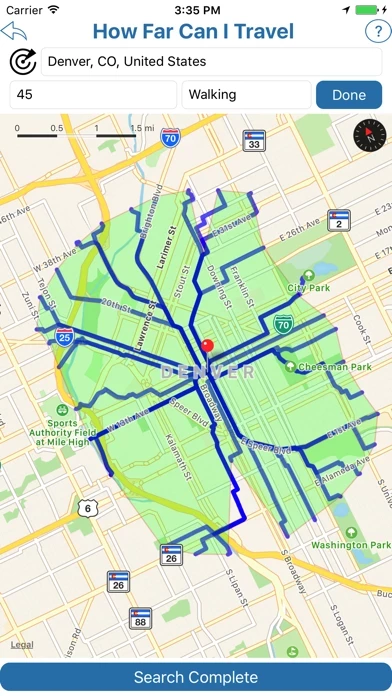
- Find How Far I Can Travel tool: show how far one can drive or walk within a set time.
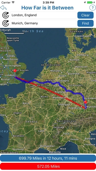
- How Far is it Between tool: find the road and crow-flies distance between 2 addresses and show both routes on the map.
- Map Tunnelling Tool: find out where on the globe your antipodal point is and find the antipode of any custom location.
- Country-specific tools for the USA and UK: use tools such as finding zip/postcodes inside a radius and finding the distance between two zip/postcodes.
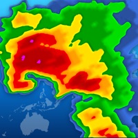
Official Screenshots
Product Details and Description of
Free Map Tools is a collection of tools based on maps. These tools allow you to perform various functions for a wide range of applications. You can measure distances and areas. You can also send or share the map as an image to indicate the area, route or radius you have plotted. The Radius Around Point tool lets you plot a distance radius on a map. You specify the centre point, the radius and other features such as colour. You can then visualise the radius to see the area covered. The Measure Distance tool lets you plot a route on a map and find out the distance covered in various units. It also uses your GPS sensor to plot the route automatically. The Area Calculator Tool lets you draw an area on the map and find the measurement of the area enclosed. The Find How Far I Can Travel tool will show how far you can drive or walk within a set time. For example, how far can I get if I drive for 60 minutes from my current location. How Far is it Between allows you to find the road and crow-flies distance between 2 addresses. It also shows both routes on the map. The Map Tunnelling Tool allows you to find out where on the globe your antipodal point is. You can also find the antipode of any custom location. Country Specific Tools ———————————————- For the following countries: ∙USA ∙UK You can use the following tools: ∙The zip/postcodes found inside a radius ∙The distance between two zip/postcodes
Top Reviews
By Tay Harris
Awesome
This app is outstandingly good. I love how professional the maps look when exporting to others. My only recommendation is making all the maps exportable. Overall, I really appreciate the time and detail that was put into this map. Great job!
By gamename5
Awesome
I don’t use this as a gps, but this is very helpful when it comes to planning out long trips.
By Elkhorn 1
Little bit slow but great tool
Just aliittle but slow but it sure does a good job. Great for hiking and kayaking