SITREP Tactical Mapping (iTAK)

SITREP Tactical Mapping (iTAK) Software


Company Name:

About: A [cyber] veteran owned and operated cybersecurity services and training company
Headquarters: Ashburn, Virginia, United States.

 
  2023-12-22

SITREP Tactical Mapping iTAK Overview


What is SITREP Tactical Mapping iTAK?

SITREP is a tactical mapping tool designed to enhance situational awareness and operational readiness. It is a mapping tool that empowers the concept of Every Soldier a Sensor, allowing for rapid data collection and streamlined report generation. The app is developed and field-tested by SOF operators throughout the special operations community.


Features


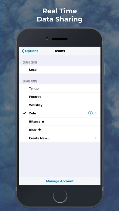
- Team Sharing: Real-time data sharing between users subscribed to the same team.

- BFT Location Sharing: Real-time team member location tracking.

- Secure Comms: Secure text/voice comms between team members.

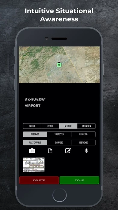
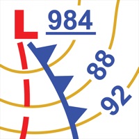
- Integrated DOD symbol library: Annotate any point of interest with MIL-STD 2525 library.

- Rapid Symbol Builder: Select symbol type and update with appropriate IFF/Observation/Conditions in seconds.

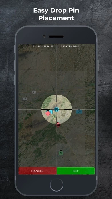
- Easy drop pins: Mark points of interest with long press on the map, Mark button, and Voice recognition pin drop.

- SALUTE Report: Simple entry SALUTE report takes the hassle out of paperwork.

- Sketch mode: Add handwritten annotations, notes, diagrams to any point of interest or map feature.

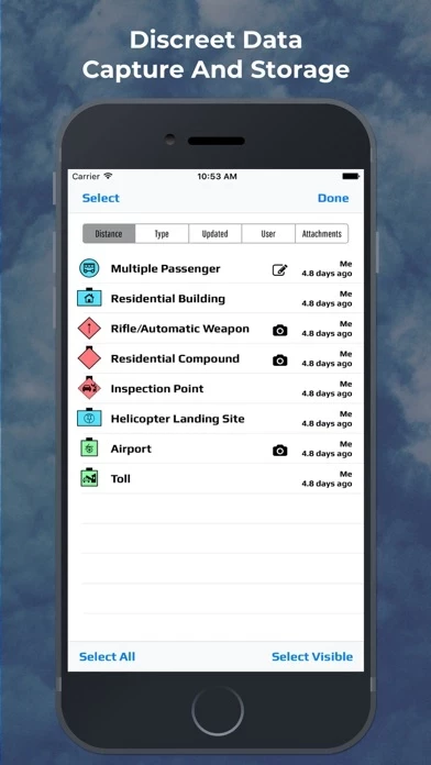
- Photo tagging: Append photos to any location.

- Audio pin: Quickly create an audio annotation pin with location and vital specs for quick recon without being slowed by data entry.

- Night vision mode: Convert to red screen for night vision optics.

- Coordinate Systems: MGRS, UTM, USNG, and Cartesian.

- Augmented Reality: View your inputted points of interest overlaid on a live A/R viewer.

- Subscription Add-ons: Teams and Teams + Blue Force Tracking (BFT) for real-time data sharing and live team member tracking.

- Help/Support: Youtube video tutorials and SITREP Support Page.

- Terms: Payment will be charged to iTunes Account at confirmation of purchase. Subscription automatically renews unless auto-renew is turned off at least 24-hours before the end of the current period. Account will be charged for renewal within 24-hours prior to the end of the current period the full price shown above. Subscriptions may be managed and auto-renewal may be turned off by going to your Account Settings after purchase. No cancellation of the current subscription is allowed during the active subscription period. A separate end-user license agreement is required for each team data sharing user. See apple.com/legal/itunes/us/terms.html for details. Any unused portion of any free trial period will be forfeited when a subscription is purchased.


Official Screenshots


Product Details and Description of


Description SITREP is a tactical mapping tool designed to maximize situational awareness and operational readiness. Summary Conceived by senior leaders from the U.S. Special Operations Forces (SOF) community, SITREP allows for rapid data collection and streamlined report generation. SITREP is the first mapping tool that empowers the concept of Every Soldier a Sensor. The intuitive interface enables discreet, real time recon to boost effectiveness in the field. SITREP augments the standard functionality of data capture and storage with all the tools needed for Military, Law Enforcement, and First Responder operations. SITREP Defining Features - Team Sharing - Real time data sharing between users subscribed to the same team. - BFT Location Sharing - Real time team member location tracking. - Secure Comms - Secure text/voice comms between team members. Additional Features - Integrated DOD symbol library - Annotate any point of interest with MIL-STD 2525 library. - Rapid Symbol Builder - Select symbol type and update with appropriate IFF/Observation/Conditions in seconds. - Easy drop pins - Mark points of interest with long press on the map, Mark button, and Voice recognition pin drop. - SALUTE Report - Simple entry SALUTE report takes the hassle out of paperwork. - Sketch mode - Add handwritten annotations, notes, diagrams to any point of interest or map feature. - Photo tagging - Append photos to any location - Audio pin - Quickly create an audio annotation pin with location and vital specs for quick recon without being slowed by data entry. - Night vision mode - Convert to red screen for night vision optics. - Coordinate Systems - MGRS, UTM, USNG, and Cartesian. - Augmented Reality - View your inputted points of interest overlaid on a live A/R viewer. Developed and field tested by SOF operators throughout the special operations community. Help/Support: - Youtube video tutorials: https://www.youtube.com/channel/UCfcuyDZ_JanBIceH01bdHwQ?view_as=subscriber - SITREP Support Page: http://www.obscurityllc.com/support.html _______________________ Available Subscription Add-ons: Teams: share data in real-time through the cloud. Teams + Blue Force Tracking (BFT): BFT adds team chat and live team member tracking Terms: - Payment will be charged to iTunes Account at confirmation of purchase - Subscription automatically renews unless auto-renew is turned off at least 24-hours before the end of the current period - Account will be charged for renewal within 24-hours prior to the end of the current period the full price shown above - Subscriptions may be managed and auto-renewal may be turned off by going to your Account Settings after purchase - No cancellation of the current subscription is allowed during active subscription period - Privacy Policy: obscurityllc.com/privacy.html - A separate end-user license agreement is required for each team data sharing user. See apple.com/legal/itunes/us/terms.html for details – Any unused portion of any free trial period will be forfeited when a subscription is purchased


Top Reviews

By CharGage

Good, Not Great

Good tool for building scenarios quickly. Would utilize more if there was a CAS 9Line feature.

By Pickedanickname

Add MGRS overlay and range and bearing tools

Imagery and point dropping work great, would love an MGRS overlay and range and bearing tool

By ArcticBear864

Good but could be way better

Would love to use this as my primary mapping for team use but to only have gps useable with location ALWAYS ON instead of also WHILE USING. I feel like the ball got dropped.


Most Popular Apps in Navigation