How to Cancel CalTopo
Published by CalTopo LLC on 2024-06-17We have made it super easy to cancel CalTopo subscription
at the root to avoid any and all mediums "CalTopo LLC" (the developer) uses to bill you.
Complete Guide to Canceling CalTopo
A few things to note and do before cancelling:
- The developer of CalTopo is CalTopo LLC and all inquiries must go to them.
- Cancelling a subscription during a free trial may result in losing a free trial account.
- You must always cancel a subscription at least 24 hours before the trial period ends.
Pricing Plans
**Gotten from publicly available data and the appstores.
- Free: Access to basic features including Map Builder Topo, Map Builder Hybrid, and Scanned 7.5' layers, as well as Contours and Map Builder Overlay overlays.
- Pro: $20/year or $5/month. Includes access to all layers and overlays, as well as offline availability for Map Builder Topo, Map Builder Hybrid, and NAIP Imagery layers. Also includes access to advanced features such as slope angle shading, viewshed analysis, parcel data, and motor vehicle use overlays.
- Desktop Pro: $50/year. Includes all Pro features, as well as access to desktop applications and additional tools for advanced trip planning and analysis.


How to Cancel CalTopo Subscription on iPhone or iPad:
- Open Settings » ~Your name~ » and click "Subscriptions".
- Click the CalTopo (subscription) you want to review.
- Click Cancel.
How to Cancel CalTopo Subscription on Android Device:
- Open your Google Play Store app.
- Click on Menu » "Subscriptions".
- Tap on CalTopo (subscription you wish to cancel)
- Click "Cancel Subscription".
How do I remove my Card from CalTopo?
Removing card details from CalTopo if you subscribed directly is very tricky. Very few websites allow you to remove your card details. So you will have to make do with some few tricks before and after subscribing on websites in the future.
Before Signing up or Subscribing:
- Create an account on Justuseapp. signup here →
- Create upto 4 Virtual Debit Cards - this will act as a VPN for you bank account and prevent apps like CalTopo from billing you to eternity.
- Fund your Justuseapp Cards using your real card.
- Signup on CalTopo or any other website using your Justuseapp card.
- Cancel the CalTopo subscription directly from your Justuseapp dashboard.
- To learn more how this all works, Visit here →.
How to Cancel CalTopo Subscription on a Mac computer:
- Goto your Mac AppStore, Click ~Your name~ (bottom sidebar).
- Click "View Information" and sign in if asked to.
- Scroll down on the next page shown to you until you see the "Subscriptions" tab then click on "Manage".
- Click "Edit" beside the CalTopo app and then click on "Cancel Subscription".
What to do if you Subscribed directly on CalTopo's Website:
- Reach out to CalTopo LLC here »»
- Visit CalTopo website: Click to visit .
- Login to your account.
- In the menu section, look for any of the following: "Billing", "Subscription", "Payment", "Manage account", "Settings".
- Click the link, then follow the prompts to cancel your subscription.
How to Cancel CalTopo Subscription on Paypal:
To cancel your CalTopo subscription on PayPal, do the following:
- Login to www.paypal.com .
- Click "Settings" » "Payments".
- Next, click on "Manage Automatic Payments" in the Automatic Payments dashboard.
- You'll see a list of merchants you've subscribed to. Click on "CalTopo" or "CalTopo LLC" to cancel.
How to delete CalTopo account:
- Reach out directly to CalTopo via Justuseapp. Get all Contact details →
- Send an email to [email protected] Click to email requesting that they delete your account.
Delete CalTopo from iPhone:
- On your homescreen, Tap and hold CalTopo until it starts shaking.
- Once it starts to shake, you'll see an X Mark at the top of the app icon.
- Click on that X to delete the CalTopo app.
Delete CalTopo from Android:
- Open your GooglePlay app and goto the menu.
- Click "My Apps and Games" » then "Installed".
- Choose CalTopo, » then click "Uninstall".
Have a Problem with CalTopo? Report Issue
Leave a comment:
Reviews & Common Issues: 1 Comments
By Timothy Robbins
11 months agoDelete my account. I have never seen anything this convoluted in my life.
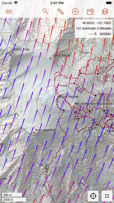
What is CalTopo?
this app for iOS extends your adventures from the desktop to the field. this app contains tools to plan your backcountry adventures including offline topographic maps and aerial imagery, slope angle shading, viewshed analysis, realtime SNOTEL and weather data, and many more options. The mobile apps integrate seamlessly with the this app website allowing realtime syncing with the web application allowing updates to maps and routes to be passed back and forth (while you still have cell service). If you're traveling off the grid you can download mapping layers and maps that you've created to help guide you on your adventures. When you're back you can sync the record of your journey back to the this app website. No more cumbersome exporting and importing from other apps. Plan your next adventure today! Layers Available: (*Indicates Offline Availability) Map Builder Topo* Map Builder Hybrid* Scanned 7.5'* FS Topo* Marine Charts FAA Sectionals NAIP Imagery (Various Years)* Shaded Relief USFS/NPS Visitor Maps Satellite Daily and Weekly Layers (Note: Weekly High Res layer requires Pro subscription) And more... Overlays Available: Contours* Map Builder Overlay* Slope Angle Shading* (LIDAR slope angle shading available on/offline) Parcel Data (Note: Requires Pro subscription) Public Lands Motor Vehicle Use* Realtime weather and SNOTEL data And many others...