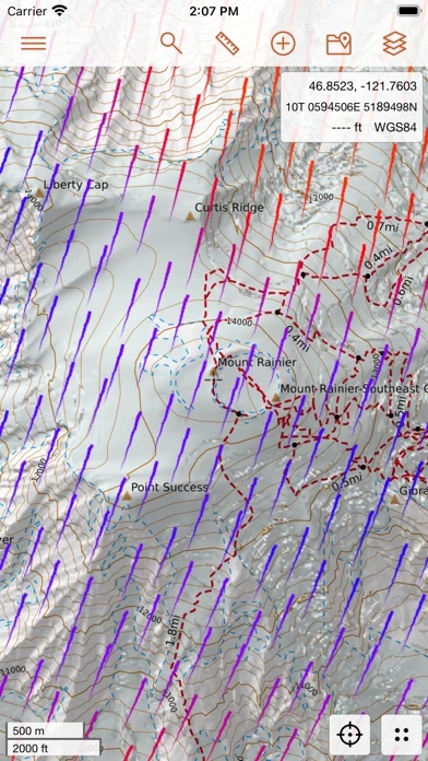
CalTopo Reviews

CalTopo Reviews

Published by on 2024-01-10

About: CalTopo for iOS extends your adventures from the desktop to the field. CalTopo
contains tools to plan your backcountry adventures including offline topographic
maps and aerial imagery, slope angle shading, viewshed analysis, realtime SNOTEL
and weather data, and many more options.


About CalTopo


What is CalTopo?

CalTopo for iOS is a mobile app that allows users to plan their backcountry adventures with offline topographic maps and aerial imagery, slope angle shading, viewshed analysis, and real-time SNOTEL and weather data. The app integrates seamlessly with the CalTopo website, allowing real-time syncing with the web application while still having cell service. Users can download mapping layers and maps they have created to guide them on their adventures and sync the record of their journey back to the CalTopo website.


Features


- Offline availability of Map Builder Topo, Map Builder Hybrid, Scanned 7.5', and FS Topo maps

- Availability of Marine Charts, FAA Sectionals, NAIP Imagery, Shaded Relief, USFS/NPS Visitor Maps, and Satellite Daily and Weekly Layers

- Overlays available include Contours, Map Builder Overlay, Slope Angle Shading, Parcel Data, Public Lands, Motor Vehicle Use, and Realtime weather and SNOTEL data

- Real-time syncing with the CalTopo website

- LIDAR slope angle shading available on/offline

- Requires Pro subscription for some features such as Weekly High Res layer and Parcel Data.


Overall User Satisfaction Rating


Negative experience
63.5%

Positive experience
36.5%

Neutral
18.4%

~ from Justuseapp.com NLP analysis of 2,708 combined software reviews.

Key Benefits of CalTopo

- Broad range of layers provided

- Ability to dynamically "layer layers" and cache maps for offline use

- Super detailed place name and trail/road info missing from many other map apps

- Accurate slope angle shading is a literal lifesaver during avalanche season

- Weekly satellite data is awesome for estimating snow cover

- Works with desktop app for managing routes

- Subscription only layers are very worth the price

- Slope angle shading helps tremendously when traversing rugged terrain

- Awesome UI and easy to use

- Rich with data and super extensible


20 CalTopo Reviews

4.8 out of 5

By


Must Have CalTopo Account to Use

Original review: CalTopo is not usable unless you have a this app account already - meaning you literally can’t get past the page that says the name of CalTopo . This was not clear based on CalTopo details provided.
Edit to respond to developer: I see CalTopo has been updated. I downloaded the newly updated app and this issue has been resolved. Not only can you create an account where you would expect to be able to create an account within CalTopo , but they’ve included options to use Apple, Google, Facebook and more (which I personally appreciate). My initial rating has been updated pending further review of the actual functionality of CalTopo .


By


Good, needs features added

Other apps are prettier but this app is rich with data and super extensible. Could you PLEASE add course up display though?! Orienting a map with the heading up is basic navigation. And it would be super handy to be able to snap lines onto map features, as one can do using a web browser.


By


Best maps anywhere, horribly buggy app

this app has all of the Forest Service maps which seem not to really be available elsewhere online. They are invaluable. Their web interface is great. However the iOS app is incredibly buggy. Map tiles go missing when you scroll despite having previously downloaded them, the FS Topo 2016 maps appear black and are not really useful versus the way they do appear on the website, the download interface has issues, the map periodically crashes, etc. It would be the best outdoors mapping app ever if they just fixed these navigation, map scrolling/zoom/management/download issues. I dare not go into the wilds alone with this as my sole map app for this reason (have had cases where I am is a tile that won’t render at all), but when it does work, it’s great.


By


Fantastic no-frills toolkit for all-around backcountry navigation

The broad range of layers provided, plus the ability to dynamically “layer layers” and cache maps for offline use, makes this my go-to navigation resource for backcountry planning and navigation. Includes super detailed place name and trail/road info missing from many other map apps. Accurate slope angle shading is a literal lifesaver during avalanche season and weekly satellite data is awesome for estimating snow cover. Only wish that the NAIP satellite data layer came with a little more detail - I usually combine with Google Earth when planning trips for better landform visualization.


By


Best mapping user experience

Users should note that there is an update with bug fixes that does not come up on CalTopo Store. You have to actually go to this app to see that that date is available.
I was having issues in the field working with CalTopo after the most recent update, and the developers fixed it within a few weeks. And there was a workaround for me until this update.


By


What a tool!

...in the best way possible! There is SO much information here. I use All Trails to find hiking routes, and this app to get more information about the area around the trail. I’ve also used it to plan or research berry harvesting areas.

I don’t really know what could be improved. It feels bare bones, but in the best way. Users are given the data options, and it is easy to navigate and manipulate map layers into valuable visual information.


By


Reliable offline, fast, high-resolution

Recent updates have made big improvements to the point where I am comfortable going on all-day backcountry outings with no cell service. Maps are not as nicely rendered as Topo Maps+ Atlas pro layer, but trails are more accurate. Works with desktop app for managing routes, which is great. Missing fancy tool features of other apps but gets the basics very well.


By


Powerful

I use this professionally and for recreation. It’s an extremely powerful mapping tool. The subscription only layers are very worth the price. Especially in winter.
The servers could be faster….. but that’s the only complaint I’ll give.
If you work or play in the backcountry, this app offers tools you cannot get anywhere else.


By


Awesome App - Needs ability to search maps

I love this app. I use it for all my backcountry needs. One thing I’d love to see is the ability to search the maps I have on my app. I have probably ~50 in there for different backcountry zones, and they aren’t organized alphabetically and they aren’t searchable. Would be an awesome addition!


By


Must sync with GFA/social media to use.

At both the website and here on CalTopo , there is no option to set up an independent account. I was going to pay for the premium service, but even on the web, your registration requires me to link either my Google, Facebook, Apple, Yahoo, or Microsoft account. That’s none of your business-and I guess my business is going back to OSMAnd who simply charges me the cost of their product and doesn’t take my data. (Great privacy-conscious alternative, btw. )


By


Search & Rescue tool

Garmin GPS now the “old standard”.
Sharing feature is the best thing since the invention of the flashlight!
We’re adding this platform in the field on phones (and tablets) as a “gold standard” tool to all of our units in the county.
Service has been good, video tutorials helpful.
OMG- sharing feature is awesome…we can see each other-day, night, you just can’t hide!
Sheriffs can see us “live tracking” helping teams find subjects faster and without a doubt keep some searches from turning into recoveries.


By


Love caltopo

I love this app but I wish they would stick to what they do best- mapmaking and leave CalTopo development to a company that does native iOS development. Just wrapping the website into an app makes for an extremely clunky UI. I understand that there is likely more money to be made with their own app rather than licensing to GAIA but I would gladly pay more for a functional app that uses this app.


By


LOVE this app

The UI can be a little clunky and unintuitive (good luck trying to find your old tracks for comparison... they’re likely there, but they’re well-hidden). But the quality of maps and overlays is fantastic. I use CalTopo on nearly every hike and ski tour.


By


It’s getting better!

I would love to see the ability to snap a line (when creating a route) to a trail/road like you can on desktop. Thanks, love this app!


By


Useful, but buggy.

Useful but buggy. Last week the latest released version bricked my iPhone 13 (yes it has the latest iOS version) and forced a manual reset at phone during a pretty inopportune time.

Love the web app. But the iOS app could use some more testing.


By


Great app but needs watch support

This is a great app but would be a lot more usable if able to use Apple Watch to navigate to points!


By


Hunters!!

Great topo map for hunting. Slope angle shading helps tremendously when traversing rugged terrain. Off-line use was a game changer for me!! Thanks this app, keep up the great work!!


By


What happened to the global satellite imagery that showed recent images such as cloud cover.

I used to use CalTopo to see global satellite images that were updated frequently this made looking at weather patterns simple. It seems that this map base layer has been removed. Why?


By


Great App!

Awesome UI and easy to use


By


What’s with this thing?

Have used Cal Topo on desktop and anticipated this would be similar. Hmmm… No instruction, no help source. To even see any kind of map I’m told I have to “upgrade” my account. No in app purchases mentioned. No instruction on how to do that either.


By


Sloooowww

Virtually unusable - takes way too long to pan the map. The browser version works fine 🤷🏻‍♂️


Is CalTopo Safe?


Yes. CalTopo is quiet safe to use but use with caution. This is based on our NLP (Natural language processing) analysis of over 2,708 User Reviews sourced from the Appstore and the appstore cumulative rating of 4.8/5 . Justuseapp Safety Score for CalTopo Is 36.5/100.


Is CalTopo Legit?


Yes. CalTopo is legit, but not 100% legit to us. This conclusion was arrived at by running over 2,708 CalTopo User Reviews through our NLP machine learning process to determine if users believe the app is legitimate or not. Based on this, Justuseapp Legitimacy Score for CalTopo Is 54.9/100..


Is CalTopo not working?


CalTopo works most of the time. If it is not working for you, we recommend you excersise some patience and retry later or Contact Support.


Pricing Information

**Pricing data is based on average subscription prices reported by Justuseapp.com users..

- Free: Access to basic features including Map Builder Topo, Map Builder Hybrid, and Scanned 7.5' layers, as well as Contours and Map Builder Overlay overlays.

- Pro: $20/year or $5/month. Includes access to all layers and overlays, as well as offline availability for Map Builder Topo, Map Builder Hybrid, and NAIP Imagery layers. Also includes access to advanced features such as slope angle shading, viewshed analysis, parcel data, and motor vehicle use overlays.

- Desktop Pro: $50/year. Includes all Pro features, as well as access to desktop applications and additional tools for advanced trip planning and analysis.


How was your experience with CalTopo? Post a Review

Leave a comment:


Alternatives