OkMap Mobile Reviews

OkMap Reviews

Published by on 2024-08-31

🏷️ About: OkMap Mobile is easy to use and its capabilities are similar to those of the best known handhelds GPS. Draw your path on the map! OkMap will calculate for you the altitude differences and travel times producing also statistics and graphs.


Overall Customer Experience 😎


😎 Positive experience
44.7%

🀬 Negative experience
35.4%

πŸ«₯ Neutral
19.9%

~ from Justuseapp.com NLP analysis of 8 combined software reviews.


Read 3 Customer Service Reviews πŸ˜ πŸ’’

3.1 out of 5
Not useful for off-road use till maps are fixed

It seems to have lots of interesting features but I'm disappointed to find that I can't zoom into any map with topographic information enough to see any useful detail. Even the USGS Topo doesn't work.

For those whose travels are confined to streets and roads, OkMap might be useful but for me, off-road travel is essential making this was a wasted purchase.

Hopefully, the developers are working on a fix.

Can’t get it to work

I downloaded this for the purpose of using my KMZ maps I created for hiking trails. OkMap crashes every time I try to import a KMZ file.

Love the app

Very useful.

Can import GPX files and render them on arial views such as google maps’ satellite view.

Changing from Metrox as opportunities arise


Is OkMap Safe? πŸ™

Yes. OkMap Mobile is very safe to use. This is based on our NLP (Natural language processing) analysis of over 8 User Reviews sourced from the Appstore and the appstore cumulative rating of 3.1/5 . Justuseapp Safety Score for OkMap Is 55.8/100.


Is OkMap Legit? πŸ’―

Yes. OkMap Mobile is a totally legit app. This conclusion was arrived at by running over 8 OkMap Mobile User Reviews through our NLP machine learning process to determine if users believe the app is legitimate or not. Based on this, Justuseapp Legitimacy Score for OkMap Is 80.7/100..


How was your experience with OkMap Mobile? Post a Review


Features

Moreover OkMap works with GPX files, the standard format to store waypoints, tracks and routes.

It's specially designed for those who make outdoor activities such as search and rescue, trekking, mountain bike, off road, boating, flying, hunting and fishing, finding mushrooms, geocaching, soft air and many others.

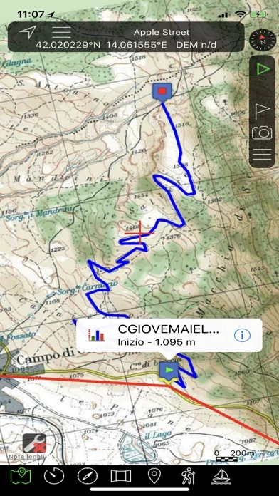
All waypoints, tracks and routes are shown on the map; recording track is drawn in real time.

Draw your path on the map! OkMap will calculate for you the altitude differences and travel times producing also statistics and graphs.

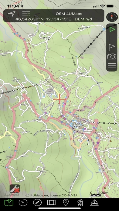
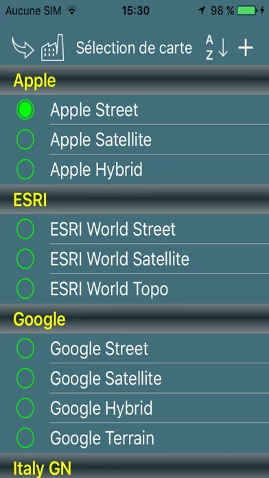
OkMap works with different online maps and offline custom maps in KMZ format.

  Contact Support
Developer:
Gian Paolo Saliola