Travel Altimeter & Elevation Reviews

Travel Altimeter & Elevation Reviews

Published by on 2024-05-29

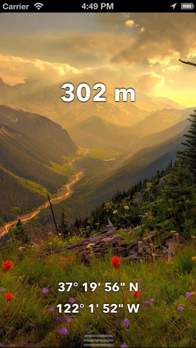
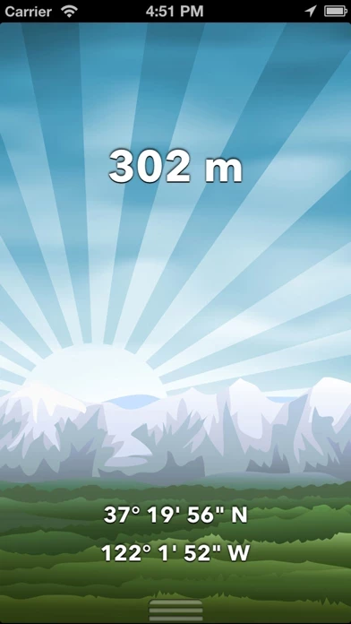
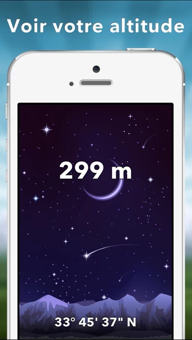
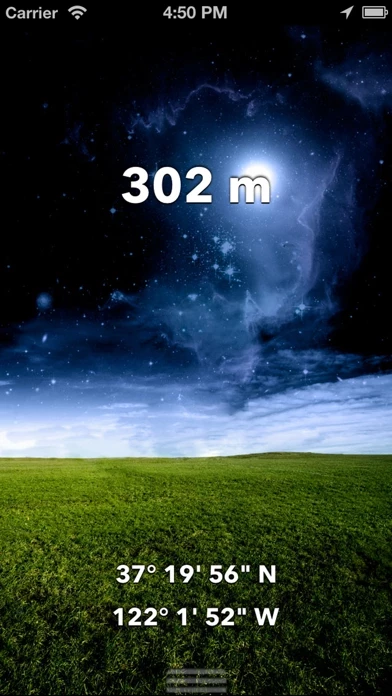
🏷️ About: This app is an altimeter and compass that allows users to view their altitude or elevation on stunning landscapes that adjust with the time of day. It is great for hiking and other outdoor activities, and the barometer lets users track their altitude changes based on the change of pressure. The app also features a compass that shows real-time orientation.



Overall Customer Experience 😎


👿🤬😠 Negative experience
50.5%

😎👌🔥 Positive experience
35.9%

🙄💅🫥 Neutral
13.6%

~ from Justuseapp.com NLP analysis of 38,014 combined software reviews.


Summary of Customer Reviews (Takeaways): 💎

- Accurately calculates elevation and fluctuates as it should based on latest data points from satellite

- Provides longitude and latitude information, which is useful for documenting locations

- Useful for exploring outdoors and determining altitude, especially for those with health conditions affected by higher elevations

- Provides information on altitude changes while driving on back country roads

- Helpful for determining distance above water incursions for those living near the coast


Read 30 Customer Service Reviews 👿🤬😡😠💢😤

4.7 out of 5

Poor design and lack of features

2022-05-24

Free version review. Basic free design is too cartoony. Free compass is hard to read. Not able to switch to decimal reading on coordinates. Shows elevation but not location information such as city and state. No ability to save location information. If you care about any of these points TravelAltimeterElevation is not for you. If developers would address these points I may reconsider trying it out again but not impressed on first walk thru.

Poor performance

2022-06-25

I climb a mountain for exercise 5 days a week and I got TravelAltimeterElevation to see what the numbers are. To add to it iPhone health app. TravelAltimeterElevation tells me the river where I park is 300 and something feet elevation, however after a hard uphill climb for 75 minutes it tells me the elevation is only 600 and something feet. I know that’s crap. Ecause I can see I’m looking down on the pass across the valley which is 1300’ so TravelAltimeterElevation is useless as it relates to my intent to use it. Complete joke!

ok...but could be better.....

2022-07-26

When traveling for three months at a time in our motor home....having accurate reading of the altitude are critical for my wife’s heart condition. This is my favorite app for altitude. I gave it 3 stars because I’ve never founded the center screen compass seems not to have a function. It’s just there and a distraction while looking for the altitude reading while driving up steep inclines or narrow mountain roads. Perhaps I don’t understand it’s use but it’s distracting none the less.

Like it, but...

2022-08-27

I get different altitudes when using TravelAltimeterElevation on my iPhone and iPad. The iPhone shows what I know to be, from several Topo maps, the correct elevation of our house. My husband has the same iPhone/iPad dichotomy. Also, the needle on the "upgraded" grey compass is the same color as cardinal lines so there’s little to no contrast, so hard to see in low light. The lettering is also very tiny,hard to parse. With a little tweaking TravelAltimeterElevation could be way better.

Turn off the compass

2022-09-28

As an altimeter this is fine. However the default compass "feature" is dangerous and useless for navigation. It mimics the behavior of a real compass except the bezel doesn't move meaning you could easily misinterpret it and go completely the wrong way. Turn it off in the upgrade section and use the default iPhone compass (or a real one!) instead.

Helpful and useful but not precise

2022-10-29

Overall, TravelAltimeterElevation was simple to install and does track your altitude when standing still, walking or driving. If the old saying “Close us close enough” works for you you’ll be quite pleased with it.

The only down side is that I can be standing still in a location and TravelAltimeterElevation keeps changing the altitude. It might count up ten or fifteen feet, start counting down from whatever altitude it stops at, then reverse and count up again.

Just to make sure that I wasn’t somehow causing the fluctuations I set the phone on a flat surface, but the “indecision” by TravelAltimeterElevation continued.

So bottom line, if you’re just curious to see approximately what altitude you’re at (e.g. about 1500 feet above sea level) it’s perfect! But if you need more precise information you’ll need to opt for a more precise meter.

But hey! It’s a free app. So for the average person who’s just wanting to know approximate altitude or whether a slight grade is going up or down, I’d highly recommend TravelAltimeterElevation.

Nice, but lacks a key feature

2022-11-30

I like how this works with one glaring exception. I wish I could lock TravelAltimeterElevation so it wouldn’t timeout when I’m driving. I connect to CarPlay and like to see my elevation as I drive. Unfortunately TravelAltimeterElevation times out and the screen goes blank. It would be a five star app if that didn’t happen.

It has a nice easy interface to work with, clear information. Easy to add features and you can remove ads for cheap. Good app, just want it to continually display while driving.

San Antonio Don

2022-12-31

I’ve had TravelAltimeterElevation now for about 10 days and I am hiking at altitudes varying from about 4,300 to over 9,000 feet. I’m finding TravelAltimeterElevation to be very useful, and easy to use. I didn’t rate it 5 stars only because when I’m using it there is a tendency for it to change elevation readings even when I’m stable and not moving. It probably makes little overall difference though, unless you need a more accurate and non-wavering reading like for construction.

Doesn’t Always Work

2023-02-01

Lately, more often than not, TravelAltimeterElevation is not displaying my altitude, and on several occasions it will display altitudes that differ by a couple hundred feet altitude readings from different locations on the same level in our home. Wouldn’t want to go skydiving with TravelAltimeterElevation as my only reference.

Good app

2023-03-05

Not as accurate as I’d like. I am measuring the altitude & location of trees at my home, and the altitude can fluctuate 20’ to 30’ at the same tree. I have to guess at the correct altitude based on nearby measurements that dId not fluctuate as much. Maybe there’s a trick to measuring the altitude and location of a tree, but I don’t know it.

Altitude

2023-04-03

Why do I have a difference in my altitude using this same app on my iPhone and my iPad Air? It’s always been the same on my phone for months but it shows a difference of almost 200ft on my iPad? Why.

Some minor issues but main stuff works well

2023-05-05

I still see ads despite buying no ads option. I think it triggered when I pressed “more apps” button. Some things seem to work a little slow and wonky but to be fair, I am using an almost 5 year old device. Will update review as I see progress on TravelAltimeterElevation . Keep up the effort. Please fix your app support store link, it goes to a 404.

Seaside Companion

2023-06-05

If you live, hike, camp, or own property near the shore it’s often handy to be able to determine how far above any anticipated water incursions you might be.

We live quite near the coast, in Maine’s Casco Bay and value the information we get from TravelAltimeterElevation a great deal.

So very helpful

2023-07-07

I have severe COPD and oxygen levels (or lack of oxygen) in higher elevations greatly affect my breathing. I use TravelAltimeterElevation all the time when traveling because it helps me know what to expect when I get out of my vehicle and if I need to attach my oxygen hose

How. High

2023-08-07

Been looking for an altimeter that seemed to work with a bit accuracy. This one seems to work the best that I have found so far. I think my up North property is one of the 10 highest points in lower Michigan. Maybe I can check it out a little bit closer now

This is a wonderful app

2023-09-08

I needed an app that gave me longitude and latitude and it was free. I needed to document these for my dad, each of the seven seas. This was awesome because I know most people are using it for altitude, but it’s giving you sea level. Which was a bonus for me, he was in the US Navy and the sea level makes it a huge bonus for me to use.

Well Pleased

2023-10-10

It does what it is designed to do quickly. User friendly. However, I wish I could input coordinates to determine elevation at that location. This would allow me to compare elevation and the differences between different waypoints when planning along a route.
Thank you
Ed

Quality app

2023-11-10

App is a great tool to use for exploring outdoors and is very accurate in doing so. Calculates elevation accurately as well. I checked Map Elevation on national database and it's accurate. The GPS Elevation fluctuates as it should (latest data points from satellite). Can't tell if GPS is accurate but looks good to me. Added flashlight feature is useful as to not having to switch app.

Love this app.

2023-12-12

I live half the year in Colorado and use TravelAltimeterElevation as we travel to the mountains from the front range. Denver is the Mile Hi city as identified by TravelAltimeterElevation. Also going to places such as Steamboat Springs or Pagosa Springs- we are crossing different passes and/ or the Continental Divide. Really fun to check the altitude along the way. We also spend time in FL and it’s neat to see the actual ‘altitude’ in spots away from the beach. Yes I recommend!

Very Useful

2024-01-12

I live in Asheville NC and enjoy being able to drive the many back country roads and watch the changes in Altitude from about 2500 ft to 6600ft. Just wish there was a link to the weather so I could approximate the temperature. I realize the temp reduces about five (5.5 degrees) F per thousand feet in elevation.

Pretty good

2024-12-22

The GPS function seems to be right on - within 50’ compared to Google Earth.

The altimeter is close - probably within 10-20 feet compared to Google Earth. Super for “How high up are we?” but not close enough if deciding how high to build your house above the river.

Mountain Life

2024-12-22

We live on live in the Smoky Mountains/Pisgah Forest on the side of a small mountain. We’ve always wondered what the elevation was- now we know. Since we also like the hiking the abundance of trails we often enjoy checking out the elevation when we reach our destination.

Great tool

2024-12-22

I would like to recommend TravelAltimeterElevation to all those who need to learn the different altitudes where are working with natural elements as level as of Forrest, water well drilling, rocks’ formation, it will help you out to relate all those elements in specific geographical areas.

Does the job

2024-12-22

I downloaded TravelAltimeterElevation while I was in the mountains. Works great. The first app I downloaded never could pick up a satellite. I had this one downloaded and working in less than two minutes. Go for it!

awesome

2024-12-22

We recently traveled the southwestern states and found TravelAltimeterElevation far more accurate than my last one. TravelAltimeterElevation also has in my opinion some fun options that I haven't seen using other elevation apps

Difference

2024-12-22

I like TravelAltimeterElevation very much. However, I have noticed a somewhat disconcerting difference between the color of the compass point that shows North on the iPhone and this iPad. On my iPhone, the red point shoes north; while on the iPad the white point showed north.

Leaving Colorado and those lozy Mountain highs

2024-12-22

I installed TravelAltimeterElevation due to health complications acquired by a land locked prison, dry and very thin Air . So to all those mind seeking adventurous people. The Colorado Rockies you might think twice . Over priced over thought think again PS it hardly snows in the cities

Good app

2024-12-22

We like to know where we are when traveling and use TravelAltimeterElevation several times on trips . It always gives us accurate information

Nice to have

2024-12-22

I wanted an app that would give me an appropriate elevation. This one was simple to load and easy to use. Now when we travel we will use TravelAltimeterElevation just for personal information.

I love the altimeter!

2024-12-22

I love finding out things and we travel be car a lot, so it is fun to be able to see just how high or just how low we are. I have never had a problem with this altimeter.


Is Travel Altimeter Elevation Safe? 🤗🙏


Yes. Travel Altimeter & Elevation is very safe to use. This is based on our NLP (Natural language processing) analysis of over 38,014 User Reviews sourced from the Appstore and the appstore cumulative rating of 4.7/5 . Justuseapp Safety Score for Travel Altimeter Elevation Is 41.6/100.


Is Travel Altimeter Elevation Legit? 💯


Yes. Travel Altimeter & Elevation is a totally legit app. This conclusion was arrived at by running over 38,014 Travel Altimeter & Elevation User Reviews through our NLP machine learning process to determine if users believe the app is legitimate or not. Based on this, Justuseapp Legitimacy Score for Travel Altimeter Elevation Is 57.4/100..


Is Travel Altimeter & Elevation not working? 🚨


Travel Altimeter & Elevation works most of the time. If it is not working for you, we recommend you excersise some patience and retry later or Contact Support.


Payments 💸🤑💰

**Pricing data is based on average subscription prices reported by Justuseapp.com users..

Pricing Plans Amount (USD)
Remove advertisements $0.99
Background Bundle $1.99
Meadow (Illustrated) $0.99
Choose Your Own Background $1.99
Mountains (Illustrated) $0.99
Pocket Compass $0.99
Grey Compass $0.99
Ship Compass $0.99
City (Illustrated) $0.99
Thank the Developers $0.99


How was your experience with Travel Altimeter & Elevation? Post a Review


Features

- Highest GPS accuracy for your device

- Ground elevation from topographical map values

- View in feet or meters

- Built-in flashlight

- Share screenshots with beautiful backgrounds on social media or via email or text message

- Custom Background upgrade to take a photo from the top of a mountain and take a screenshot with your altitude overlaid to show your family & friends

- Backgrounds available for in-app purchase, including meadow landscape, cityscape, mountains, abstract, and choose your own

- Simple and uncluttered interface to read altitude or elevation, latitude, and longitude

Note: The altitude shown is potentially subject to large inaccuracies and this app should NOT be used as a primary device for determining altitude for medical reasons.

  Customer Service/Support
Developer:
BranchenKing Ltd.


Privacy Policy: