Topo Map & Hiking Tracker Erfahrungen und Bewertung

Topo Map & Hiking Tracker Erfahrungen und Bewertung

Veröffentlicht von

Über: ** The #1 Hiking Tracker App for iOS ** TRACK YOUR STATS! + Total distance +
Total vertical + Total time + Calories burned * Optimized to save battery
life VIEW YOUR TRACKS! + Recap your hike on the map + Color coded tracks
based on relative elevation + Quickly view stats on Apple Watch display + iOS
14 home screen widget BACKUP TO iCLOUD + Automatically backup data to iCloud
+ Share data between devices THE BES.


Über Topo Map Hiking Tracker


USGS Topo project is a tile cache base map service that combines the most current data in The National Map (TNM), and other public-domain data, into a multi-scale topographic reference map.

USGS Imagery Topo is a tile cache base map of orthoimagery in The National Map and US Topo vector data.

Orthoimagery data are typically high resolution images that combine the visual attributes of an aerial photograph with the spatial accuracy and reliability of a planimetric map.

Data themes included are Boundaries, Geographic Names, Transportation, Contours, Hydrography, Land Cover, Shaded Relief, Trails, etc.

The USFS Topo Map Area of Interest covers the USFS National Forests and Grasslands.


0 Topo Map Hiking Tracker Erfahrungen und Bewertung
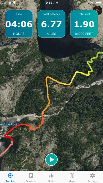
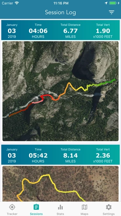
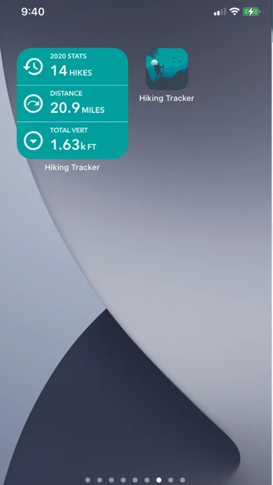
5.0 out of 5

Siehe 0 weitere Bewertungen


Wie war Ihre Erfahrung mit Topo Map & Hiking Tracker? Schreiben Sie eine Rezension

Einen Kommentar hinterlassen:


Alternative