PredictWind Offshore Weather Software
Company Name: PredictWind Limited
About: PredictWind Limited was founded by Jon Bilfe
Headquarters: Waitakere, Auckland, New Zealand.
PredictWind Offshore Weather Overview
What is PredictWind Offshore Weather?
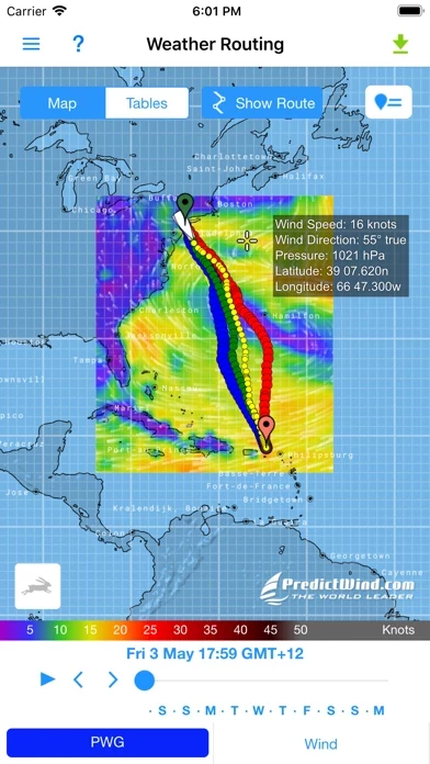
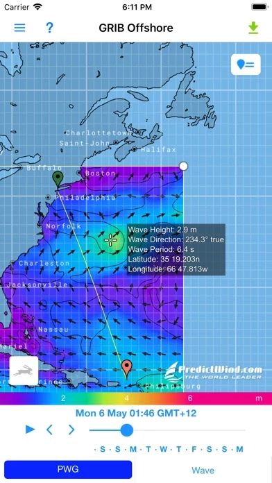
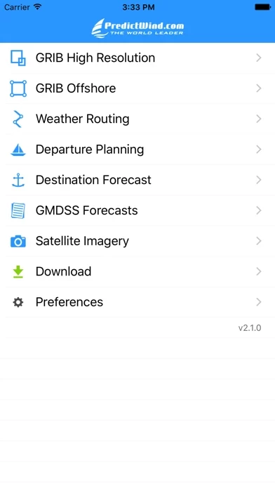
The Offshore App is a marine weather forecasting app powered by PredictWind. It allows users to download and view multiple GRIB files for coastal or offshore passages. The app provides accurate weather forecasts using proprietary PWG and PWE marine weather forecast models, along with the ECWMF and GFS models. The app also offers weather routing and departure planning for offshore passages, which is calculated on the PredictWind server with the highest resolution forecast data.
Features
- Seamless downloading of multiple GRIB files
- Intuitive interface for easy viewing of GRIB files, weather routes, GMDSS Text forecasts, and satellite imagery
- Proprietary PWG and PWE marine weather forecast models, along with ECWMF and GFS models
- Animated weather forecasts
- Weather routing and departure planning for offshore passages
- Ideal for transmission over low bandwidth satellite and SSB connections
- Works with Wi-Fi, mobile networks, and most satellite connections using Iridium GO!, Globalstar, and Optimizer interface.
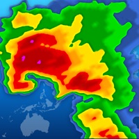
Official Screenshots
Product Details and Description of
Powered by PredictWind's world leading marine weather forecasts, the free offshore app allows seamless downloading of multiple GRIB files for your coastal or offshore passage. The intuitive interface allows you to download and immediately view GRIB files, weather routes, GMDSS Text forecasts and Satellite Imagery. PredictWind's proprietary PWG and PWE marine weather forecast models are available along with the ECWMF and GFS models to provide the most accurate forecasts, available at the highest resolution. Download and view animated weather forecasts, Weather Routing and Departure Planning for your next offshore passage. The Weather Routing & Departure Planning is calculated on the PredictWind server with the highest resolution forecast data, but the file size is incredibly small, making it ideal for transmission over low bandwidth Satellite & SSB connections. Works with Wi-Fi, mobile networks, and most satellite connectons using the Iridium GO!, Globalstar, and Optimizer interface in the Offshore App.
Top Reviews
By alexchiric
A have to have companion at see
I use predictwind/offshore application by more than one year. Actually, I have passed 7 seas and I am on the way to cross the Atlantic Ocean. In more than 95%the forecasts have been accurate and the mathematical model used let you a plenty of options to choose a departure schedule or to make a passage.
By MikesRandomTravels
Works great with Iridium Go
Used both the IOS and Mac version on a recent passage. Both were intuitive and seamlessly linked to Iridium Go. While it is a little easier to add coordinates in the Mac version, I found the convenience of the IPad outweighed this minor inconvenience.
By Vdgtfhhf
Excellence
An excellent weather departure and passage planning application. I used it extensively on my transatlantic and will continue to do so in the future.