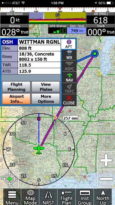
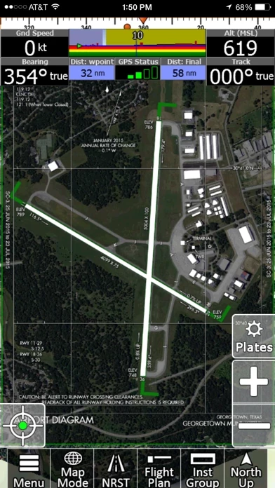
- Geo-Reference Approach Plates and Airport Diagrams
- 3D Synthetic Vision / EFIS Mode
- Terrain, Obstructions, Traffic, and Airspaces Alerts
- Complete ADSB support
- AutoTaxi+ for safe taxing at any airport
- RealView airport imagery
- RealPlan automatic VFR Planner
- Auto-load approach into plan
- Complete VFR and IFR databases and charts (FAA)
- Sectionals
- Customizable Instruments
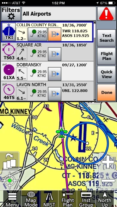
- Public & Private Airports
- Winds aloft including forecasts for 36 hours
- Hi/Lo-Enroute Charts
- Terminal Area Charts(TAC)
- World Aeronautical Charts(WAC)
- Vector Mode
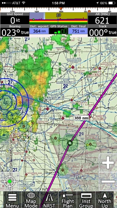
- Weather (Pre-Flight or ADS-B Live)
- Hi-res Winds Aloft Optimizing
- Rapid Flight planning
- Plates & Diagrams (Approach, Departure Plates, Stars, SIDs Airport Diagrams)
- Instruments Panel
- Day/Night Mode
- Online Flight Plan Filing
- Custom Instrument Layouts (24 Instruments, e.g. HSI, Vertical Profile, and AHRS)
- Vertical Terrain planning and Airspace preview
- Find Nearest
- History
- North Up / Track Up
- Pinch Zooming w/ One Touch Feature
- Dynamic Distance Ring
- Hybrid Compass Rose w/ Nav Function
- Extended Course Line
- Flight Trails
- Past Flights
- Rubber Band route modification
- Custom Aircraft icons
- AutoTaxi+
- Alerts & Warnings
- Button Fading (maximizes screen space)
- Custom User Waypoints
- Customizable Instruments
- Simulator Mode