Pocket Earth Maps Reviews

Pocket Earth Maps Reviews

Published by on 2023-04-19

About: Have fun getting lost with Pocket Earth! • Detailed worldwide maps and travel
guides • Topographic contour maps for the outdoors • Works completely
offline even with GPS • Great when abroad or in the wilderness, NO data
roaming charges • Online routing with Voice Guidance and much more! • We
give you one offline city for free, in-app upgrade to access unlimited worldwide
offline maps and topographic maps feature..


About Pocket Earth Maps


What is Pocket Earth Maps? Pocket Earth is a travel app that provides detailed worldwide maps and travel guides, topographic contour maps for outdoor activities, and works completely offline even with GPS. It is great for use abroad or in the wilderness, with no data roaming charges. The app offers online routing with voice guidance and many other features. It is available for download on the App Store.


Features


- Beautiful Retina quality maps at a fraction of the size

- Detailed and interactive worldwide maps with more than 100,000 places

- Access to maps online and offline, saving on data roaming costs

- Personalization of maps to show the information you want

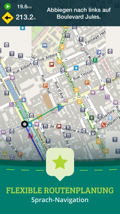
- Online routing with directions and the ability to save multi-stop itineraries for offline voice-guided navigation

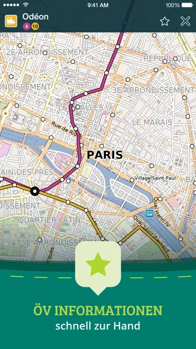
- Online street address search and contacts integration

- More than 25,000 detailed Wikivoyage Travel Guides and more than 1 million Wikipedia articles in 7 languages, all offline

- Customizable pins and favorites groups, with the ability to add notes and mark and share favorite spots

- Share maps links and your current location

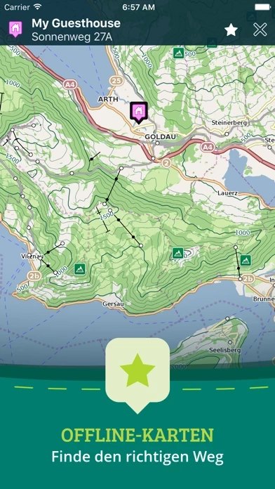
- In-app purchase option for topographic maps with high performance, high accuracy 10m/50ft contour display worldwide

- Hiking and cycling maps, great for geocaching and getting off the track

- GPS track recording to see the route taken, great for hikes, cycling, and off-road activities

- Import/export support for GPX and CSV files, with the ability to share with friends using PE Archives

- Displays and lets you search for map coordinates in all common formats

- Numerous GPS settings for preferred configuration, including compass and heading arrow or rotation, look ahead mode, accuracy, and recording settings.


Overall User Satisfaction Rating


Neutral
52.0%

Negative experience
51.9%

Positive experience
48.1%

~ from Justuseapp.com NLP analysis of 563 combined software reviews.

Key Benefits of Pocket Earth Maps

- Downloaded all of the maps for the Eastern European countries, as well as several for the USA.

- Able to put in a street or address, and find my way to the location while offline.

- Constantly upgraded as you move in the direction of your destination, so that it does take you there.

- Offline maps function is huge.


21 Pocket Earth Maps Reviews

4.7 out of 5

By


Many great features

Two complaints in an otherwise solid app: (1) Minor roads only appear when you zoom pretty far in. They should be visibility at pretty much all zooms as very light lines (for example). (2) Road labels don’t appear on minor roads until you are zoomed way, way in.

These are vector maps, so all the data is there at all zooms - the developer just chooses not to display it for us. Give us a switch/option to “show all roads”, for example - some of us would choose to have a busier map for certain applications, given that is has more information.


By


Great maps

Great site. You find where your going and open the map then keep that spot and your set


By


One of my favorite Apps

Before leaving for a Danube River cruise, I downloaded all of the maps for the Eastern European countries, as well as several for the USA. They didn't take up much space, but were incredible, both while walking and driving. I was amazed to find out how much additional information was available everywhere with Wikipedia references that were quite extensive and that went far beyond what our local guides had given us, even in remote locations that I had never even previously heard of.

While walking I was able to put in a street or address, and find my way to the location while offline. This worked well, but of course the one much to be desired improvement would be the ability to get turn by turn directions while offline, as the destination is drawn as a straight line from location to destination. However it is constantly upgraded as you move in the direction of your destination, so that it does take you there.

We are a traveling family, and I have urged everyone to make the purchase. It is probably the best few bucks I have ever spent.


By


Pocket Earth

Awesome tool. Wiki feature is very nice for touring especially in Europe. I like to save favorites places and at end of trip create a route showing all the places visited. Not happy with lack of map updates that I find in OSM but not in app


By


Won’t download maps anymore

Every time I try to download maps on a cellular connection, it says there is no connection even when I have checked the box to allow cellular downloads.


By


Crashes all the time

Crashes all the time.


By


Great map for foreign holiday

Used PocketEarthMaps extensively during a recent 7 week hiking and cycling holiday in Europe. Used it daily. Wouldn't want to be without it.

How I used it:

1. Offline maps. If you have a limited data plan or are traveling in an area with poor cellular data, the offline maps function is huge. You can put your phone in airplane mode and still have full map functionality. Google maps will not work in areas without cellular data. Even if you have lots of data, putting your phone in airplane mode saves tons of battery power, keeps your charge up through long days of touring.

2. GPX functionality. I downloaded some cycling routes from a web site and was able to upload these on my iPhone and visualize these on the Pocketearth App. Similarly, I was able to record my rides and save them as GPX files, which I could then share with friends. This is an inexpensive introduction to the world of digital mapping and GPX.

3. Hiking. We downloaded GPX files of our hiking route and during the hike were able to check we were on the right path. Given that we were hiking on unmarked trails, this was incredibly reassuring that we would not get lost. Could also track how many miles we walked.

4. Altitude. The altitude was within a few metes of both the topographic map and a friend with a $200 altimeter.

Amazing that you can get this for only $10!

One criticism: cannot follow an existing GPX track AND simultaneously record one's own track.


By


One of the best apps I've downloaded

I loaded PocketEarthMaps before a trip to Europe. Since my carrier does not offer international service, I wanted a mapping program that did not require a cell signal. Pocket Earth has exceeded my expectations. It is fast and accurate. It scales quickly and does well in cities and towns. Car navigation so far has been flawless. The user manual is one of the best app manuals I've come across. Great job by the developers!!


By


Can't really be used offline

I thought this would be the solution for getting around while out of the country without paying foreign data rates. It's not. You can't do something as basic as get a route to a landmark without being online. I was left clumsily trying to drive while repeatedly looking down at my screen to see where on the map I am since I couldn't plan a route or get turn by turn directions without being online even though the full map had been downloaded to my phone. I don't see the point of this if it can't give you directions without being online.


By


Free update is incredibly great!

Pocket Earth has had several new features added, and just keeps getting better. Now with Drop-a-Pin at my location, and add my own pictures to the Pin, we can record so much more about our travels so easily.

Excellent OFFLINE, stored on my iPad maps; POIs galore, my at-home travel research Pins; Wikipedia POIs; import of trails and routes found online; add up to an app without which I cannot live.


By


Well designed, incredibly useful.

I am moving to a new city and being able to tag, store, and organize various locations is amazing. Using it offline is great, it will even remember pre-planned (and downloaded) routes on my ipad. Then with cell data on iphone can show location and give spoken directions. Worth so much more than I paid!


By


Great app

Of all the maps I downloaded, even the paid ones, this was the best and has aided in our hunting trip tremendously. Offline, in the dark, dense in a thicket, no issues. Tracks you down and pinpoints where your at and where you will head back and head on. Very well made!!! If there was a 10 star, this would be it.


By


Great for Travel

PocketEarthMaps has amazingly detailed maps of the major cities. It even shows where restrooms and traffic lights are. Upgrade to Pro for $9 to download maps for offline use, then plan & save your routes. It's great for travel when you don't want to use too much data. For me, this is a godsend.


By


Does not work offline as stated

Really unhappy because I purchased the world maps and tried to get route guidance while offline but got repeated alerts asking to establish internet connection so in fact PocketEarthMaps does NOT "work completely offline" as stated in the description. The maps do appear to download and I guess some people are happy with how PocketEarthMaps works for them but I barely made it to my destination. Please update so that it truly does work completely offline and I'll be happy to change my rating. Requesting a refund from Apple is too cumbersome.


By


Just used in Addis Ababa

Got stuck in traffic in Addis Ababa, Ethiopia and pulled out PocketEarthMaps. Found a side street that got me on a main road I was familiar with, got home in just 10 minutes later than we planned. Love PocketEarthMaps as we live in our host country, Ethiopia!


By


A very handy map app

I have tried quite a few maps and atlas type apps and this is my favorite for traveling. Is has city maps for all major cities of course but it also covers many smaller places as well. The guide books are also a nice feature.


By


Very limited demo

Only shows Ireland, so I don't know if this will fulfill my needs or not. Am NOT willing to pay three dollars to find out it is not what I need after all. It does zoom in very closely to a chosen city in Ireland, though, but that is not what I am wanting. I wish to have a quality atlas that shows all the countries on each continent, and also zooms into each city.


By


Great maps

The maps are very easy to use. A simple spreading apart of two fingers and more detailed maps quickly appear. I've searched through other apps and really enjoy using this one.


By


Not much Topo detail

I found that there is not much detail to elevation lines and wetlands are not marked very well if at all.
I mainly download it for use offline with what3words


By


great for exploring

i find PocketEarthMaps helpful to review areas i explore on my motorcycle. i do find the interface a little less than intuitive (i deleted a ride yesterday in error and i really wanted to see the woods i was exploring at home yesterday) but PocketEarthMaps works great when i use it correctly. a stop/pause and then end route would be nice. i deleted thinking i was marking the end of my route.
overall though PocketEarthMaps is great to use offline and doesnt seem to drain the battery as much as expected. plus its free, thanks!


Paolo Vitali   3 months ago


I purchased the PRO version with the topographic maps download option, I used it and I was happy, both online and offline. Now I changed my iPhone, but I can use only the free version! Offline Maps shows me I have 221 MB of offloaded maps, but the list is empty, from Settings Manage Add-ons I try the Restore Purchases, but it prompts me "No previous purchases to restore". Apparently every time you change the phone you have to subscribe and pay again. Very bad! I tried to contact the support from the "Contact us" window and with a direct mail to info@redacted but I didn't receive any answer! Double very bad!


Is Pocket Earth Maps Safe?


Yes. Pocket Earth Maps is very safe to use. This is based on our NLP (Natural language processing) analysis of over 563 User Reviews sourced from the Appstore and the appstore cumulative rating of 4.7/5 . Justuseapp Safety Score for Pocket Earth Maps Is 48.1/100.


Is Pocket Earth Maps Legit?


Yes. Pocket Earth Maps is a totally legit app. This conclusion was arrived at by running over 563 Pocket Earth Maps User Reviews through our NLP machine learning process to determine if users believe the app is legitimate or not. Based on this, Justuseapp Legitimacy Score for Pocket Earth Maps Is 100/100..


Is Pocket Earth Maps not working?


Pocket Earth Maps works most of the time. If it is not working for you, we recommend you excersise some patience and retry later or Contact Support.


How was your experience with Pocket Earth Maps? Post a Review

Leave a comment:


Alternatives