Pocket Earth PRO Reviews

Pocket Earth PRO Reviews

Published by on 2024-08-20

🏷️ About: Pocket Earth is a travel app that provides detailed worldwide maps and travel guides, topographic contour maps for the outdoors, and works completely offline even with GPS. It is great for use abroad or in the wilderness, with no data roaming charges. The app also offers online routing with offline voice guidance and many other features.


Overall Customer Experience 😎


😎👌🔥 Positive experience
49.8%

👿🤬😠 Negative experience
32.5%

🙄💅🫥 Neutral
17.7%

~ from Justuseapp.com NLP analysis of 1,720 combined software reviews.


Summary of Customer Reviews (Takeaways): 💎

- Can be used on older phones without cellular service

- Can download maps for offline use

- GPS still works even without cell coverage

- Ability to switch which maps are downloaded

- Great for travel on major roads


Read 25 Customer Service Reviews 👿🤬😡😠💢😤

4.8 out of 5

Maps out of date; customer support nil

2022-05-21

I generally like PocketEarthPRO but its maps are not refreshed in any regularity. I understand that PocketEarthPRO pulls from other map sources - but those sources have been updated months ago and they are still not reflected in PocketEarthPRO. Emails to the developers fall into a black hole. How about some support? PocketEarthPRO is invaluable for those who want to travel off the grid but with bad data it is a risky proposition.

Great app, woefully out of date maps

2022-06-22

When I first found PocketEarthPRO, they promised to update the data every couple weeks. A few years later and I’ve found that updates seem to come 6mo apart or worse. Given that the maps are derived from OSM, the maps are being improved *daily*. I just looked at an area that I know was updated months ago with more detail, yet even after updating the data is missing. I’ve contacted the developer in the past and when they bothered to respond they gave promises of updates that then failed to materialize. Very disappointed.

Pocket Earth Pro

2022-07-23

Pocket Earth Pro is a great resource for those interested in traveling, adventures of those who just want to access maps for almost every location around the world. Almost any helpful information you can think of can be used for assistance. Whether individual travel guides for numerous locations, Wikipedia articles to provide information on locations, whether large maps of known and unknown areas that can be downloaded and accessed offline Pocket Earth has it. Most importantly PocketEarthPRO is easy to navigate and use which can sometimes not be true of an application brimming with information. The side bar can be used to access a category or customize your personal settings. Pocket Earth is an application well worth a download whether the free or Pro version.

Very good app

2022-08-24

PocketEarthPRO is one of the first apps I downloaded when I got my iPad. It has been extremely useful when traveling. It has got my buddies and I to are destination several times when all their cell phones could not, and I was only using the offline maps. The transportation info is always accurate (train route numbers, bus numbers, etc,) and will usually show your hotel. I am not a tech guy so I only gave it 4 stars because it is complex, otherwise I would have given it 5 stars. Any young person can use with no problem I’m sure. I was never sorry I got PocketEarthPRO. Stevo

Works like a champ

2022-09-25

LOVE the fact that it works offline.

I put it on my trusty iPod and not needing wifi or internet makes it an indispensable asset when I travel to remote areas.

Sometimes I disagree with its choices for fastest or shortest routes, but on the other hand that frequently reveals alternate routes I can use when my preferred ones are jammed with traffic.

I wish for the option to enter street intersections as a destination. Sometimes you don't have an address but you otherwise know exactly where you'd like to go. If its possible to do so and I missed it, my apologies. :)

So Useful

2022-10-26

Download the maps where you’re going and you are set. No need for a data connection, and pretty simple and intuitive. I use it every time I travel, drop pins at places of interest, or even where I park my car. Five stars!

Love it - and I'm a map geek

2022-11-27

I LOVE this map. I first used it many years ago with my iTouch and now have the Pro version on my iPhone.

You can navigate with iPhone even if you have no cell coverage; the GPS still works. I always pre-download maps when I travel. I can then navigate off line, which saves data fees as well as battery.

The ability to switch which maps are downloaded is great, and very easy. I can for example download British Columbia topo maps for a backcountry trip; then later remove it before downloading Italy for my next trip. The level of detail and the number of "points of interest" is fantastic! I’ve even used it to navigate the Paris metro system!

I d like to see more icon choices for “favorites” I save. A way to indicate a trailhead, or a picture of a car come to mind.

Another update I’d like to see is that I’d like to be able to search for routes or tracks that are “Nearby”. The only way to find them currently is to search “Groups & Filters” by name date or user. Since I have dozens if not hundreds of Tracks and Routes, this is cumbersome. I usually don’t remember the name or date, and the user is always me, so I must scroll through the entire list.

Great Resource!

2022-12-28

I bought this so I would have maps when I had no cell service. We’ve used this in Europe and for some Caribbean cruises. Just download the maps you need before you leave. I also appreciate the POI data which is included.

Most used app?

2023-01-29

Possibly. Pretty simple to use, easy to measure distance , put markers on. Ability to download maps helps. Not always complete with trails and/or landmarks but good enough. Helps you not to lose your way and to plan your routes. I’ve used it all over the world, very helpful and functional.

Highly recommend

2023-03-02

Sandy and I kayak oftentimes way off grid in complex waterways. The tracking feature not only helps with navigation, but also helps us keep a record of all our expeditions. We tell many people about PocketEarthPRO wherever we go. Thank you pocket earth.

Super useful especially when you have to go off the grid

2023-03-31

I use this for finding hiking trails during the day then a place to park when going out at night. I've not found a better offline mapping solution and I consult it constantly. All the points of interest you could hope for and travel guides to boot.

Great Offline Maps

2023-05-02

Great to use on older phones that no longer have cellular service. Load PocketEarthPRO , download the maps and just use the internal gps with the map software. For $5 you can download the topographical maps, if you know how to read them. I’ve always just wanted mapping software that didn’t rely on having data available. Now I can just download while on WiFi and go. If you are running low on memory, you can just download the states you are in or visiting individually. From time to time I have noticed that maps are deleted when PocketEarthPRO is updated. I did have to reload maps, but if I was already out and about I would just download the state and I can always restore my purchase of the topo maps and be on my way. Have fun, enjoy and get out and go explore.

Best Nav App

2023-06-02

I travel a lot around the world and use PocketEarthPRO everywhere I go. At new places, I drop pins first at the hotel, the work site, then all the restaraunts, convenient stores and other points of interest. When I walk around, I set a track to the pins so I know which direction to walk. I can get coordinates from Google Maps and use it to drop pins too.

Vertical Route Planner/Tracker, etc.

2023-07-04

I’ve been using PocketEarthPRO for several years now and I’m very happy to see that it continues to be updated. Don’t be lazy. Take time to understand the user interface. It’s well thought out. If you do you will find Pocket Earth great for planning travels, recording tracks and discovering places of interest at way points. Finally, you can download maps that cover your route even when you lack internet.

Great app for outdoor!

2023-08-04

Amazing app! Way to customize the route such as avoid hill in cycling is something never seen in other apps! At any time any location you can see your moving speed and altitude. So many features am so excited about. Real masterpiece if you are all for outdoor activities! Better than any other popular and heavily advertised apps out there! Don’t get blown away by so many options initially. Once you get used to it, it’s hard to find anything else that can compete with this one!

Fav maps! Offline, topo, accurate, configurable

2023-09-05

Pocket Earth is awesome for several reasons:

1) Offline maps. PocketEarthPRO was my go-to choice for a year abroad where I often would not have internet. It was amazing to download *the entire country* in one easy step (and it didn't even take up that much space!)

2) Topographic maps. Great for backpacking & cross-country skiing.

3) Configurable points of interest. I can enable banks & tourist spots while disabling other things when traveling, or enabling Wikipedia locations(!) in an area I'm curious about.

4) Easy saving & copy-pasting of recorded GPS tracks and coordinates (in many different formats!)

5) Most accurate running tracker I've used! This is an unexpected and random benefit, but it really does do a better job tracking my runs than the many other running-specific apps I tried (all other running apps had pretty bad "jitter").

Great app, thank you! :)

My go-to travel planning tool

2023-10-07

I like to plan my trips well, and that means being able to find and mark locations on map and plan routes. I have found no better tool for this. Takes a little work to figure out how best to use - but worth the investment. My top desires for future updates is to be able to turn off all Wikipedia icons and even better ability to turn off all icons other than the ones saved - I like to print off maps that show my locations of interest but map gets too cluttered with unwanted icons.

The Best

2023-11-07

This was one of the first vector based mapping software out there, and it’s still so vital to have. It’s one of the easiest to download huge areas right to your iPhone or iPad so you can take it with you anywhere. Never disappointed. Shows more details than others even when using the same OpenStreet Map. For example, power lines! Which can be very useful if your hiking in a rural spot.

I’m glad to see some updates lately, and I could see some need for an interface update soon, but until then, this is simply the best offline vector map out there.

Okay for many uses, not for back roads

2023-12-09

This is a great app for many applications. Travel on major roads, for example. However, for backroad users (hunters, fishermen, storm chasers) there is a major flaw: the minor roads disappear almost immediately when you zoom out. This makes it impossible to overview the road network of minor roads at a glance. There have been times I've been in the middle of nowhere and need to find a route 'out' to a major road. I can't easily do that, because when I zoom out, the road I'm on (and others I'm trying to find) simply disappear.

It would be a simple fix: just add a setting that says to show minor roads at a wider variety of zoom levels. Until this is implemented, backroad users might want to steer clear.

Pocket Earth Pro

2024-01-09

I wrote this last year and have used Pocket Earth Pro even more since then. An essential travel tool which only gets better.

“Fantastic app for any traveller. Offline maps including location based wiki articles and tons of layers to show or not. Very smooth scrolling in/out. Import POI's or add within PocketEarthPRO - and create routes for offline,voice guided driving. Even shows one-way streets in tiny Spanish towns! I never leave home without it.”

Great offline maps

2024-12-16

Very detailed maps. I love how tapping on a transit stop reveals the entire route that goes through that stop, so you can easily see where you can go from that stop.

Path tracking is a nice feature, but I wish the altitude and velocity lines could be individually toggled because sometimes the lines overlap and make the chart hard to read.

Me

2024-12-16

I bought PocketEarthPRO to enable me to use tracks for an upcoming cycling trip in Slovenia. The ease with which I was able to load the necessary map and then the gpx tracks made available to me was remarkable. I look forward to using the navigation features on the trip.

Super useful especially when you have to go off the grid

2024-12-16

I use this for finding hiking trails during the day then a place to park when going out at night. I've not found a better offline mapping solution and I consult it constantly. All the points of interest you could hope for and travel guides to boot.

Best offline maps solution

2024-12-16

This might be my first app review but I felt compelled to write one because I don’t believe PocketEarthPRO gets enough recognition. I like to do a lot of hiking and of all the apps I’ve tried (All Trails, Gaia, Avenza, OffMaps, MapMyHike, etc..) this is by far the best and most feature-filled one. Downloading maps is a breeze and the amount of detail that can be seen is surprising give how little storage space the downloads occupy. It’s very easy to import and save gpx tracks and saving offline driving directions is a cool feature you don’t see in other apps. One feature I would love to see however is the ability to draw/plan routes within PocketEarthPRO (with distance and elevation gain stats). In addition to all the cool feature, this is also the cheapest solution considering that it’s a one-time payment instead of a subscription based model. I seriously can’t recommend PocketEarthPRO enough!!

Per Axel Oxenstirna
2021-09-25

The map will not open at all in this app. And the developers email is returned.


Is Pocket Earth PRO Safe? 🤗🙏


Yes. Pocket Earth PRO is very safe to use. This is based on our NLP (Natural language processing) analysis of over 1,720 User Reviews sourced from the Appstore and the appstore cumulative rating of 4.8/5 . Justuseapp Safety Score for Pocket Earth PRO Is 60.5/100.


Is Pocket Earth PRO Legit? 💯


Yes. Pocket Earth PRO is a totally legit app. This conclusion was arrived at by running over 1,720 Pocket Earth PRO User Reviews through our NLP machine learning process to determine if users believe the app is legitimate or not. Based on this, Justuseapp Legitimacy Score for Pocket Earth PRO Is 82/100..


Is Pocket Earth PRO not working? 🚨


Pocket Earth PRO works most of the time. If it is not working for you, we recommend you excersise some patience and retry later or Contact Support.


Payments 💸🤑💰

**Pricing data is based on average subscription prices reported by Justuseapp.com users..

Pricing Plans Amount (USD)
Topographic Maps $4.99


How was your experience with Pocket Earth PRO? Post a Review


Features

- Beautiful Retina quality maps at a fraction of the size

- Detailed and interactive worldwide maps with more than 100,000 places

- Access to maps online and offline, saving on data roaming costs

- Personalization of maps to show the desired information

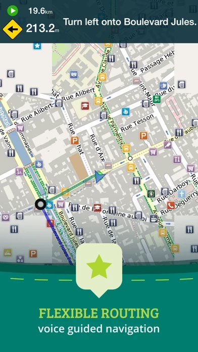
- Online routing with voice-guided turn-by-turn directions and the ability to save multi-stop itineraries for offline navigation

- Online street address search and contacts integration

- More than 25,000 detailed Wikivoyage Travel Guides and more than 1 million Wikipedia articles in 7 languages, all offline

- Customizable pins and favorites groups with the ability to add notes and mark and share favorite spots

- Share maps links and current location via SMS, Facebook, WhatsApp, Email, etc.

- An in-app purchase option for topographic maps with high performance, high accuracy 10m / 50ft contour display worldwide

- Hiking and cycling maps, great for geocaching and getting off the track

- GPS track recording to see the route taken, great for hikes, cycling, and off-road

- Import/export support for GPX and CSV files, share with friends using PE Archives

- Displays and lets you search for map coordinates, including DD, DDM, DMS, MGRS, UTM/UPS, GeoHash, and what3words

- Numerous GPS settings for preferred configuration, including compass and heading arrow or rotation, look ahead mode, accuracy, and recording settings.

  Customer Service/Support
Developer:
GeoMagik LLC

Contact e-Mail:

Website: