Earth Now Overview
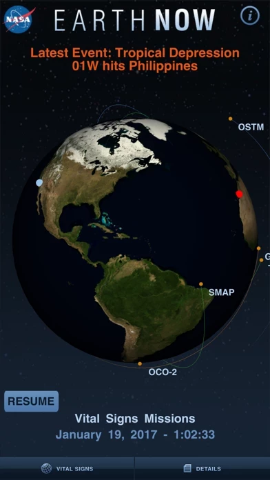
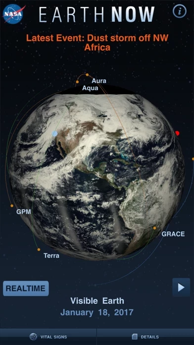
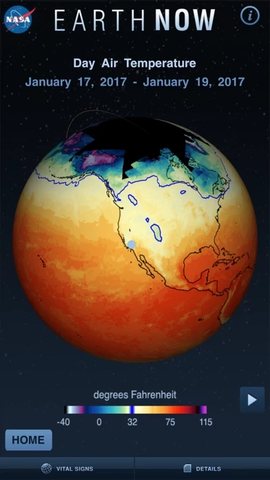
NASA's Earth Now is an application that visualizes recent global climate data from Earth Science satellites, including surface air temperature, carbon dioxide, carbon monoxide, ozone, and water vapor as well as gravity and sea level variations.
Official Screenshots
Product Details and Description of
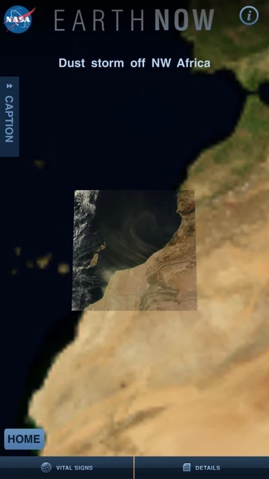
NASA's Earth Now is an application that visualizes recent global climate data from Earth Science satellites, including surface air temperature, carbon dioxide, carbon monoxide, ozone, and water vapor as well as gravity and sea level variations. Data sets are visually described using "false color" maps. Color-coded legends are provided to indicate relative strength or weakness of an environmental condition. The resulting 3D model of the Earth may be rotated by a single finger stroke, and may also be zoomed in or out by pinching 2 fingers. It was developed by the Earth Science Communications and Visualization Technology Applications and Development Teams at NASA's Jet Propulsion Laboratory, with support from NASA Headquarters.
Top Reviews
By Keek Po
Easy to use & Research based
This delightful App comes from the Jet Propulsion Laboratory, a division of the credible California based science institution, CalTech. In partnership with NASA, this app streams live data from a dozen orbiting satellites to give the curious minded visual representations of temperature, water moisture, carbon dioxide, and more. Perfectly integrates with many NGSS standards from early elementary through secondary school.
By ha999999
Load strip
Very good app, hope you just move loading strip from the center of the screen, it annoying during low internet speed, tanks
By Heathen54
Pretty Great
I hope they continue to update and add more content and info as they are able to.