Radar MAX Future Weather Radar Reviews
Published by Elecont LLC on 2025-11-18🏷️ About: Free. Fast.


We Investigate the app owner's website (Elecont.com), verify their legitimacy, and uncover hidden scams and complaints.
- Separate options for storm spotting, weather photography, and storm chasing
- Includes satellite and radar imagery
How many ways can this be awful?!?Here are just a few that were obvious upon opening app:
• app graphics don't look anything like what is shown on App Store, they are pale even at 0% transparency
• ad to get you to remove the ad by buying "full" version covers lower 1/3 of map in portrait view, and is right across the whole map in landscape view
• with both the ad to remove the ad and the control slider taking up so much room on the screen, viewable map area is so small it is less than worthless
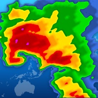
• radar is nowhere near hi-definition or hi-resolution, just shows amorphous moving blobs that are all same color even in strong storm cells – no detail means no real information
• IF overlays icon is functioning, options are either radar or satellite, BUT since it goes suddenly gray and is then inactive, you can only see what was last selected
Bottom line: don't waste your time. I wish I hadn't.
Awesome separate option to use and prep for Storm spotting, Weather Photography, Satellite/Radar WX-Atmospheric Imagery Chasing, and Storm chasing🌪!!!.
Radar MAX Future Weather Radar appears generally safe, but use with caution.
JustUseApp Safety Score for Radar MAX Future Weather Radar is 26/100.
This assessment is based on our NLP analysis of 101 user reviews.
Combined with the app store average rating of 4.3/5.
Radar MAX Future Weather Radar appears legitimate, though exercise caution.
Our NLP models processed user feedback to estimate legitimacy. JustUseApp Legitimacy Score for Radar MAX Future Weather Radar is 44.8/100 .
This conclusion is based on analysis of 101 user reviews.
Radar MAX Future Weather Radar collected the following data from you:
**Pricing data is based on average subscription prices reported by Justuseapp.com users..
| Pricing Plans | Amount (USD) |
|---|---|
| Remove Ads & Limits | $1.99 |
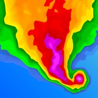
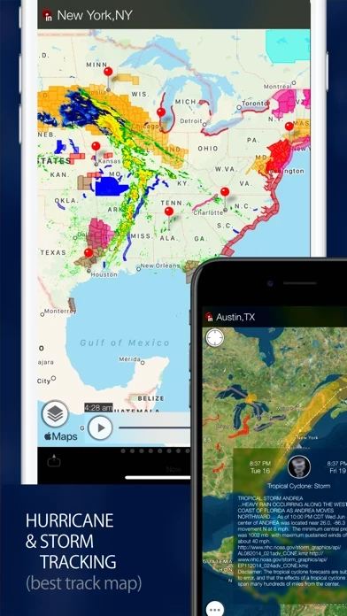
Using the data from Storm Prediction Center and Global Disaster Alert and Coordination System (SPC & GDAC) Radar MAX provides information about tropical storms and hurricanes for locations worldwide, areas affected by storms and severe weather, coordinates and wind speed, storm tracks & path projections.
A weather radar is used to locate precipitation, calculate its motion, estimate its type (rain, snow, hail, etc.), and forecast its future position and intensity.
Satellite images provide an excellent view on the clouds in the sky and an indication of the weather over the United states, Europe, Japan, Australia and Indonesia.
Interactive map includes live international weather conditions, local weather and time, ten-day forecasts and sunrise/sunset times for multiple places.
Lighter areas of cloud show where the cloud tops are cooler and therefore where weather features like fronts and shower clouds are.