Radar MAX Future Weather Radar app not working? crashes or has problems?

Radar MAX Future Weather Radar Status

Published by on 2024-01-03

Free. Fast.


I have a problem with Radar MAX Future Weather Radar

Are you having issues? Select the issue you are having below and provide feedback to Radar MAX Future Weather Radar.


problems reported in the last 24 hours

24 hour clock

Most reported problems


Reported Issues: 1 Comments

By Linda Rich   11 months ago


Really don’t like this app. I am unable to turn off advisories, and the clutter up the map so bad, I can’t see approaching storms.


Common dislikes about Radar MAX Future Weather Radar app

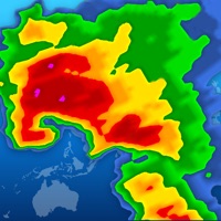
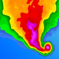
- App graphics do not match what is shown on the App Store

- Ad to remove ads covers a significant portion of the map

- Small viewable map area due to ad and control slider taking up space

- Radar imagery is not high-definition or high-resolution

- Limited options for overlays and they may not function properly


Have a Problem with Radar MAX Future Weather Radar? Report Issue

Leave a comment:


Common Radar MAX Future Weather Radar Problems & Solutions. Troubleshooting Guide


  Contact Support

Some issues cannot be easily resolved through online tutorials or self help. So we made it easy to get in contact with the support team at Elecont LLC, developers of Radar MAX Future Weather Radar.


52% Contact Match

Developer: R. Baldwin

E-Mail: [email protected]

Website: Visit Radar MAX Future Weather Radar Website


About this app

Using the data from Storm Prediction Center and Global Disaster Alert and Coordination System (SPC & GDAC) Radar MAX provides information about tropical storms and hurricanes for locations worldwide, areas affected by storms and severe weather, coordinates and wind speed, storm tracks & path projections.  Stunning and sharp images. (U. S. * Animated satellite images of cloud cover (U. S. , E. U. * Current weather conditions directly on the map. 130,000 locations worldwide. * Current weather details and ten-day forecast in pop-up window. * three different layers to get the weather: ground stations, radar and satellite.  At a glance you can see the time and weather for all of your favorites. * The real time radar images provided by NEXRAD an accurate view of the weather situation in the U. S. * All severe weather alerts on interactive map, 126 weather alert types (U. S. * High resolution weather radar.  A weather radar is used to locate precipitation, calculate its motion, estimate its type (rain, snow, hail, etc. ), and forecast its future position and intensity.  Satellite images provide an excellent view on the clouds in the sky and an indication of the weather over the United states, Europe, Japan, Australia and Indonesia.  Interactive map includes live international weather conditions, local weather and time, ten-day forecasts and sunrise/sunset times for multiple places.  Lighter areas of cloud show where the cloud tops are cooler and therefore where weather features like fronts and shower clouds are.  Predictive high-resolution Weather Radar. Severe weather warnings.  RadarMAXFutureWeatherRadar also allows you to check the weather on your favorite places on maps.  Use Radar MAX to see what weather is coming your way!  Radar shows areas of current precipitation or future simulated radar prediction!.  Green color indicates lesser precipitation while the yellow color code indicates intense precipitations.  Satellite images come from satellites which remain above a fixed point on the Earth (i. e. they are “geostationary”).  Precipitation type is indicated by the color.  The color code red is indicative of the most intense precipitations.  Blue color indicates snow. 


Solve Problems with Similar Apps: