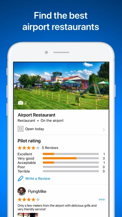
Where can you call in an order over the radio while youβre still up in the air? Which airport restaurant has a great sun deck with a view of the runway? In RunwayMap, youβll find restaurants at and near airports.
With just a few clicks, add your flight documents, such as the Jeppesen approach charts, FAA terminal procedures and airport diagrams, ForeFlight manuals or the Garmin pilotβs guide.
Your subscription will be automatically renewed (another month for monthly subscribers, another year for annual subscribers) if you do not cancel it at least 24 hours before expiry of the current term.
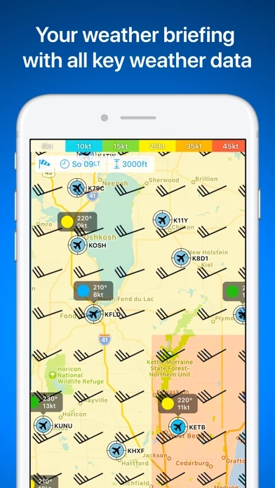
In addition, you can see the decoded METAR with wind, clouds, gusts, and visibility on the airport's detail page.
Based on the wind data from METAR or the forecast, the best runway for landing and the crosswind component will be displayed for the desired time.
Receive important information such as the address, position, runways, and airport restaurants.
The weather data shown in RunwayMap is only general information about possible weather development.
For navigation purposes, we strongly recommend using only approved and updated aviation information such as ForeFlight, Skydemon or Garmin Pilot.
Your account will be debited for the next term within 24 hours of expiry of the current subscription.
On each airport's detail page, you can find the times for sunrise and sunset as well as the beginning and end of civil twilight.
You can choose between Weather PLUS / 3D PLUS as a monthly subscription or an annual subscription.
Important note: RunwayMap is not intended to provide aeronautical information or navigation aids.
It does not replace professional weather briefing by an official body before the flight.
You cannot cancel the current subscription during the ongoing subscription period.