How to Cancel Commander Compass
Published by Pavel AhafonauWe have made it super easy to cancel Commander Compass subscription
at the root to avoid any and all mediums "Pavel Ahafonau" (the developer) uses to bill you.
Complete Guide to Canceling Commander Compass
A few things to note and do before cancelling:
- The developer of Commander Compass is Pavel Ahafonau and all inquiries must go to them.
- Check the Terms of Services and/or Privacy policy of Pavel Ahafonau to know if they support self-serve subscription cancellation:
- Cancelling a subscription during a free trial may result in losing a free trial account.
- You must always cancel a subscription at least 24 hours before the trial period ends.
Pricing Plans
**Gotten from publicly available data and the appstores.
Commander Compass Plus offers a monthly subscription for $2.99. It gives you access to additional map styles like cycling maps or public transport maps.

How to Cancel Commander Compass Subscription on iPhone or iPad:
- Open Settings » ~Your name~ » and click "Subscriptions".
- Click the Commander Compass (subscription) you want to review.
- Click Cancel.
How to Cancel Commander Compass Subscription on Android Device:
- Open your Google Play Store app.
- Click on Menu » "Subscriptions".
- Tap on Commander Compass (subscription you wish to cancel)
- Click "Cancel Subscription".
How do I remove my Card from Commander Compass?
Removing card details from Commander Compass if you subscribed directly is very tricky. Very few websites allow you to remove your card details. So you will have to make do with some few tricks before and after subscribing on websites in the future.
Before Signing up or Subscribing:
- Create an account on Justuseapp. signup here →
- Create upto 4 Virtual Debit Cards - this will act as a VPN for you bank account and prevent apps like Commander Compass from billing you to eternity.
- Fund your Justuseapp Cards using your real card.
- Signup on Commander Compass or any other website using your Justuseapp card.
- Cancel the Commander Compass subscription directly from your Justuseapp dashboard.
- To learn more how this all works, Visit here →.
How to Cancel Commander Compass Subscription on a Mac computer:
- Goto your Mac AppStore, Click ~Your name~ (bottom sidebar).
- Click "View Information" and sign in if asked to.
- Scroll down on the next page shown to you until you see the "Subscriptions" tab then click on "Manage".
- Click "Edit" beside the Commander Compass app and then click on "Cancel Subscription".
What to do if you Subscribed directly on Commander Compass's Website:
- Reach out to Pavel Ahafonau here »»
- Visit Commander Compass website: Click to visit .
- Login to your account.
- In the menu section, look for any of the following: "Billing", "Subscription", "Payment", "Manage account", "Settings".
- Click the link, then follow the prompts to cancel your subscription.
How to Cancel Commander Compass Subscription on Paypal:
To cancel your Commander Compass subscription on PayPal, do the following:
- Login to www.paypal.com .
- Click "Settings" » "Payments".
- Next, click on "Manage Automatic Payments" in the Automatic Payments dashboard.
- You'll see a list of merchants you've subscribed to. Click on "Commander Compass" or "Pavel Ahafonau" to cancel.
How to delete Commander Compass account:
- Reach out directly to Commander Compass via Justuseapp. Get all Contact details →
- Send an email to [email protected] Click to email requesting that they delete your account.
Delete Commander Compass from iPhone:
- On your homescreen, Tap and hold Commander Compass until it starts shaking.
- Once it starts to shake, you'll see an X Mark at the top of the app icon.
- Click on that X to delete the Commander Compass app.
Delete Commander Compass from Android:
- Open your GooglePlay app and goto the menu.
- Click "My Apps and Games" » then "Installed".
- Choose Commander Compass, » then click "Uninstall".
Have a Problem with Commander Compass? Report Issue
Leave a comment:
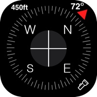
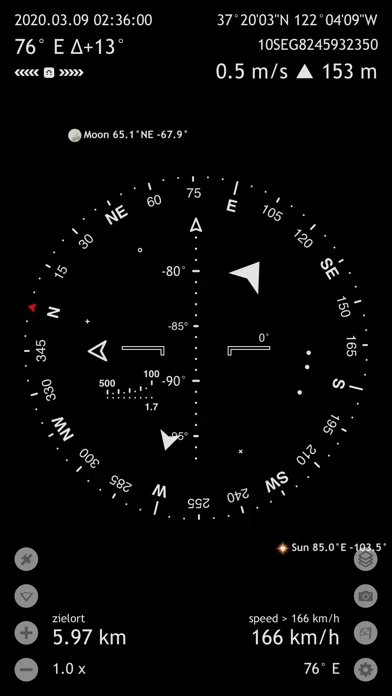
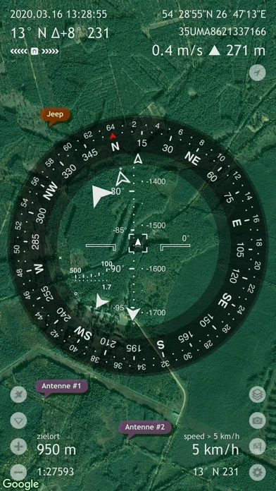
What is Commander Compass?
Commander Compass is an essential offline GPS app for outdoors and off-road navigation. Packed with tools it serves as a hi-tech compass with maps, gyrocompass, GPS receiver, waypoint tracker, speedometer, altimeter, Sun, Moon and star finder, gyro horizon, and coordinate converter. It saves your custom places and waypoints, navigates precisely to them later, shows them on maps, displays detailed GPS info, measures distances, angles, and does a lot more. COMPASS & GYROCOMPASS Accuracy improvement techniques, special compass modes and calibration methods available in Commander Compass only make it a real instrument – the most advanced and accurate digital compass. FINDER, TRACKER & NAVIGATION Commander Compass operates in 3D to show real-time object positions, info and directions to them overlaid over maps or a simple background. Save current position, add points from maps, manually enter location coordinates and bearings, add stars by hand or use a built-in star catalogue. Find saved places and objects later simply by following directional arrows. Commander Compass tracks multiple targets simultaneously and shows their info – distance, direction, azimuth, elevation and estimated time of arrival. Copy, paste and share locations, coordinates and map links using many supported formats. GPS, SPEEDOMETER & ALTIMETER Find and track your location and get detailed real-time GPS data – coordinates in dozens of formats, altitude, course, current, maximum and vertical speed, u...