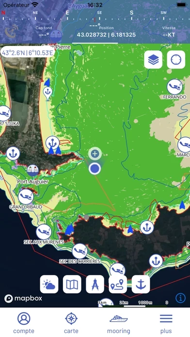
The application provides access to various descriptive data (information on ports, anchorage sites, diving sites, anchorage and light equipment areas, geo-referenced underwater image galleries), navigation functionalities (heading and time prediction arrow, speed, waypoints and measurement tools, navigation routes) as well as safety at sea tools (skid, entanglement and collision alarm pack).
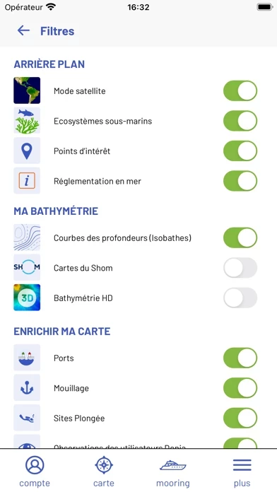
The Premium version of the application (€24.99 per year, €2.99 per month) gives access to the SHOM (Service Hydrographique et Océanographique de la Marine) nautical charts (updated in 2022) as well as nearly 230 high-definition bathymetric charts allowing users to find new sites of interest, plan diving routes, or visualise faults and rocky outcrops.
The application offers the display of AIS (Automatic Identification System) data from the AISHUb network, weather forecasts every 3 hours up to +72 hours, preferred anchorage areas (sheltered) according to the weather, and local regulations.
DONIA works and raises awareness of environmental conservation by providing extremely accurate maps of the nature of the seabed, enabling Mediterranean yachtsmen to anchor outside sensitive ecosystems such as posidonia meadows and coralligenous reefs, in compliance with the law.
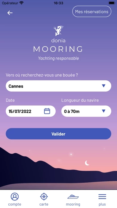
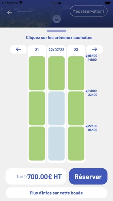
The DONIA application incorporates the mapping of buoys and mooring boxes in a buoy reservation module called "DONIA Mooring".