onWater Fish Overview
What is onWater Fish? The onWater app is a comprehensive tool for fly fishing enthusiasts, providing access to detailed maps, local fishing reports, river shuttle services, real-time river flows and weather conditions, and more. The app requires a subscription, with both monthly and yearly options available.
Features
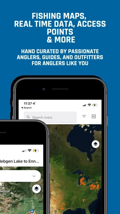
- Hundreds of detailed maps of top fishing waters, including access areas, boat ramps, and camping locations
- Ability to download maps for offline use and track location and movement
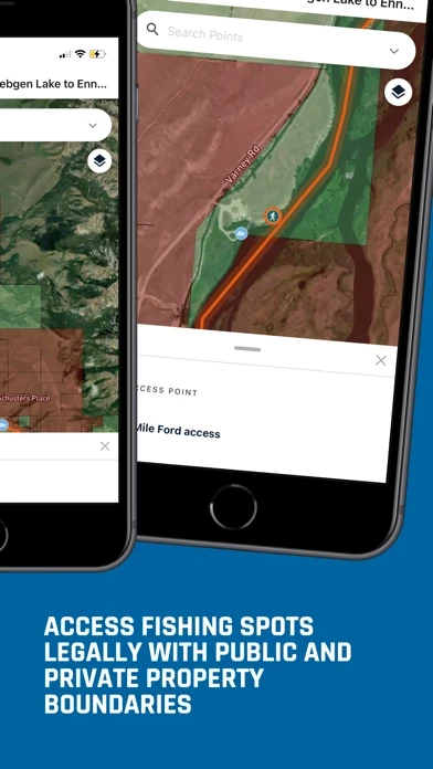
- Tracking of location relative to public and private land boundaries
- Distance tracking between points on the river or user's location
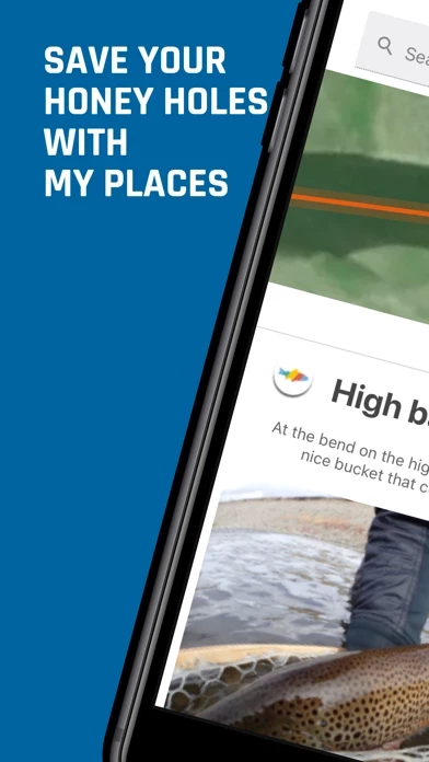
- Ability to mark personal favorite locations
- Access to current local fishing reports and fly shops
- Information on river shuttle services and local access regulations
- Real-time river flows and local weather conditions
- Listings of top lodges and local accommodations
- Ability to upload photos and capture river location, flows, weather, and fly used
Official Screenshots


Product Details and Description of
Whether you’re planning a fly fishing destination trip, exploring, or just getting out for the day, everything you need is right at your fingertips with the onWater app. * Hundreds of detailed maps of the top fishing waters showing access areas, boat ramps, camping and more * Download maps for offline use to track your location and movement * Track your location relative to public and private land boundaries * Track distances between points on the river or your location * Mark your personal honey hole(s) or favorite location * Access to current local fishing reports and local fly shops * River shuttle services and local access regulations * Real time river flows and local weather conditions * Top lodges and local accommodations * Upload photos and capture river location, flows, weather & fly used onWater requires a subscription to access the app. There is a monthly $3.99 option and a yearly $39.99 option. Both come with a free two week trial and can be cancelled anytime before being billed.
Top Reviews
By fishingstev
Not worth it
$39 plus a $39 yearly subscription. You get maybe 5% of the rivers in a given state. Even the major rivers are missing large chunks of data. I get it’s new, but I would expect a lot more for the amount of money you spend