Official Screenshots

Product Details and Description of
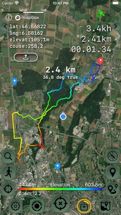
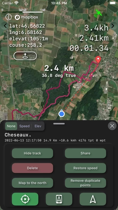
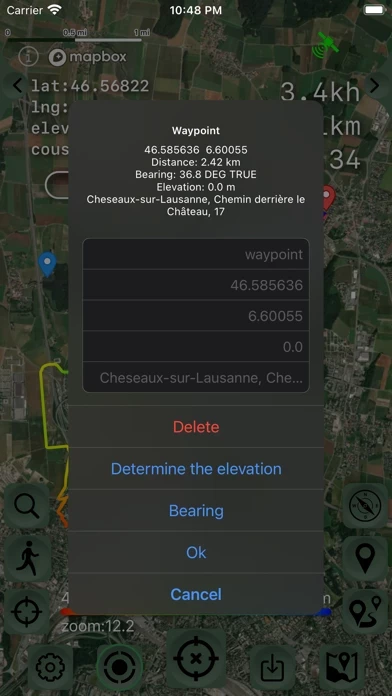
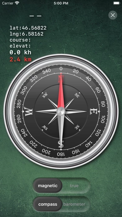
Create, import, export tracks with waypoints. Supports offline maps, no time limits, no ads, no in-app purchases. The main functions of the application: - new fast engine from MapBox. - convenient and fast loading of maps. - determination of the height of any waypoint. - search by address. - search by coordinates. - compass. - processing and optimization of tracks. - loading and unlimited storage of maps of the travel area. - supports all import and export methods available for your device with services, friends and applications in .gpx format. - color gradient for speed and height, if this information is in the imported track. - color gradient for speed and height for recorded tracks. - recording speed and altitude in the track. - relief contours in outdoor mode - extended track information: average and maximum speed, track duration by time and distance, number of waypoints and number of steps. - different units of measurement: miles, kilometers, feet, meters. - pedometer when recording a track and saving information. - work in the background. - does not contain in-app purchases, additional payments for cards, advertisements and has no time limits for use. - viewing one or more tracks in any application mode, including the recording mode of another track. - installation, editing, deletion of waypoints in any application mode and anywhere. - the ability to adjust the quality of the track, distance filters, energy saving mode. - export and import of tracks and waypoints to various services - Open Street Map and others. - has a pointer to the target waypoint and shows the distance to it. Easy target waypoint selection in several ways. - display of additional information on the screen - scale, coordinates, height, speed, number of steps. - shows the current distance traveled by the track and the travel or walk time. - has several map styles - satellite, streets, combo and dark. - Supports dark theme. - easy start and stop of tracking in several ways. - the ability to continue any previously recorded or imported track. - several modes of map orientation - by the heading of the phone, in the direction of travel, centering and to the north. - Possibility of tilting the map with double pinch. - quick and easy selection and viewing of saved tracks, waypoints and maps. - speed and altitude graphs can be scaled and scrolled. - in the settings link to the user manual .