Planimeter 55 Measure on map Reviews
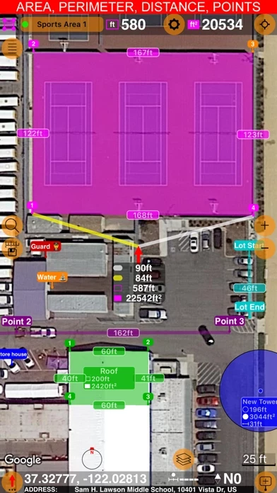
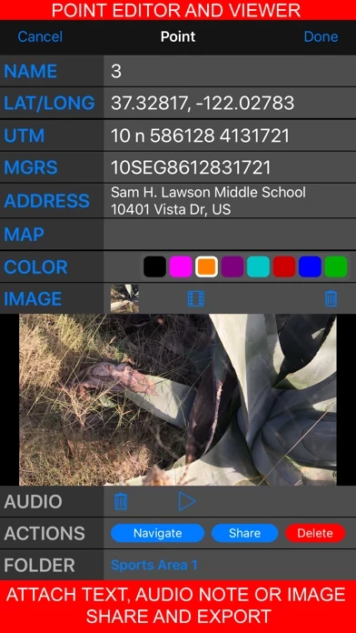
Published by Kalimex-Consulting s.r.o. @Blocoware & Stanislav Dvoychenko on 2026-01-02🏷️ About: Planimeter is an app that allows users to measure distance, perimeter, and area on a map. It also allows users to add stand-alone points to better understand what is where on a map. The app is useful for measuring construction sites, roofs, lawns, fences, paving, pools, parking lots, fields, and paths. It also allows users to capture photos stamped with location, direction, altitude, and time, and share and export their projects.