Hiking and Skiing Reviews
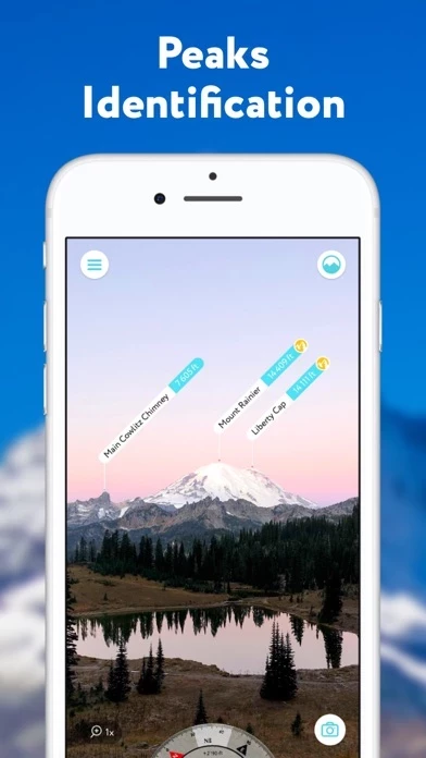
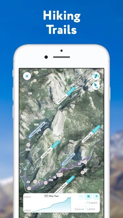
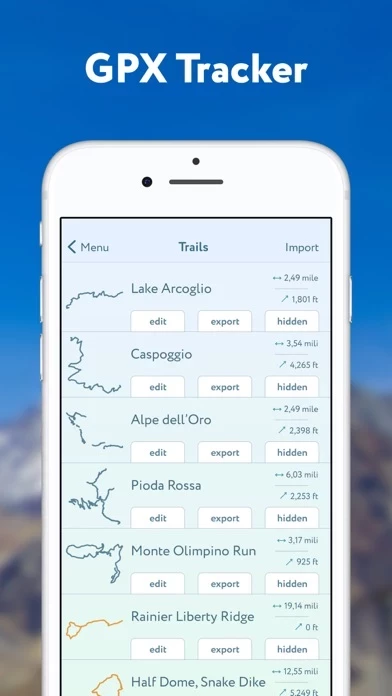
Published by Routes Software SRL on 2026-05-15🏷️ About: PeakVisor is an app that uses augmented reality technology to display the names and elevation of nearby peaks. It provides state-of-the-art 3D maps and mountain identification features to help users navigate the outdoors. The app allows users to identify mountains, plan hiking routes, track their outdoor adventures, and even identify mountains in photos. It is available for offline use and is useful for winter sports as well.