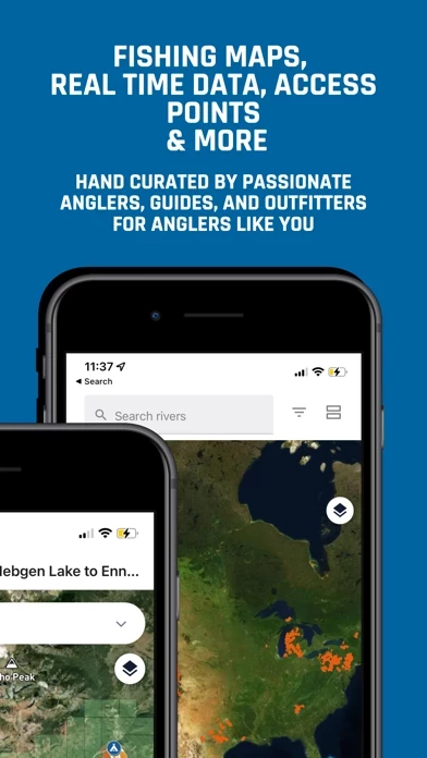
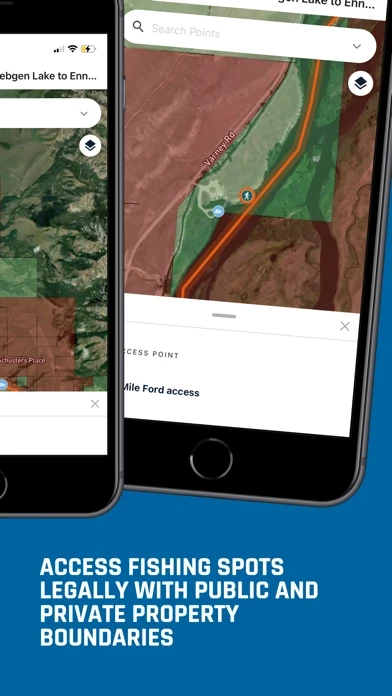
I recently used the offline map tool when floating the South Fork of the Boise River. Because I was unfamiliar with the river and the float, access points, river distances to campsites, whitewater hazards, and other points of interest to the angler, the offline map was invaluable to me in planning snd executing the 2 day overnight float.
Although near the growing city of Boise, ID, the South Fork runs through a remote and deep river canyon setting without reliable cell phone service, so I downloaded the fully curated off-line map and was able to track my float without a glitch! This helped immensely in understanding where I was in relation to my planned campsite for the night, putting me at ease in the late afternoon by knowing exactly where I would be camping and not needing to push through good evening water to ensure I found my camp while there was still daylight. Also, I was able to see exactly where whitewater hazards were located, enabling me to make better decisions, for example, choosing to set camp rather than trying to run a relatively simple but technical rapid in the fading light of the day.
I have always used digital resources when planning a river trip, but the research aspect of this process is tedious, requiring a search of several resources to get the whole big picture. With onWater’s app everything is right there in one location making trip planning and the overall experience so simple and incredibly informative with its hand-curated and detailed information. Thanks, onwater!