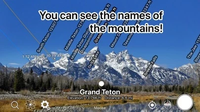
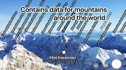
- Displays the name, altitude, and distance of the mountaintop when you point your iOS device at it
- Identifies the names of all the mountain peaks in the 360-degree panoramic AR view
- Displays three-dimensional coordinates and a gyroscope to display the name at the peak, even if you tilt the camera
- Displays the three-dimensional terrain semi-transparently, making it easy to compare it with the actual shape of the mountain and check the location of the peak
- Switches to a 3D view looking down from the sky when you point your iOS device downward
- Allows you to check the names of the terrain and mountains that can be seen from any location specified on the map
- Lets you take a photo with the name of the peak and share it via SNS or email
- Allows you to adjust the position of the peak name display by swiping the AR display up, down, left, or right
- Lets you adjust the position of the peak name display after the picture is taken
- Allows you to import photos taken with another app and add the peak name
- All features are free to use.


